San José de Ocoa
| San José de Ocoa | ||
|---|---|---|
| ||
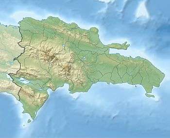 San José de Ocoa San José de Ocoa in the Dominican Republic | ||
| Coordinates: 18°33′00″N 70°30′00″W / 18.55000°N 70.50000°WCoordinates: 18°33′00″N 70°30′00″W / 18.55000°N 70.50000°W | ||
| Country |
| |
| Province | San José de Ocoa | |
| Founded | 1805 | |
| Municipality since | 1858 | |
| Area[1] | ||
| • Total | 484.87 km2 (187.21 sq mi) | |
| Elevation[2] | 475 m (1,558 ft) | |
| Population (2012)[3] | ||
| • Total | 21,148 | |
| • Density | 44/km2 (110/sq mi) | |
| • Demonym | Ocoeño(a) | |
| Distance to – Santo Domingo |
112 km | |
| Municipal Districts |
3 | |

San José de Ocoa is the capital of San José de Ocoa province in the Dominican Republic. It is located north of the Peravia province, and was part of that province until 1 January 2002.
Geography
The city lies in a valley in the southern region of the Central Cordillera. It is located at an altitude of 475 meters. The municipality covers an area of 484.87 km².
Climate
| Climate data for San José de Ocoa (1961–1990) | |||||||||||||
|---|---|---|---|---|---|---|---|---|---|---|---|---|---|
| Month | Jan | Feb | Mar | Apr | May | Jun | Jul | Aug | Sep | Oct | Nov | Dec | Year |
| Record high °C (°F) | 35.8 (96.4) |
34.5 (94.1) |
35.6 (96.1) |
34.7 (94.5) |
35.5 (95.9) |
37.6 (99.7) |
36.7 (98.1) |
37.6 (99.7) |
37.6 (99.7) |
35.7 (96.3) |
35.6 (96.1) |
36.4 (97.5) |
37.6 (99.7) |
| Average high °C (°F) | 28.8 (83.8) |
29.3 (84.7) |
29.7 (85.5) |
30.1 (86.2) |
30.4 (86.7) |
31.1 (88) |
31.8 (89.2) |
32.0 (89.6) |
31.8 (89.2) |
31.0 (87.8) |
30.0 (86) |
28.6 (83.5) |
30.4 (86.7) |
| Average low °C (°F) | 17.5 (63.5) |
17.3 (63.1) |
17.7 (63.9) |
18.0 (64.4) |
18.6 (65.5) |
19.1 (66.4) |
19.7 (67.5) |
19.9 (67.8) |
19.6 (67.3) |
19.4 (66.9) |
18.7 (65.7) |
17.9 (64.2) |
18.6 (65.5) |
| Record low °C (°F) | 10.5 (50.9) |
11.3 (52.3) |
11.5 (52.7) |
11.5 (52.7) |
11.6 (52.9) |
11.6 (52.9) |
11.5 (52.7) |
12.5 (54.5) |
11.5 (52.7) |
12.6 (54.7) |
10.4 (50.7) |
10.5 (50.9) |
10.4 (50.7) |
| Average rainfall mm (inches) | 15.9 (0.626) |
24.8 (0.976) |
34.6 (1.362) |
70.3 (2.768) |
151.4 (5.961) |
106.1 (4.177) |
63.4 (2.496) |
97.0 (3.819) |
135.6 (5.339) |
115.1 (4.531) |
55.0 (2.165) |
25.4 (1) |
894.6 (35.22) |
| Average rainy days (≥ 1.0 mm) | 3.1 | 3.6 | 4.1 | 5.7 | 10.6 | 8.6 | 6.6 | 7.8 | 10.6 | 9.9 | 5.4 | 2.8 | 78.8 |
| Source: NOAA[4] | |||||||||||||
History
The town was founded in 1805 by persons from the southern town of Baní. The Canarian descendants were the first ethnic group to settle in San José de Ocoa, remaining a significant minority in the town. Other families from Spain, Italy and France, notably the Minyettys, would soon follow. Blacks also would later settle in San José de Ocoa, most of them being Cocolo descendants arriving from San Pedro de Macoris.[5] In December 1858, San José de Ocoa was elevated to the category of municipality in the former province of Santo Domingo; in 1895, it was transferred to the province of Azua. In 1944 when the province of Peravia was created, San José de Ocoa became a municipality of this province. Finally, the town became the capital municipality of the new province of San José de Ocoa on 6 September 2000.
Economy
Agriculture is the dominant sector in the economy of the municipality. The main crops are coffee, beans and potatoes. Other vegetables, such as cabbage and carrot are also grown as well as some tropical fruits (avocado and mango). Other economic activities are trade, carpentry workshops, mechanical and some processing of agricultural products.
Prominent residents of the city
- Rafael Sanchez, better known by the alias of Jack Veneno, former professional wrestler and current sub-secretary of sports, was born in San José.
References
- ↑ Superficies a nivel de municipios, Oficina Nacional de Estadistica
- ↑ De la Fuente, Santiago (1976). Geografía Dominicana (in Spanish). Santo Domingo, Dominican Republic: Editora Colegial Quisqueyana.
- ↑ Censo 2012 de Población y Vivienda, Oficina Nacional de Estadistica
- ↑ "San J. Ocoa Climate Normals 1961-1990". National Oceanic and Atmospheric Administration. Retrieved September 19, 2016.
- ↑ "Municipio de San José de Ocoa".
| |||||||||||||||||||||||||||||||||||||||||||||||||||||||||||||||