San Francisco Transbay Terminal
Transbay Terminal | |
|---|---|
|
Intermodal (1939–1959) Bus (1959–2010) | |
|
A 2008 view of the facade of the now-demolished 1939 "Transbay Transit Terminal" which was designed by Timothy L. Pflueger | |
| Location | First and Mission |
| Coordinates | 037°47′22″N 122°23′47″W / 37.78944°N 122.39639°WCoordinates: 037°47′22″N 122°23′47″W / 37.78944°N 122.39639°W |
| Owned by | Caltrans |
| Other information | |
| Website | http://transbaycenter.org/project/terminal-history |
| History | |
| Opened | 14 January 1939 |
| Closed | 7 August 2010 |
| Location | |
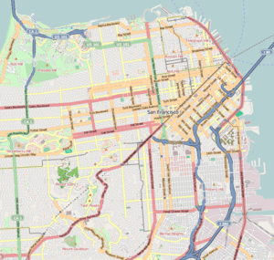 Transbay Terminal Location within San Francisco | |
The San Francisco Transbay Terminal or The Transbay Terminal, was a transportation complex in San Francisco, California, United States, roughly in the center of the rectangle bounded north–south by Mission Street and Howard Street, and east–west by Beale Street and 2nd Street in the South of Market area of the city. It opened on January 14th, 1939 as a train station and was converted into a bus depot in 1959. The terminal mainly served San Francisco's downtown and Financial District, as transportation from surrounding communities of the Bay Area terminated there such as: Golden Gate Transit buses from Marin County, AC Transit buses from the East Bay, and SamTrans buses from San Mateo County. Long-distance buses from beyond the Bay Area such as Greyhound and Amtrak also served the terminal. Several bus lines of the San Francisco Municipal Railway connected with the terminal.
It closed on August 7, 2010, to make way for the construction of the replacement facility, the Transbay Transit Center, and associated towers. All long-distance and transbay bus operations were transferred to a Temporary Transbay Terminal at the nearby block bounded by Main, Folsom, Beale, and Howard Streets.
The new Transbay Transit Center broke ground on August 11, 2010.[1] US Secretary of Transportation Ray LaHood, US Speaker of the House Nancy Pelosi, and the Mayor of San Francisco Gavin Newsom attended the ceremony. The new transit center is scheduled to be completed in 2017.
Bridge Railway
The Transbay Terminal served as the San Francisco terminus for the electric commuter trains of the Interurban Electric (Southern Pacific), the Key System and the Sacramento Northern (Western Pacific) railroads, which ran on the south side of the lower deck of the Bay Bridge. Bus services such as Greyhound and local Muni streetcar lines had stops at the main entrance.
History
The Terminal was designed by Timothy L. Pflueger[2][3] in the Art Moderne style.[4] Bids were taken for construction of the terminal in June 1937,[5] excavation began on 29 July 1937, and the first steel was erected on 12 January 1938.[6] Structural concrete was complete by May 1938.[7] The San Francisco-Oakland Bay Bridge Electric Railway Terminal Building was formally dedicated on January 14, 1939. State Director of Public Works Frank W. Clark turned the facilities over to the State of California, as represented by Lieutenant Governor Ellis E. Patterson, who turned over management of the facility to the three electric railroad companies.[6] State officials and guests rode electric trains to the opening ceremony.[6][8]
Construction of rail facilities (including laying tracks on the bridge and construction of the new San Francisco terminal) for the Bay Bridge had cost the state an estimated US$15,000,000 (equivalent to $255,600,000 in 2015), and the state had invested an additional US$3,666,129 (equivalent to $62,500,000 in 2015) in rolling stock, which was leased to the railroad companies.[9] The terminal cost was estimated at US$2,300,000 (equivalent to $39,200,000 in 2015),[8] and it was expected to serve upwards of 60,000 passengers per day.[10][11]
Train service
Governor Frank Merriam piloted the first (ceremonial) electric train across the bridge on 23 September 1938,[12] although regular service did not commence until January 1939, after the terminal was complete. Trains were controlled with a custom electric switchboard, which was considerably simpler than the typical mechanical lever system then in use.[13] A loop was built so trains could turn around and go back across the bridge. Even after rail service ended, the loop continued to be used by AC Transit, Thruway Motorcoach and Greyhound buses until the station closed. Surprisingly, a track was never made to connect to the Southern Pacific's Third and Townsend Depot so trains could go further south. There were eight tracks (counting the ones owned by Muni). By November 1940, the Interurban Electric Company was seeking permission to abandon East Bay service, prompting Director Clark to consider proposals for the state to assume operation of trains across the bridge.[14] The SP and Sacramento Northern trains ceased service across the Bay in 1941 only two years after the Terminal was completed. Interurban stated they were forced to discontinue service, citing falling passenger counts, revenues, and a failed proposed consolidation with the Key System.[15] After Interurban was granted permission to discontinue service, Sacramento Northern also applied to discontinue service in 1941.[9] Sacramento Northern carried only a minuscule fraction (less than 1%) of the total rail traffic over the Bay Bridge,[16][17] which meant Sacramento Northern likely also operated at a loss. Trains carried 37,334,000 passengers across the Bay Bridge at peak ridership in 1945, driven in part by gasoline rationing, but ridership declined precipitously, managing to move only 6,113,000 passengers in 1957.[18] The Key System successfully petitioned the Public Utilities Commission to discontinue service across the Bay Bridge in 1955 due to falling revenues, after failing to discontinue service in an unsuccessful 1953 petition. The Oakland City Planning Commission reported that since 1945, all the petitions from the Key System had invariably asked for cuts to service and increased fares, which also contributed to declining ridership.[19] The last train crossed the bridge on 20 April 1958, less than twenty years after service was inaugurated in 1939, despite the vital role the trains played. There have been several attempts to restore rail service across the bridge (though not necessarily into the Transbay Terminal), but none have been successful.
Rebuilt for bus service
During the next year, the Transbay Terminal was rebuilt into a bus depot.[18] The tracks were removed and replaced with pavement[20] for use primarily by the buses of the publicly owned successor of the Key System, AC Transit. All lines were operating from the rebuilt terminal by 12 July 1959, and Greyhound service was added on 1 February 1960.[18] In 1971 Amtrak started running buses into the Transbay Terminal from the Southern Pacific's 16th Street Station. Bus service thrived until late 1974, when BART's Transbay Tube opened. Many people preferred BART over AC Transit. The tube didn't run through the terminal, resulting in its decline. Homeless people noticed the dropping commuters and took the chance to inhabit it.
The Transbay Terminal hosted a cocktail lounge, a diner, a newsstand, and a state police office until the 1990s, when the tenants were either evicted or unable to meet safety regulations.[21] Because the Terminal straddled First and Fremont streets, the large overpass structures and lobby spaces unofficially served to shelter numerous homeless people.[22] After demolition commenced, several Transbay Terminal residents refused to move, preferring instead to sleep next to demolition debris.[23]
Demolition
The last bus departed the Transbay Terminal early on 7 August 2010, just after ownership of the building was transferred from Caltrans to TJPA.[24] Wrecking commenced in December 2010,[25][26] and demolition was declared complete on 7 September 2011.[27]
A sculpture assembled from Transbay Terminal debris by Tim Hawkinson was selected in March 2011 to be erected on the corner of Mission and Fremont Streets after the new Transbay Transit Center is complete.[28][29]
Agencies that serve the Temporary Transbay Terminal
Several agencies currently serve the Temporary Transbay Terminal, including:
- AC Transit (stops inside the terminal; Route 800 stops on Beale between Howard and Folsom Sts.)
- Commute-only routes: Routes B, C, CB, E, FS, G, H, J, L, LA, LC, NX, NX1, NX2, NX3, NX4, NXC, OX, P, S, SB, V, W, and Z
- Daily Transbay routes: Routes F, NL, and O
- All-Nighter route: Route 800
- Golden Gate Transit (stops on Main between Howard and Folsom Sts.; most commute service bus routes still stop near old Transbay Terminal location)
- Routes 10, 70, 101, 101X
- Amtrak Thruway Motorcoach (stops inside terminal)
- Routes 17 (Santa Barbara), 34 (Stockton), 99 (Emeryville/Oakland)[30]
- Greyhound Bus Lines/BoltBus (stops inside terminal)
- Innercity routes: 540 (Reno), 607 (Arcata), 615 (Los Angeles via I-5), 618 (Los Angeles via Santa Barbara), 630 (Los Angeles via Fresno)[31]
- BoltBus to Los Angeles
- Muni (stops on Howard, Beale, and Main Sts.)
- Local routes: Routes 5, 7, 25, 38, 41*,
- Limited stop routes: Routes 7R*, 30X*, 38R*, 80X*, 81X*, and 82X*
- All-Nighter routes: Routes 25 and 38
- PresidiGo Shuttle (stops on Howard St.)
- Downtown route
- SamTrans (stops on Main St.)
- Commute-only route: Route KX
- Daily routes: Routes 292
- All-Nighter route: Route 397
- WestCAT (stops inside terminal)
- Commute-only route: Lynx
- Other services:
- Caltrans Bay Bridge Bike Shuttle (stops on Main St.)
- Kaiser Shuttle to Kaiser San Francisco
Note: * - operates select days and times only
Environmental
On January 30, 1986, four underground storage fuel tanks were excavated and removed from the 150 First Street site. Each of these tanks had a capacity of 1,000 gallons (Earth Metrics, 1989). Eight soil samples showed the existence of total petroleum hydrocarbons in levels ranging from 20 to 9,000 parts per million. On February 3, 1986, the excavation was backfilled.
Transbay Terminal Replacement Project
The new terminal
The City and County of San Francisco, the Alameda – Contra Costa Transit District (AC Transit), and the Peninsula Corridor Joint Powers Board (Caltrain) proposed to replace the underutilized original Transbay Terminal with an entirely new and more functional building at roughly the same location.
In addition to maintaining the current bus services, the new Transbay Transit Center terminal will also include a tunnel that extends the terminus of the Caltrain commuter rail line from its current location at Fourth and King Streets; the downtown Caltrain extension is projected to alleviate roadway traffic and Caltrain rider delays, resulting in an estimated $20 million savings per year.[32] The Caltrain extension depends on the electrification of its rolling stock, as the current diesel engines are not appropriate for tunnel service. When this project is completed, Caltrain riders would no longer need to transfer to Muni in order to reach the downtown financial district. Additionally, the heavy rail portion of the terminal would be designed to accommodate the planned High Speed Rail from Los Angeles, which shares the right-of-way (Peninsula Corridor) with Caltrain between San Francisco and San Jose. Like the original Transbay Terminal, the new Transbay Transit Center would span both First and Fremont streets.[33]
BART has also expressed interest in being part of this plan by having their proposed "Second Transbay Tube" connect to the new terminal and Alameda.[34]
The final Environmental Impact Report (EIR) was published in 2004,[35] and construction began in August 2010 on Phase 1, the new Transbay Transit Center (TTC) building. Much of the initial work was underground, and aboveground evidence of construction did not appear until late 2014.[36] The TTC is anticipated to be complete by late 2016, with bus operations anticipated to resume in August 2017. The budget for the TTC is US$1,900,000,000 (equivalent to $1,900,000,000 in 2015)[37] Phase 2 of the project, the downtown rail extension (DTX) has not started due to a funding gap. DTX was initially scheduled to be open to rail service in 2019 at a budgeted cost of US$2,600,000,000 (equivalent to $2,600,000,000 in 2015).[36] The DTX scope also includes moving the existing 4th & King Caltrain station underground.[38] Part of the DTX project also includes building out two below-grade levels below the TTC; one level would serve as the actual train platform, hosting six tracks and three platforms to accommodate Caltrain and HSR service; the other level would be a passenger waiting area, including ticket sales and retail amenities. The waiting area would be connected via tunnel to the BART/Muni Metro Embarcadero Station.[38]
In 2006, developers agreed to a new Mello-Roos tax district in the area surrounding the Transbay Transit Center in order for permits for higher buildings to move forward. San Francisco set the tax rate was set in 2012 at 0.55 percent of assessed value; due to rising real estate prices, however, the 2014 tax burden had risen by nearly 50% compared to the 2012 tax burden, and the developers threatened to pull their building plans entirely or sue the city.[39] The lawsuits never materialized, however.[40]
New skyscrapers
Along with the new terminal, thirteen towers have been proposed on sites around the new terminal, ranging from 300 feet (91 m) to 1,200 feet (366 m) tall.[41] If built out to fund the construction of the new terminal, San Francisco will have a new tallest building and its skyline will be altered. 2,600 new homes (35 percent of which will be affordable), 3,000,000 square feet (280,000 m2) of new office and commercial space and 100,000 square feet (9,300 m2) of retail are planned as well . City officials have decided to consider rezoning the area around the new terminal, and will analyze the potential to raise existing height limits (550 ft. (170 m) max) upward, with the possibility of three towers exceeding 1,000 ft. (300 m) in height. On December 21, 2006, Renzo Piano proposed a five tower complex of one 600 foot (180 m) tower, two 900 foot (275 m) towers and two 1,200 foot (370 m) towers.[42] Other towers are under construction nearby on Rincon Hill and at Millennium Tower (301 Mission Street).
Construction status
The temporary Transbay Terminal has opened, on the block bounded by Main, Folsom, Beale, and Howard Streets. With its completion, the old Transbay Terminal was closed, and as of June 2011 its demolition was complete. The construction of the new terminal is currently ongoing with weekly updates provided by the TJPA.[43]
The competition winner
As of September 20, 2007, the design proposed by César Pelli was chosen. This decision ends the eight-month competition between various design firms around the world. PWP landscape Architecture, Pelli Clarke Pelli Architects, Except Integrated Sustainability, and Hines design includes an elevated park, some sixty feet above the street, to hide the inner workings of the terminal. A single tower will also rise into the sky, changing the skyline of San Francisco.
See also
- California High-Speed Rail
- Ferry Building
- Key System
- List of tallest buildings in San Francisco
- San Francisco Transbay development
- Transbay Tube
Bibliography
- Earth Metrics Inc, ‘'Environmental Site Assessment, Assessors Block 3747, San Francisco'‘, File 7825W0.001, 25 April 1989
References
- ↑ "San Francisco breaks ground on $4.2B Transbay Transit Center". Metro Magazine. 2010-08-12.
- ↑ King, John (22 April 2010). "Plan for new Transbay Terminal in, under budget". San Francisco Chronicle. Retrieved 25 March 2016.
- ↑ Nolte, Carl (25 July 2010). "Transbay Terminal finally going terminal". San Francisco Chronicle. Retrieved 25 March 2016.
- ↑ Nyren, Ron (21 September 2015). "The Transformation of Transbay". Urbanland: The Magazine of the Urban Land Institute. Retrieved 25 March 2016.
- ↑ "Bay Bridge Terminal Bids to be Opened". Berkeley Daily Gazette. 14 June 1937. Retrieved 24 March 2016.
- 1 2 3 "Bay Bridge Terminal Dedicated" (PDF). California Highways and Public Works. California Department of Highways and Public Works. 17 (2): 6–9; 28. February 1939. Retrieved 24 March 2016.
- ↑ "Building Bay Bridge Railroad" (PDF). California Highways and Public Works. California Department of Highways and Public Works. 16 (5): 8–11. May 1938. Retrieved 24 March 2016.
- 1 2 "Bridge Crossed by First Train". San Jose News. AP. 14 January 1939. Retrieved 24 March 2016.
- 1 2 "U.C. Man to Make Survey of Span Transport Lines". Berkeley Daily Gazette. 2 May 1941. Retrieved 24 March 2016.
- ↑ "Opening of Rail Traffic on Bay Bridge Feted Saturday". Madera Tribune. 12 January 1939.
- ↑ King, John (10 March 2011). "Huge sculpture to rise from debris of transit hub". San Francisco Chronicle. Retrieved 25 March 2016.
- ↑ "Governor Merriam Pilots First Train Across Bay Bridge" (PDF). California Highways and Public Works. California Department of Highways and Public Works. 16 (10): 18–19. October 1938. Retrieved 24 March 2016.
- ↑ "Bay Bridge Train Movements Controlled By Push Buttons" (PDF). California Highways and Public Works. California Department of Highways and Public Works. 16 (9): 24–25. September 1938. Retrieved 24 March 2016.
- ↑ "State Operation of Bay Trains Urged". Berkeley Daily Gazette. UP. 18 November 1940. Retrieved 24 March 2016.
- ↑ Johnson, Hal (26 February 1940). "S.P. Would Abandon Train Lines to S.F.". Berkeley Daily Gazette. Retrieved 24 March 2016.
President A.T. Mercier said: 'This action was made inevitable by circumstances beyond our control.
'While patronage on this transbay commuter service has been declining and has been unremunerative [sic] for years, the losses have increased from the date of completion of the Bay Bridge in November, 1936. In 1920 there were 22,657,418 transbay passengers carried in this service, as compared with 9,937,466 in 1939, while the population of the East Bay cities and San Francisco increased more than 50 per cent in the same period. [...]
'Loss of business to vehicular travel over the bridge has been given impetus by progressive reduction of automobile tolls from 65 cents to 35 cents. Fur[ther] reduction in tolls is being considered, which would bring further increased losses to the Interurban. [...]
'Every possible solution of the problem looking to economies of operation or possibility of consolidation of the Interurban Electric with the Key System, has been considered. All of these efforts have failed, and we are, therefore, left with no alternative but to abandon our service at the earliest practicable date.' - ↑ "Bay Bridge Traffic Declines in August". Berkeley Daily Gazette. UP. 30 September 1940. Retrieved 24 March 2016.
- ↑ "Commuters Do Get Around Quite a Lot". Healdsburg Tribune, Enterprise and Scimitar. UP. 25 March 1940. Retrieved 24 March 2016.
- 1 2 3 Raab, N.C. (July–August 1960). "Bay Bridge: First Phases of Reconstruction For Added Capacity Completed" (PDF). California Highways and Public Works. Division of Highways, California Department of Public Works. 39 (7–8): 35–42. Retrieved 24 March 2016.
- ↑ Griffith, John; Holmes, Dallas (August 1967). "BART and the Victoria Line: A Comparison of New Commuter Transport in California and London". 55 (3). doi:10.15779/Z38K175.
On July 24, 1953, a strike paralyzed Key System for seventy-six days. The California Public Utilities Commission refused to grant permission to Key System to abandon its train service on "A" and "B" transbay lines. [...] [In February 1954,] Key System applied to the Commission to cut services further. This was granted whereupon Key System announced that it conemplated still more curtailments and asked for tax relief of $188,000 per year. [...] In July [1954], Key System served public notice that it intended to abandon all transbay trains and substitute coaches within one or two years. [...] In October [1954], Key System was allowed by the Public Utilities Commission to curtail services on the East Bay motor coach lines and to increase fares [...] In January 1955, Key System applied to abandon all its rail services, and a rapid transit district was created in the East Bay to replace it.
- ↑ "Remodeling of S.F. Transit Terminal Continues" (PDF). California Highways and Public Works. Division of Highways, California Department of Public Works. 39 (1–2): 59. January–February 1960. Retrieved 24 March 2016.
The elevated track area from the San Francisco Anchorage which faces Beale Street in San Francisco, around the Terminal Loop, and through the building, has now been repaved and the 14 motor coach lines of the Key System Transit Lines are now operating out of the terminal, thus relieving the city streets of this traffic. [...] Included in this remodeling was the construction of a new stairway to the garage area below the street level, the installation of fluorescent lights in the main waiting room and on the mezzanine floor, the opening of various previously closed areas for freer movement of pedestrian traffic throughout the building, and the installing of a new stairway flanked on both sides by escalators, leading from the lobby to the mezzanine level.
- ↑ Cabanatuan, Michael (30 July 2010). "Travel into the Transbay Terminal's past". San Francisco Chronicle. Retrieved 25 March 2016.
- ↑ Coté, John (31 July 2010). "Mayor urges homeless to leave Transbay Terminal". San Francisco Chronicle. Retrieved 25 March 2016.
- ↑ Fagan, Kevin (11 February 2011). "Transbay Terminal hurdle: hard-core homeless". San Francisco Chronicle. Retrieved 25 March 2016.
- ↑ Cabanatuan, Michael (6 August 2010). "Crews to ready Transbay Terminal for demolition". San Francisco Chronicle. Retrieved 25 March 2016.
- ↑ "Demolition of Transbay Terminal". San Francisco Chronicle. 3 December 2010. Retrieved 25 March 2016.
- ↑ "Wrecking ball begins Transbay Terminal demolition". San Francisco Chronicle. 4 December 2010. Retrieved 25 March 2016.
- ↑ Tyler, Carolyn (7 September 2011). "Demolition of old Transbay Terminal complete". ABC7 News. Retrieved 25 March 2016.
- ↑ "New Sculpture by Tim Hawkinson to be Installed at the New Transbay Transit Center" (Press release). San Francisco Arts Commission. 10 March 2011. Retrieved 25 March 2016.
- ↑ "Public Art: Tim Hawkinson". Transbay Transit Center. 2011. Retrieved 25 March 2016.
- ↑ San Francisco - Transbay Terminal (SFC)
- ↑ "Greyhound Lines Inc. - System Timetable". Extranet.greyhound.com. Retrieved 2015-08-12.
- ↑ "1: Purpose and Need for the Project". Final EIS/IER Transbay Terminal/Caltrain Downtown Extension/Redevelopment Project (PDF). Transbay Transit Center (Report). 15 June 2004. pp. 1–12. Retrieved 28 March 2016.
Relocating Caltrain’s San Francisco terminus to the Transbay Terminal area has been projected to result in a seven percent reduction in the number of person hours of auto travel. Morning peak hour delay would be expected to be reduced by 20 percent. Implementation of the Caltrain Extension would result in daily travel time savings of 7,200 person hours, which includes 5,700 person hours saved for Caltrain riders and 1,500 person hours for roadway travelers in the corridor. Using FTA procedures, this represents an approximate $20 million per year savings (7,200 hours/day x $11.26/hour x 250 work days/year).
- ↑ King, John (14 May 2015). "Transit center takes shape, showing how a city transforms". San Francisco Chronicle. Retrieved 28 March 2016.
- ↑ Cabanatuan, Michael (22 June 2007). "BART's New Vision: More, Bigger, Faster". San Francisco Chronicle. pp. A–1. Retrieved 2008-04-17.
- ↑ "Final EIS/IER Transbay Terminal/Caltrain Downtown Extension/Redevelopment Project". Transbay Transit Center. 15 June 2004. Retrieved 28 March 2016.
- 1 2 King, John (26 January 2015). "After years of construction, new Transbay terminal is on the rise". San Francisco Chronicle. Retrieved 28 March 2016.
- ↑ "Transbay Transit Center and Caltrain Downton Extension". San Francisco County Transportation Authority. 2015. Retrieved 28 March 2016.
- 1 2 "Downtown Rail Extension (DTX)". Transbay Transit Center. 2015. Retrieved 28 March 2016.
- ↑ Coté, John; Dineen, J.K. (25 September 2014). "How Transbay Transit Center deal's collapse would alter S.F.". San Francisco Chronicle. Retrieved 28 March 2016.
- ↑ Dineen, J.K. (4 February 2015). "Developers drop threats over special Transbay tax district". San Francisco Chronicle. Retrieved 28 March 2016.
- ↑ "SOARING PLANS FOR TRANSBAY TERMINAL / The West Coast's tallest building: 3 competing ideas show audacity that adds to the city's rising skyline". SFGate. 2007-08-07. Retrieved 2015-08-12.
- ↑ King, John (2006-12-22). "Sky's the limit South of Market / 4 of developers' proposed high-rises would be taller than anything else in S.F.". SFGate. Retrieved 2015-08-12.
- ↑ "Current Activity « Transbay Center". Transbaycenter.org. Retrieved 2015-08-12.
| Wikimedia Commons has media related to San Francisco Transbay Terminal. |
External links
- Official website
- Transbay Temporary Terminal website The "temporary" transbay terminal, expected to operate until at least 2017.
- Planning Department district planning project
- Site with information on Key System service to the transbay terminal
- New Transbay Transit Center
- Photo: Key System Train Inside Transbay Terminal
- Transit Unlimited - Transbay Terminal transit information
- Key System train on ramp to Bay Bridge, 1939, Dorothea Lange photo
- Carlsson, Chris (June 2011). "Transbay Terminal: Historical Essay". FoundSF. Retrieved 24 March 2016.
- Jue, Tim; Guerra, Vanessa (2 August 2010). "The end of an era: farewell to the Transbay Terminal". CaliforniaBeat. Retrieved 24 March 2016.