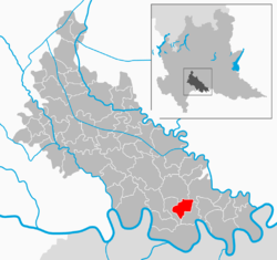
San Fiorano
| San Fiorano | |
|---|---|
| Comune | |
| Comune di San Fiorano | |
 | |
 San Fiorano Location of San Fiorano in Italy | |
| Coordinates: 45°7′N 9°41′E / 45.117°N 9.683°ECoordinates: 45°7′N 9°41′E / 45.117°N 9.683°E | |
| Country | Italy |
| Region | Lombardy |
| Province / Metropolitan city | Province of Lodi (LO) |
| Frazioni | Campone, Divizia, Lazzaretto, Regone |
| Area | |
| • Total | 8.9 km2 (3.4 sq mi) |
| Elevation | 56 m (184 ft) |
| Population (Dec. 2004) | |
| • Total | 1,724 |
| • Density | 190/km2 (500/sq mi) |
| Demonym(s) | Sanfioranesi |
| Time zone | CET (UTC+1) |
| • Summer (DST) | CEST (UTC+2) |
| Postal code | 26848 |
| Dialing code | 0377 |
| Website | Official website |
San Fiorano is a comune (municipality) in the Province of Lodi in the Italian region Lombardy, located about 60 kilometres (37 mi) southeast of Milan and about 25 kilometres (16 mi) southeast of Lodi. As of 31 December 2004, it had a population of 1,724 and an area of 8.9 square kilometres (3.4 sq mi).[1]
The municipality of San Fiorano contains the frazioni (subdivisions, mainly villages and hamlets) Campone, Divizia, Lazzaretto, and Regone.
San Fiorano borders the following municipalities: Codogno, Maleo, Fombio, Santo Stefano Lodigiano.
Pictures
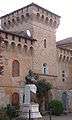 The Castle of San Fiorano
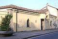 The Lazzaretto
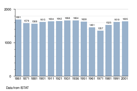
Demographic evolution
References
External links
- www.comune.sanfiorano.lo.it/
- San Fiorano online: portal dedicated to San Fiorano and to San Fiorano's patron saint, St. Florian of Lorch
- History, photos and info about San Fiorano and its patron saint, St. Florian of Lorch
This article is issued from Wikipedia - version of the 1/31/2015. The text is available under the Creative Commons Attribution/Share Alike but additional terms may apply for the media files.