San Emilio
| San Emilio | ||
|---|---|---|
| Municipality | ||
| ||
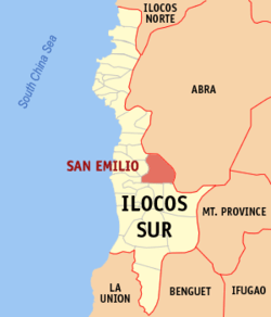 Map of Ilocos Sur showing the location of San Emilio | ||
.svg.png) San Emilio Location within the Philippines | ||
| Coordinates: 17°14′N 120°37′E / 17.233°N 120.617°ECoordinates: 17°14′N 120°37′E / 17.233°N 120.617°E | ||
| Country | Philippines | |
| Region | Ilocos Region (Region I) | |
| Province | Ilocos Sur | |
| District | 2nd District | |
| Barangays | 8 | |
| Government[1] | ||
| • Mayor | Ferdinand A. Banua Sr. | |
| Area[2] | ||
| • Total | 141.44 km2 (54.61 sq mi) | |
| Population (2010)[3] | ||
| • Total | 7,427 | |
| • Density | 53/km2 (140/sq mi) | |
| Time zone | PST (UTC+8) | |
| ZIP code | 2722 | |
| Dialing code | +63 (0)77 | |
| Income class | 4th class | |

San Emilio is a fourth class municipality in the province of Ilocos Sur, Philippines. According to the 2010 census, it has a population of 7,427 people.[3]
Barangays
San Emilio is politically subdivided into 8 barangays.[2]
- Cabaroan (Poblacion)
- Kalumsing
- Lancuas
- Matibuey
- Paltoc
- San Miliano
- Sibsibbu
- Tiagan
Demographics
| Population census of San Emilio | ||
|---|---|---|
| Year | Pop. | ±% p.a. |
| 1995 | 6,173 | — |
| 2000 | 6,717 | +1.83% |
| 2007 | 6,920 | +0.41% |
| 2010 | 7,427 | +2.61% |
| Source: National Statistics Office[3][4] | ||
References
- ↑ "Official City/Municipal 2013 Election Results". Intramuros, Manila, Philippines: Commission on Elections (COMELEC). 1 July 2013. Retrieved 20 September 2013.
- 1 2 "Province: ILOCOS SUR". PSGC Interactive. Makati City, Philippines: National Statistical Coordination Board. Retrieved 20 September 2013.
- 1 2 3 "Total Population by Province, City, Municipality and Barangay: as of May 1, 2010" (PDF). 2010 Census of Population and Housing. National Statistics Office. Retrieved 20 September 2013.
- ↑ "Province of Ilocos Sur". Municipality Population Data. LWUA Research Division. Retrieved 20 September 2013.
External links
- Pasyalang Ilocos Sur
- Philippine Standard Geographic Code
- Philippine Census Information
- Local Governance Performance Management System
 |
Burgos | Pilar, Abra / Villaviciosa, Abra | Luba, Abra | |
| Lidlidda | |
Tubo, Abra | ||
| ||||
| | ||||
| Candon Galimuyod |
Gregorio del Pilar | Quirino |
This article is issued from Wikipedia - version of the 12/1/2016. The text is available under the Creative Commons Attribution/Share Alike but additional terms may apply for the media files.