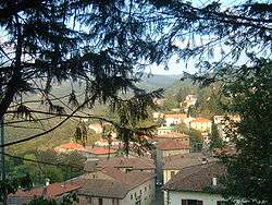
San Benedetto Val di Sambro
| San Benedetto Val di Sambro | |
|---|---|
| Comune | |
| Comune di San Benedetto Val di Sambro | |
 | |
 San Benedetto Val di Sambro Location of San Benedetto Val di Sambro in Italy | |
| Coordinates: 44°13′N 11°14′E / 44.217°N 11.233°ECoordinates: 44°13′N 11°14′E / 44.217°N 11.233°E | |
| Country | Italy |
| Region | Emilia-Romagna |
| Province / Metropolitan city | Bologna (BO) |
| Frazioni | Castel dell'Alpi, Cedrecchia, La Villa di Cedrecchia, Madonna dei Fornelli, Monteacuto Vallese, Montefredente, Pian del Voglio, Pian di Balestra, Qualto, Ripoli, Sant'Andrea, Zaccanesca |
| Area | |
| • Total | 66.74 km2 (25.77 sq mi) |
| Elevation | 602 m (1,975 ft) |
| Population (31 May 2007)[1] | |
| • Total | 4,535 |
| • Density | 68/km2 (180/sq mi) |
| Demonym(s) | Gianluca Stefanini |
| Time zone | CET (UTC+1) |
| • Summer (DST) | CEST (UTC+2) |
| Postal code | 40048 |
| Dialing code | 0534 |
| Website | Official website |
San Benedetto Val di Sambro is a comune (municipality) in the Province of Bologna in the Italian region Emilia-Romagna, located about 35 kilometres (22 mi) southwest of Bologna.
See also
References
External links
![]() Media related to San Benedetto Val di Sambro at Wikimedia Commons
Media related to San Benedetto Val di Sambro at Wikimedia Commons
This article is issued from Wikipedia - version of the 5/31/2015. The text is available under the Creative Commons Attribution/Share Alike but additional terms may apply for the media files.