Saltwater State Park
| Saltwater State Park | |
| Washington State Park | |
 | |
| Country | United States |
|---|---|
| State | Washington |
| County | King |
| Coordinates | 47°22′22″N 122°19′24″W / 47.37278°N 122.32333°WCoordinates: 47°22′22″N 122°19′24″W / 47.37278°N 122.32333°W |
| Area | 87.4 acres (35 ha) |
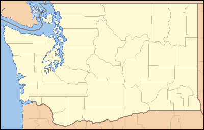 Location in the state of Washington | |
| Website: Saltwater State Park | |
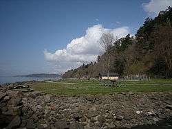
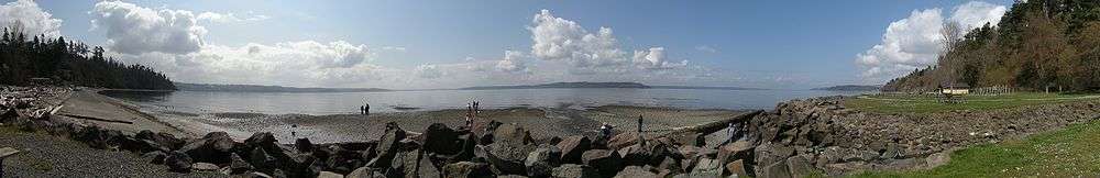
Saltwater State Park is a 87.4 acres (0.354 km2) plot of second-growth timber on Puget Sound in the City of Des Moines, Washington, United States halfway between Seattle and Tacoma. The main attraction is 1,445 feet (440 m) of saltwater beachfront, including a sandy swimming beach in the southwest corner, and rocky tideflats along the west with a submerged artificial reef that is popular with scuba divers. A forty-person group camp looks down on the beach from a high bluff.
Overlooked by most visitors is the steep ravine of McSorley (formerly Smith) Creek which winds inland in a gentle "S" curve joined by three tributary streams. Fifty-two campsites are situated on a road that parallels the creek, serving the public on a first-come-first-served basis. On both the north and south sides of the ravine there is a network of hiking trails which follow up the side creeks, rise through jungles of stinging nettles, skirt the edges of cliffs and ridges, and cross wooded plateaus.
As of 2009, Saltwater State Park has been designated a Marine Protected Area. Salmon spawn in McSorley Creek and the area provides habitat for many species of fish. There is some concern that the increase in visitors to the park due to the artificial reef may harm fish populations. In addition, the boundaries of the Marine Protected Area are not well marked and both professional and amateur geoduck harvesters may sometimes accidentally be out of compliance with the Marine Protected Area harvest restrictions.
Marine View Drive passes over the park on a 200 feet (61 m) high bridge, and 16th Avenue S crosses two branches of McSorley Creek to form the eastern boundary. One trail rises between the two branches of the creek to exit the park, while another trail continues from the dead-end of the campground service road a short way east of 16th Ave. along the main branch of the creek, informally extending the park.
The Redondo turn point for jets approaching SeaTac Airport is just to the south, so the park is rather noisy, but Saltwater remains the most-used State Park in the Puget Sound region with an average of 750,000 visitors a year.
Sources
| Wikimedia Commons has media related to Saltwater State Park. |
- Hacking, Sue Muller (1997). Take A Walk. Seattle: Sasquatch Books.
- Mueller, Marge & Ted (1993). Washington State Parks: A Complete Recreation Guide. Seattle: The Mountaineers. ISBN 0-89886-893-9.
- "Saltwater State Park Marine Preserve". Washington Department of Fish and Wildlife.
External links
- Saltwater State Park. Washington State Parks and Recreation Commission