Saltville, Virginia
| Town of Saltville, Virginia | ||
|---|---|---|
| Town | ||
 | ||
| ||
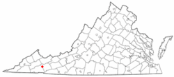 Location in the Commonwealth of Virginia | ||
| Coordinates: 36°52′25″N 81°45′39″W / 36.87361°N 81.76083°WCoordinates: 36°52′25″N 81°45′39″W / 36.87361°N 81.76083°W | ||
| Country | United States | |
| State | Virginia | |
| Counties | Smyth, Washington | |
| Government | ||
| • Mayor | C. Todd Young | |
| Area | ||
| • Total | 8.1 sq mi (21.0 km2) | |
| • Land | 8.1 sq mi (20.9 km2) | |
| • Water | .04 sq mi (0.1 km2) .49% | |
| Elevation | 1,726 ft (526 m) | |
| Population (2010) | ||
| • Total | 2,077 | |
| • Density | 274/sq mi (105.7/km2) | |
| U.S. Census Bureau, 2010 Population Estimates | ||
| Time zone | EST (UTC-5) | |
| • Summer (DST) | EDT (UTC-4) | |
| ZIP code | 24370 | |
| Area code(s) | 276 | |
| FIPS code | 51-70096[1] | |
| GNIS feature ID | 1486913[2] | |
| Website | http://www.saltville.org/ | |

Saltville is a town in Smyth and Washington counties in the U.S. state of Virginia. The population was 2,077 at the 2010 census.[3] It is part of the Kingsport–Bristol (TN)–Bristol (VA) Metropolitan Statistical Area, which is a component of the Johnson City–Kingsport–Bristol, TN-VA Combined Statistical Area – commonly known as the "Tri-Cities" region.
History
Saltville was named for the salt marshes in the area. Prior to European settlement, these marshes attracted local wildlife. Excavations at the SV-2 archaeological site in the area have recovered several well preserved skeletons of now extinct species dating back to the last ice age.[4] Indigenous peoples of varying cultures hunted at the marshes. The historic Native American people in the area were the Chisca.
Archaeologists in 1992 proposed the existence of a prehistoric "Saltville Complex Petty Chiefdom", with a paramount village located at the Northwood High School site, 44SM8. They reported "Saltville style gorgets" as well as iron and copper materials, scattered across the region.[5]
During the spring of 1567, Spanish conquistador Hernando Moyano de Morales led a force of 15-20 soldiers northward from Fort San Juan in Joara, a city in what is now western North Carolina.[6] The force attacked and burned the Chisca village of Maniatique, which may have been located at or near the site of Saltville.[7][8]
During the American Civil War, Saltville was one of the Confederacy's main saltworks. The saltworks were considered vital to the Confederate war effort because the salt was used in preserving meat for Confederate soldiers and civilians. Because of its importance, the town was attacked by Northern forces intent on destroying the saltworks. On October 2, 1864 the First Battle of Saltville was fought here. In the battle Union forces attacked Saltville but were defeated by Confederate troops. Following the battle a number of wounded black troops were murdered in what was dubbed the "Saltville Massacre." (Shortly after the war Champ Ferguson was tried, convicted, and executed for war crimes for this and other killings.)
Two months later General George Stoneman, a Union cavalry commander, led a second attack on the saltworks (known as the Second Battle of Saltville). This time the Confederates were defeated and the saltworks were destroyed by Union troops. The loss of the Saltville works was considered a major blow to the Confederacy's dwindling resources.
Preston House, Saltville Battlefields Historic District, Saltville Historic District, and the Scott-Walker House are listed on the National Register of Historic Places.[9]

Geography
Saltville is located at 36°52′25″N 81°45′39″W / 36.87361°N 81.76083°W (36.873480, -81.760833).[10]
According to the United States Census Bureau, the town has a total area of 8.1 square miles (21.0 km²), of which, 8.1 square miles (20.8 km²) of it is land and 0.04 square miles (0.1 km²) of it (0.49%) is water.
The salt caverns in Saltville, Virginia are used for gas storage, the only one to serve the Mid-Alantic states. The cavern type in Saltville, is considered the best for this purpose because the gas can be injected and removed quickly to meet immediate demand. The structure is very safe and has the structural strength of steel.
Muck Dam collapse
Saltville was the location of the infamous "Muck Dam" break on December 24, 1924 which allowed the release of a huge volume of liquid chemical waste (stored there by the Mathieson Alkali Company) into the North Holston River taking the lives of nineteen people who lived along the river.[11] The river remained polluted and virtually dead for several decades afterward.[12][13][14][15]
Museum of the Middle Appalachians
Saltville is also home of the Museum of the Middle Appalachians. The museum is centrally located in the town and offers an excellent view into the past of the town and the region. The museum displays numerous exhibits on topics such as the geologic past, Civil War, the company town, and the Woodland Indians.[16]
Government
Saltville's current mayor is C. Todd Young, who took office in 2014 when he polled nearly 64 percent of all ballots cast.[17] The town is also regulated by a town council consisting of six other members, currently: Randall Brickey, Darrol Coe, Johnny Norris, Ron Orr, Vincent Maiden, and Terry Hunt, as well as Mayor Young.[18]
Demographics
| Historical population | |||
|---|---|---|---|
| Census | Pop. | %± | |
| 1880 | 185 | — | |
| 1900 | 1,051 | — | |
| 1910 | 1,628 | 54.9% | |
| 1920 | 2,248 | 38.1% | |
| 1930 | 2,964 | 31.9% | |
| 1940 | 2,650 | −10.6% | |
| 1950 | 2,678 | 1.1% | |
| 1960 | 2,844 | 6.2% | |
| 1970 | 2,527 | −11.1% | |
| 1980 | 2,376 | −6.0% | |
| 1990 | 2,300 | −3.2% | |
| 2000 | 2,204 | −4.2% | |
| 2010 | 2,077 | −5.8% | |
| Est. 2015 | 2,031 | [19] | −2.2% |
| source:[20] | |||
As of the census of 2010, there were 2,077 people, 879 households, and 593 families residing in the town. The population density (in 2000) was 273.7 people per square mile (105.7/km²). There were 967 housing units. The racial makeup of the town was 98.5% White, 0.4% African American, 0.1% Native American, 0.05% from other races, and 0.7% from two or more races. Hispanic or Latino of any race were 0.5% of the population.
There were 879 households out of which 24% had children under the age of 18 living with them, 45.4% were married couples living together, 14.6% had a female householder with no husband present, and 32.5% were non-families. The average household size was 2.36 and the average family size was 2.91.
In the town the population was spread out with 24.5% under the age of 19, 6.5% from 20 to 24, 21.2% from 25 to 44, 30.5% from 45 to 64, and 17.5% who were 65 years of age or older. The median age was 43.4 years. For every 100 females there were 89.3 males. For every 100 females age 18 and over, there were 85.1 males.
The median income for a household in the town was $24,375, and the median income for a family was $42,639. Males had a median income of $36,071 versus $30,063 for females. The per capita income for the town was $19,595. About 18.1% of families and 20.6% of the population were below the poverty line, including 41.4% of those under age 18 and 15.9% of those age 65 or over.
Notable people
- Clay Davidson - Country musician
- Texas Gladden- Sister of Smith, also a successful musician
- Robert Porterfield - founder of the Barter Theater
- Hobart Smith - Old time music legend
Climate
Climate in this area has mild differences between highs and lows, and there is adequate rainfall year round. The Köppen Climate Classification subtype for this climate is "Cfb". (Marine West Coast Climate/Oceanic climate).[21]
References
- ↑ "American FactFinder". United States Census Bureau. Archived from the original on 2013-09-11. Retrieved 2008-01-31.
- ↑ "US Board on Geographic Names". United States Geological Survey. 2007-10-25. Retrieved 2008-01-31.
- ↑ "American FactFinder". United States Census Bureau. Retrieved 2014-01-11.
- ↑ "Virginia Museum Natural History". Vmnh.net. Retrieved 2011-12-07.
- ↑ Barber and Barfield, "The Late Woodland in the Environs of Saltville, Virginia: A Case for Petty Chiefdom Development," 5th Upland Archaeology in the East Symposium, Boone, N.C., cited in Beck 1997 "From Joara to Chiaha"
- ↑ James O. Glanville (2004). Conquistadors at Saltville in 1567?: A Review of the Archeological and Documentary Evidence. Smithfield Review.
- ↑ JSTOR: Southeastern Archaeology, Vol. 16, No. 2 (Winter 1997), pp. 162-169
- ↑ Berrier Jr., Ralph (September 20, 2009). "The slaughter at Saltville". The Roanoke Times. Retrieved October 9, 2011.
- ↑ National Park Service (2010-07-09). "National Register Information System". National Register of Historic Places. National Park Service.
- ↑ "US Gazetteer files: 2010, 2000, and 1990". United States Census Bureau. 2011-02-12. Retrieved 2011-04-23.
- ↑ Selden, Ina Lee (March 13, 1980). "The town that would not die". The Christian Science Monitor. Boston, Mass.
- ↑ "The Atlanta Journal - Constitution Article on Dam". Mywebpages.comcast.net. Archived from the original on 2006-05-27. Retrieved 2011-12-07.
- ↑ "Roanoke Times Article on Dam". Roanoke.com. Retrieved 2011-12-07.
- ↑ "US EPA Superfund Site". Epa.gov. 2006-06-28. Retrieved 2011-12-07.
- ↑ "VA Department Environmental Quality" (PDF). Retrieved 2011-12-07.
- ↑ "Museum of the Middle Appalachians". Museum-mid-app.org. Retrieved 2011-12-07.
- ↑ "Saltville Voters Give Nod to Young; Chilhowie Unseats 2 Incumbents, Marion Incumbents Get OK". swvatoday.com. 2014-05-07.
- ↑ "Saltville Town Council". Saltville, VA. Retrieved 2014-01-11.
- ↑ "Annual Estimates of the Resident Population for Incorporated Places: April 1, 2010 to July 1, 2015". Retrieved July 2, 2016.
- ↑ "Population Finder: Saltville CDP, Virginia". U.S. Census Bureau. Retrieved 2010-01-04.
- ↑ Climate Summary for Saltville, Virginia
External links
Municipalities and communities of Smyth County, Virginia, United States | ||
|---|---|---|
| Towns | 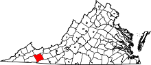 | |
| CDPs | ||
| Unincorporated communities | ||
Municipalities and communities of Washington County, Virginia, United States | ||
|---|---|---|
| Towns | 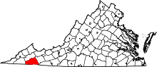 | |
| CDPs | ||
| Unincorporated communities | ||
| Footnotes | ‡This populated place also has portions in an adjacent county or counties | |