Salisbury District
Coordinates: 51°04′01″N 1°47′53″W / 51.067°N 1.798°W / 51.067; -1.798
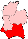
Salisbury was a local government district in Wiltshire, England, from 1974 to 2009. Its main urban area was the city of Salisbury.
The district was formed on 1 April 1974, under the Local Government Act 1972, as a merger of the previous municipal boroughs of Salisbury and Wilton, along with Amesbury Rural District, Mere and Tisbury Rural District and Salisbury and Wilton Rural District.
On 1 April 2009, the district was abolished as part of the 2009 structural changes to local government in England, when its functions were taken over by the new Wiltshire Council unitary authority. At the same time, a parish council serving only Salisbury and its suburbs was formed, called Salisbury City Council.
Political control
The political control of the Council was as follows:[1]
- 1976-1979 NOC (No Overall Control)
- 1979-1983 NOC
- 1983-1987 NOC
- 1987-1991 Conservative
- 1991-1995 Conservative
- 1995-1999 Liberal Democrat
- 1999-2003 NOC
- 2003-2007 Conservative
- 2007-2009 NOC (administration by coalition of Liberal Democrat and Labour)
The political composition of the authority when it came to an end on 31 March 2009 was 22 Conservatives, 19 Liberal Democrats, ten Labour members, and four Independents.
Places
- Alderbury, Allington, Alvediston, Amesbury, Ansty
- Berwick St John, Berwick St Leonard, Broad Chalke, Bulford
- Donhead St Andrew, Donhead St Mary, Downton, Durrington
- Ebbesbourne Wake
- Laverstock
- Mere
- Redlynch
- Salisbury, Shrewton
- Tilshead, Tisbury
- West Grimstead
- Wilton, Winterbourne Stoke, Winterslow
References
|
|---|
|
| Unitary authorities | |
|---|
|
| Major settlements | |
|---|
|
| Rivers | |
|---|
|
| Topics | |
|---|
|
|---|
|
| |
|---|
| Abolished | | |
|---|
| New | |
|---|
| Existing (1990s) | |
|---|
|
|
|
| |
|---|
| Abolished | | |
|---|
| New | |
|---|
| Existing (1990s) | |
|---|
|
|
|
| |
|---|
| Abolished | | |
|---|
| New | |
|---|
| Existing (1890s) | |
|---|
|
|
|
| |
|---|
| Abolished | | |
|---|
| New | |
|---|
| Existing (1990s) | |
|---|
|
|
|
| |
|---|
| Abolished | | |
|---|
| New | |
|---|
| Existing (1990s) | None |
|---|
|
|
|
| |
|---|
| Abolished | | |
|---|
| New | |
|---|
| Existing (1990s) | |
|---|
|
|
|
| |
|---|
| Abolished | | |
|---|
| New | |
|---|
| Existing (1990s) | |
|---|
|
|
.png)
.png)
.png)
.png)
.png)
.png)
.png)