Saiq
| Saiq | |
|---|---|
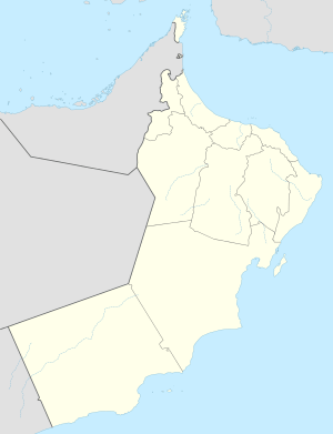 Saiq Location in Oman | |
| Coordinates: 23°4′0″N 57°39′0″E / 23.06667°N 57.65000°ECoordinates: 23°4′0″N 57°39′0″E / 23.06667°N 57.65000°E | |
| Country |
|
| Subdivision | Ad Dakhiliyah Region |
Saiq is a town in the region Ad Dakhiliyah, in northeastern Oman. It has its own airport, Saiq Airport.[1]
Climate
Saiq has a hot semi-arid climate (Köppen climate classification: BSh) for an isotherm of the coldest month's mean temperature of 0 °C (32 °F) or lower, or as a cold semi-arid (BSk) for an isotherm of the yearly mean temperature of lower than 18 °C (64 °F),[2] with very warm summers and cool winters. Precipitation is higher, and temperatures are lower, than in many other towns in Oman due to its high altitude in the Al Hajar Mountains. The highest temperature recorded in Saiq is 37.1 °C (98.8 °F), recorded on August 1, 1997,[3] and the lowest temperature is −3.6 °C (25.5 °F), recorded on January 26, 1983.[4][5]
| Climate data for Saiq | |||||||||||||
|---|---|---|---|---|---|---|---|---|---|---|---|---|---|
| Month | Jan | Feb | Mar | Apr | May | Jun | Jul | Aug | Sep | Oct | Nov | Dec | Year |
| Record high °C (°F) | 21.5 (70.7) |
23.5 (74.3) |
26 (79) |
29.2 (84.6) |
34.5 (94.1) |
34.8 (94.6) |
34.4 (93.9) |
37.1 (98.8) |
32.2 (90) |
28.4 (83.1) |
26.5 (79.7) |
22.2 (72) |
37.1 (98.8) |
| Average high °C (°F) | 12 (54) |
13.5 (56.3) |
16.9 (62.4) |
20.8 (69.4) |
24.7 (76.5) |
27.6 (81.7) |
27.3 (81.1) |
26.4 (79.5) |
24 (75) |
20.5 (68.9) |
16.1 (61) |
12.9 (55.2) |
20.23 (68.42) |
| Daily mean °C (°F) | 9.3 (48.7) |
11.4 (52.5) |
14.8 (58.6) |
18.4 (65.1) |
22.2 (72) |
25.1 (77.2) |
25 (77) |
24.1 (75.4) |
21.7 (71.1) |
18.1 (64.6) |
13.4 (56.1) |
10.5 (50.9) |
17.83 (64.1) |
| Average low °C (°F) | 3.7 (38.7) |
6.4 (43.5) |
9.5 (49.1) |
12.9 (55.2) |
16.5 (61.7) |
19.4 (66.9) |
19.8 (67.6) |
19 (66) |
16.4 (61.5) |
12.5 (54.5) |
7.2 (45) |
4.9 (40.8) |
12.35 (54.21) |
| Record low °C (°F) | −3.6 (25.5) |
−3 (27) |
1.4 (34.5) |
2.3 (36.1) |
5.3 (41.5) |
10.2 (50.4) |
11.3 (52.3) |
11.5 (52.7) |
9.4 (48.9) |
5.2 (41.4) |
−1.2 (29.8) |
−3.6 (25.5) |
−3.6 (25.5) |
| Average precipitation mm (inches) | 6.2 (0.244) |
60.1 (2.366) |
51.9 (2.043) |
32.6 (1.283) |
26.2 (1.031) |
13 (0.51) |
37.2 (1.465) |
51.2 (2.016) |
18.6 (0.732) |
1.6 (0.063) |
5.8 (0.228) |
11.7 (0.461) |
316.1 (12.442) |
| Average relative humidity (%) | 52 | 58 | 45 | 41 | 31 | 27 | 41 | 37 | 38 | 35 | 47 | 59 | 42.6 |
| Source #1: NOAA (1961-1990) [6] | |||||||||||||
| Source #2: Tutiempo.net (August record high) [3] | |||||||||||||
References
- ↑ "Saiq airports". airportdatabase.net. Retrieved January 15, 2013.
- ↑ "Climate: As Saiq (altitude: 1966m) - Climate graph, Temperature graph, Climate table". Climate-Data.org. Retrieved 2013-12-10.
- 1 2 Date of maximum recorded temperature - "Climate Saiq - Year 1997". TuTiempo.net. Retrieved January 15, 2013.
- ↑ Date of minimum recorded temperature - "Global Summary of the Day (GSOD)". National Climatic Data Center. Retrieved January 15, 2013.
- ↑ Record temperatures - "Extreme Temperatures Around the World". Retrieved January 15, 2013.
- ↑ "Saiq Climate Normals 1961-1990". National Oceanic and Atmospheric Administration. Retrieved January 15, 2013.
Capital: Nizwa | |
| Wilayah | |
| Towns and villages | |
This article is issued from Wikipedia - version of the 10/24/2014. The text is available under the Creative Commons Attribution/Share Alike but additional terms may apply for the media files.