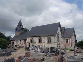
Sainte-Croix-sur-Aizier
| Sainte-Croix-sur-Aizier | |
|---|---|
 | |
 Sainte-Croix-sur-Aizier | |
|
Location within Normandy region  Sainte-Croix-sur-Aizier | |
| Coordinates: 49°25′05″N 0°37′50″E / 49.4181°N 0.6306°ECoordinates: 49°25′05″N 0°37′50″E / 49.4181°N 0.6306°E | |
| Country | France |
| Region | Normandy |
| Department | Eure |
| Arrondissement | Bernay |
| Canton | Bourg-Achard |
| Intercommunality | Quillebeuf-sur-seine |
| Government | |
| • Mayor (2008–2014) | Didier Lannoy |
| Area1 | 4.82 km2 (1.86 sq mi) |
| Population (2008)2 | 254 |
| • Density | 53/km2 (140/sq mi) |
| Time zone | CET (UTC+1) |
| • Summer (DST) | CEST (UTC+2) |
| INSEE/Postal code | 27526 / 27500 |
| Elevation |
35–132 m (115–433 ft) (avg. 120 m or 390 ft) |
|
1 French Land Register data, which excludes lakes, ponds, glaciers > 1 km² (0.386 sq mi or 247 acres) and river estuaries. 2 Population without double counting: residents of multiple communes (e.g., students and military personnel) only counted once. | |
Sainte-Croix-sur-Aizier is a former commune in the Eure department in Normandy in northern France. On 1 January 2016, it was merged into the new commune of Bourneville-Sainte-Croix.[1]
Population
| Historical population | ||
|---|---|---|
| Year | Pop. | ±% |
| 1962 | 211 | — |
| 1968 | 226 | +7.1% |
| 1975 | 241 | +6.6% |
| 1982 | 234 | −2.9% |
| 1990 | 192 | −17.9% |
| 1999 | 194 | +1.0% |
| 2008 | 254 | +30.9% |
See also
References
- ↑ Arrêté préfectoral 23 November 2015 (French)
| Wikimedia Commons has media related to Sainte-Croix-sur-Aizier. |
This article is issued from Wikipedia - version of the 3/24/2016. The text is available under the Creative Commons Attribution/Share Alike but additional terms may apply for the media files.