Sainte-Apolline-de-Patton, Quebec
| Sainte-Apolline-de-Patton | |
|---|---|
| Parish municipality | |
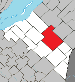 Location within La Matapédia RCM. | |
 Sainte-Apolline-de-Patton Location in province of Quebec. | |
| Coordinates: 46°48′N 70°12′W / 46.800°N 70.200°WCoordinates: 46°48′N 70°12′W / 46.800°N 70.200°W[1] | |
| Country |
|
| Province |
|
| Region | Chaudière-Appalaches |
| RCM | Montmagny |
| Constituted | December 14, 1909 |
| Government[2] | |
| • Mayor | Thérèse Mercier |
| • Federal riding |
Montmagny—L'Islet— Kamouraska—Rivière- du-Loup |
| • Prov. riding | Côte-du-Sud |
| Area[2][3] | |
| • Total | 257.60 km2 (99.46 sq mi) |
| • Land | 259.35 km2 (100.14 sq mi) |
|
There is an apparent contradiction between two authoritative sources | |
| Population (2011)[4] | |
| • Total | 621 |
| • Density | 2.4/km2 (6.2/sq mi) |
| • Pop 2006-2011 |
|
| • Dwellings[4] | 384 |
| Postal code(s) | G0R 2P0 |
| Area code(s) | 418 and 581 |
| Highways |
|
| Website |
www depatton |
Sainte-Apolline-de-Patton is a parish municipality of 621 people[4] in Montmagny Regional County Municipality in the Chaudière-Appalaches region of Quebec.
See also
- L'Islet Regional County Municipality
- Big Black River (Saint John River), a river
- List of parish municipalities in Quebec
References
- ↑ Reference number 56056 of the Commission de toponymie du Québec (French)
- 1 2 Geographic code 18025 in the official Répertoire des municipalités (French)
- ↑ "(Code 2418025) Census Profile". 2011 census. Statistics Canada. 2012.
- 1 2 3 "Corrections and updates: Population and dwelling count amendments, 2011 Census". Statistics Canada. February 14, 2013. Retrieved February 15, 2013.
 |
Cap-Saint-Ignace | Saint-Cyrille-de-Lessard | Saint-Marcel | |
| Notre-Dame-du-Rosaire | |
Saint-Adalbert | ||
| ||||
| | ||||
| Saint-Paul-de-Montminy | Saint-Fabien-de-Panet | Sainte-Lucie-de-Beauregard |
| Cities & Towns | |
|---|---|
| Municipalities | |
| Parishes | |
| |
This article is issued from Wikipedia - version of the 8/12/2016. The text is available under the Creative Commons Attribution/Share Alike but additional terms may apply for the media files.