St. George, Utah
| St. George, Utah | |
|---|---|
| City | |
 | |
| Nickname(s): Utah's Dixie, STG | |
 Location in Washington County and the state of Utah | |
| Coordinates: 37°5′43″N 113°34′41″W / 37.09528°N 113.57806°WCoordinates: 37°5′43″N 113°34′41″W / 37.09528°N 113.57806°W | |
| Country | United States |
| State | Utah |
| County | Washington |
| Settled | 1861 |
| Incorporated | 1862 |
| Named for | George A. Smith |
| Government | |
| • Mayor | Jon Pike |
| • City Manager | Gary Esplin |
| Area | |
| • City | 64.9 sq mi (168.0 km2) |
| • Land | 64.4 sq mi (162.2 km2) |
| • Water | 0.5 sq mi (1.2 km2) 0.72% |
| Elevation | 2,860 ft (872 m) |
| Population (2015) | |
| • City | 80,202 |
| • Metro | 155,600 |
| Demonym(s) | St. Georgian |
| Time zone | Mountain (UTC-7) |
| • Summer (DST) | Mountain (UTC-6) |
| ZIP Code | 84770-84771, 84790-84791 |
| Area code(s) | 435 |
| Federal Information Processing Standards | 49-65330 |
| Geographic Names Information System feature ID | 1455098 |
| Website | St. George, Utah |
St. George is a city located in the southwestern part of the U.S. state of Utah on the Utah-Arizona border, and is the county seat of Washington County, Utah. It is the principal city of the St. George Metropolitan Statistical Area. The city lies in the northeastern-most part of the Mojave Desert adjacent to Pine Valley Mountains; it's also at the convergence of three distinct geological areas: the Mojave Desert, Colorado Plateau, and Great Basin. It is 118 miles northeast of Las Vegas, Nevada and 300 miles south-southwest of Salt Lake City along Interstate 15. The city is named after George A. Smith, a Church of Jesus Christ of Latter Day Saints Apostle.
As of 2015, St. George had a population of 80,202, and the metropolitan area, defined as Washington County, had an estimated population of 155,600.[1] St. George is the seventh-largest city in Utah and the most populous city in the state outside of the Wasatch Front. In 2005, St. George was the second fastest-growing metropolitan area in the United States, only after Greeley, Colorado, a trend that continued through 2010, when growth slowed substantially due to the economic recession. Today, however, growth trends have rebounded at a steady, but more manageable pace, ranking St. George as the fifth fastest-growing metro area in the country in 2015.[2]
History
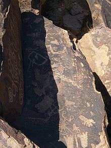
Prior to the arrival of Europeans, the St. George area was inhabited by the Virgin River Anasazi and later by the Paiute tribe. The first Europeans in the area were part of the Dominguez–Escalante Expedition in 1776. St. George was founded as a cotton mission in 1861 under the direction of Apostle Erastus Snow which was called Dixie by Brigham Young, who was then the president of The Church of Jesus Christ of Latter-day Saints. While early settlers did manage to grow cotton, it was never produced at competitive market rates; consequently, cotton farming was eventually abandoned and replaced by a tourist based economy as the railroads developed bringing visitors to the nearest National Park which is Zion National Park.
At the outbreak of the American Civil War in 1861, Brigham Young organized the settlement of what is now Washington County, Utah.
Fearing that the war would take away the cotton supply, he began plans for raising enough in this southwestern country to supply the needs of his people. Enough favorable reports had come to him from this warm region below the rim of the Great Basin, that he was convinced cotton could be raised successfully here. At the general church conference in Salt Lake City on October 6th, 1861, about three hundred families were "called" to the Dixie mission to promote the cotton industry. Most of the people knew nothing of this expedition until their names were read from the pulpit; but in nearly every case, they responded with good will, and made ready to leave within the month’s time allotted to them. The families were selected so as to ensure the communities the right number of farmers, masons, blacksmiths, businessmen, educators, carpenters, as needed.[3]
The settlement was named after George A. Smith, an apostle of the Church of Jesus Christ of Latter-day Saints.[4]
Notable events
In April 1877, the LDS Church completed the St George, Utah Temple. It is the Church's third temple, and it is the longest continually operating temple in southern Utah. St. George was the location of the 1997 United States Academic Decathlon national finals and more recently, in January 2005 a 100-year flood occurred throughout the region due to prolonged heavy rainfall overflowing the Virgin River and Santa Clara River (Utah). One person was killed and twenty-eight homes were destroyed by the raging Santa Clara River.[5][6]
Nuclear contamination
St. George received the brunt of the fallout of above-ground nuclear testing in the Yucca Flats/Nevada Test Site northwest of Las Vegas in the early 1950s. Winds routinely carried the fallout of these tests directly through the St. George and southern Utah area. Marked increases in cancer not limited to leukemia, lymphoma, thyroid cancer, breast cancer, melanoma, bone cancer, brain tumors, and gastrointestinal tract cancers were reported from the mid-1950s and still continue today.[7][8]
A 1962 United States Atomic Energy Commission report found that children living in St. George, Utah, at the time of the fallout may have received doses to the thyroid of radioiodine as high as 120 to 440 rads" (1.2 to 4.4 Gy).[9]
Geography

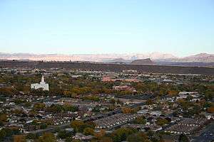
According to the United States Census Bureau, the city has a total area of 64.9 square miles (168.0 km²), of which, 64.4 square miles (166.8 km²) of it is land and 0.5 square miles (1.2 km²) of it (0.72%) is water. St. George lies in a desert valley with most of the city lying below 3,000 feet (900 m). Wildlife and vegetation are typical of the Mojave Desert in which it lies. It is situated near a unique geological transition zone where the Mojave, Colorado Plateau and Great Basin all converge. The Beaver Dam Mountains, commonly referred to as Utah Hill, lie to the west, the Red Cliffs National Conservation Area and Pine Valley Mountains to the north, the western edge of the Colorado Plateau and Zion National Park to the east, and the Arizona Strip to the south. The Virgin River passes through the city.
Cityscape
The urban area is studded by numerous hills, mesas, waterways and habitat reserves, creating natural boundaries of sections, neighborhoods and communities within the city. Today, the city appears much differently than in its early days in history when the town was tucked below the red sandstone bluffs between the two black volcanic ridges. The city is bordered by its suburbs, Washington to the east, Santa Clara and Ivins to the west-northwest and the community of Bloomington which forms the southwestern part of the city. As the city expanded, so did the network of roads and highways, and with all the ridges and rugged terrain of the valley, it made for a challenge, especially for east-west oriented travel. When the grid was originally plotted, the streets were built unusually wide so horse wagons could easily make U-turns and park with ample space.
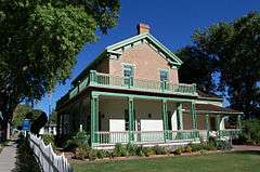
The downtown area is generally defined as being the central valley between the Black Hill to the west, the red sandstone bluff or Red Hill to the north, Foremaster Ridge to the east and the Virgin River to the south. Interstate 15 cuts nearly through the center, severing many surface streets of the grid. The major roads, St. George Boulevard, Bluff Street and Dixie Drive are the main downtown area interchanges, and are part of the Interstate 15 business loop, however, Dixie Drive serves as the major thoroughfare connecting downtown and I-15 with the west side of the valley. Interestingly, due to the topography, not one of the city's major roadways actually runs unobstructed from one end of the city to the other. The old part of downtown has a well defined grid of broad, tree-lined avenues, with the center point being at the intersection of Tabernacle and Main Streets. All streets parallel to Tabernacle run east-west and all streets parallel to Main run north-south. The downtown area is home to the city's historic district with many preserved pioneer-era homes and storefronts registered on the national historic list, as well as the campus of Dixie State University and many of the city's office, retail, health and religious centers. Both the city's east and west sides are predominantly urban and suburban residential neighborhoods with growing neighborhood residential/commercial mixed shopping districts, however the east side and along the River Road corridor boasts the majority of the area's shopping centers and industrial parks.
Much of the city's more exclusive, high-end neighborhoods lie among the elevated hills and mesas to capture the scenic views of the area that comes with a price. One such neighborhood is Stone Cliff, a high-end master planned gated community of multi-million dollar estates perched on a hillside overlooking downtown and the valley from the southeast.[10][11] Sun River, in the far southwest part of the city, is Utah's first and only active adult master planned retirement community offering golfing and resort-style amenities. New subdivisions in the far southern reaches of the valley such as Desert's Edge are popping up in remote territory along Southern Parkway (SR-7), a southern spur of the future Dixie Beltway, south of the regional airport. This area city planners and organizers refer to as the 'South Block', a section of vast open desert lands within city limits straddling the Arizona border proposed for future urban development. Most of the remaining agricultural areas exist primarily in the open-spaced southeastern parts of the city known as Little Valley, a rapidy-growing area where residents are striving to preserve one of the last remaining rural-lifestyle areas in the city. The Dixie Downs neighborhood in the northwest part of town, is named for an old horse race track that once existed near what is now the intersection of Dixie Downs Road and Snow Canyon Parkway. It's a densely developed area of mixed low to mid-income housing and projects. Dixie Downs is notable for being the most ethnically diverse neighborhood in the city and is home to the first dual-language immersion public school in the Washington County School District.
Geology

In southwestern Utah, soil and rock formations are red in appearance due to the presence of iron oxide, although portions of the older section of the city, particularly the southern part near the Virgin River, lie on floodplain alluvium, but much of St. George proper is built directly upon Jurassic, Triassic, and Permian period sedimentary bedrock. The following formations are listed in chronological order and can be found within the city limits.
Kaibab Limestone (Permian): Grey fossiliferous limestone, exposed at the center of the Virgin River anticline along Horseman Park Drive and in the low hills to the south of South Bloomington Hills.
Moenkopi Formation (Triassic): Chocolatey-red and white banded mudstone, shale, limestone, and siltstone containing thick layers of gypsum, exposed at Bloomington, South Bloomington Hills, and the south side of Webb Hill.
Shinarump Conglomerate (Triassic): Yellow to brown cliff-forming sandstone and conglomerate containing fossilized oyster shells and petrified wood. Forms the cliff faces north of Bloomington, on Webb Hill, and along the Virgin River south of 1450 South Street. This is actually the lowest member of the Chinle formation.
Chinle Formation (Triassic): Purple, white, grey and locally green bentonitic shale weathering to clay. Because of the softness of the strata, structures built on this formation run a higher risk of settling or slippage. The Chinle formation underlies large portions of St. George, including North Bloomington Hills, much of Green Valley, and much of the east side of the city around Riverside Drive and Pine View High School.

Moenave Formation (Jurassic): Red and orange sandstone, siltstone, and mudstone. There is some confusion about distinguishing between the Springdale sandstone member of the Moenave formation and the overlying Navajo sandstone, which is similar in appearance, in the St. George area. It is now generally assumed that the red cliffs north of downtown (north of Red Hills Parkway) and at the Dixie Red Hills golf course are part of the Moenave formation. Other exposures include cuts into the east and west Black Hills and the southern part of the Dixie Downs neighborhood.
Kayenta Formation (Jurassic): Red, orange, and purple sandstone, shale, and mudstone. Forms slopes below the massive Navajo sandstone in the northern part of the city including northern Dixie Downs and along Snow Canyon Parkway.
Navajo Sandstone (Jurassic): Grey to brown, red, and (in its upper layers) white massive sandstone. Forms cliff faces above Snow Canyon Parkway and white outcrops at Winchester Hills.
Basaltic lava flows from the Quaternary period form the black ridges to the east and west of the old part of St. George city. The volcanic eruptions producing these flows are thought to date back 1.2 million years.
Other points of geologic interest include the Virgin River anticline; the rock has eroded away in the center leaving sheer walls surrounding the "Purgatory Flats" area to the east of St. George. Another geologic feature is Pine Valley Mountain, composed of one solid piece of granite, it is one of the largest laccoliths in the world.
Climate
St. George's climate is significantly warmer on average than the rest of Utah, and typical of the desert southwest, with an arid desert climate (Köppen BWks or BWhs), featuring long, hot summers and brief, cool winters. The monthly daily average temperature ranges from 41.3° in December to 87.9° in July, while there are 60 days with 100°+ highs with an average window of June 29 thru August 13, and 122 days with 90° with the average window fluctuating between late April and early October, and approximately 61 days where the low reaches freezing with the historical average window between November 12 and March 14.
The highest temperature statewide was 118 °F which was recorded in a remote area south of St. George proper, near the Arizona border on July 4, 2007, breaking the previous record-holder, in St. George itself, at 117° set on July 5, 1985.[12] The record high minimum temperature is 89° set on July 15, 1970, and July 3, 2013. Nighttime freezes are common during the winter due to radiative cooling. Both the record low temperature of −11 °F and record low maximum temperature of 17 °F were set on January 22, 1937; the record low temperature occurred again on January 26, 1937.[12]
The city has abundant sunshine year-round and averages of over 300 sunny days per year, averaging 8.80 inches of precipitation annually.[12] Precipitation is fairly evenly distributed throughout the year, except for a dry period from mid April through June which occurs after the pacific storm season but before the southwest monsoon. Precipitation mostly comes from the Pacific Ocean from late fall through early spring. The storm track usually lifts north of the city by mid-April. The monsoon brings localized and often intense thunderstorms early-July through mid-September. The greatest rainfall in 24-hours was 2.40 inches and was on August 31, 1909.[12] Snowfall is rare in the city with many seasons recording no measurable accumulation; the normal seasonal snowfall is 1.4 inches.[12] The earliest snowfall was measured on October 29, 1971 and the latest on April 11, 1927.[12] The record single day snowfall is 10.0 inches which was set on January 5, 1974. The most recent major snowfall was on December 8, 2013, when between 6.0 and 8.0 inches blanketed the city, making it the third heaviest snowfall in St. George's recorded history. It was also a remarkable storm for how low temperatures fell and remained that way for several days, killing much of the area's non-native sensitive vegetation. Temperatures during that first week of December 2013 were the coldest the city had seen dating back 100 years, with an unofficial nighttime low temperature of -1 °F.[12][13]
| Climate data for St. George, Utah (1981–2010 normals) | |||||||||||||
|---|---|---|---|---|---|---|---|---|---|---|---|---|---|
| Month | Jan | Feb | Mar | Apr | May | Jun | Jul | Aug | Sep | Oct | Nov | Dec | Year |
| Record high °F (°C) | 72 (22) |
84 (29) |
91 (33) |
100 (38) |
108 (42) |
115 (46) |
117 (47) |
113 (45) |
109 (43) |
107 (42) |
88 (31) |
75 (24) |
117 (47) |
| Average high °F (°C) | 53.7 (12.1) |
58.8 (14.9) |
67.3 (19.6) |
75.2 (24) |
85.8 (29.9) |
95.7 (35.4) |
101.4 (38.6) |
99.1 (37.3) |
91.7 (33.2) |
77.7 (25.4) |
62.9 (17.2) |
51.9 (11.1) |
76.8 (24.9) |
| Average low °F (°C) | 31.0 (−0.6) |
35.3 (1.8) |
41.6 (5.3) |
48.7 (9.3) |
58.7 (14.8) |
67.3 (19.6) |
74.5 (23.6) |
72.8 (22.7) |
63.2 (17.3) |
49.7 (9.8) |
38.0 (3.3) |
30.6 (−0.8) |
51.0 (10.6) |
| Record low °F (°C) | −11 (−24) |
1 (−17) |
12 (−11) |
18 (−8) |
20 (−7) |
35 (2) |
41 (5) |
43 (6) |
25 (−4) |
20 (−7) |
4 (−16) |
−4 (−20) |
−11 (−24) |
| Average precipitation inches (mm) | 1.38 (35.1) |
1.26 (32) |
1.18 (30) |
.55 (14) |
.21 (5.3) |
.17 (4.3) |
.48 (12.2) |
.76 (19.3) |
.57 (14.5) |
.68 (17.3) |
.71 (18) |
.85 (21.6) |
8.8 (223.6) |
| Average snowfall inches (cm) | 0.7 (1.8) |
0.3 (0.8) |
0.2 (0.5) |
trace | 0.0 (0) |
0.0 (0) |
0.0 (0) |
0.0 (0) |
0.0 (0) |
trace | 0.1 (0.3) |
0.1 (0.3) |
1.4 (3.6) |
| Average precipitation days (≥ 0.01 in) | 5.2 | 6.1 | 5.3 | 3.6 | 2.2 | 1.5 | 2.9 | 3.5 | 2.6 | 3.7 | 3.5 | 4.5 | 44.6 |
| Average snowy days (≥ 0.1 in) | 0.2 | 0.2 | 0.1 | 0.1 | 0.0 | 0.0 | 0.0 | 0.0 | 0.0 | 0.0 | 0.1 | 0.2 | 0.9 |
| Source: NOAA (extremes 1893–present)[12] | |||||||||||||
Government and infrastructure
The St. George city government is organized as a 6-Member Council District with the mayor acting as a member within that body.[14] As of January, 2014, the mayor of St. George is Jon Pike. The city manager of 37 years is Gary Esplin, Assistant City Manager is Marc M. Mortensen, and council members are Gil Almquist, Jimmy Hughes, Michele Randall, Joe Bowcutt, and Bette Arial, who was appointed on Jan. 23 by the other four members to fill the seat that Jon Pike vacated when he was sworn in as mayor. City Council meetings are held on the first and third Thursdays of each month at the City Council Chambers.[15]
The U.S. Federal Courthouse, Washington County Justice Court, Juvenile Court and the Fifth District Courthouse are located downtown.

Healthcare
Dixie Regional Medical Center is an Intermountain Health Care hospital offering a 24-hour trauma center and basic emergency services for the tri-state region of southern Utah, northwest Arizona and southeastern Nevada.[16]
Utilities
St. George is served by City of St. George Utilities, which serves most of the city, and Dixie Power, which serves southern areas of the city. Rocky Mountain Power serves parts of the greater St. George area.
Arts and culture
St George is fast becoming internationally known as an arts and cultural destination, and is home to an increasing number of world-known events and attractions. The city and surrounding areas have a high concentration of artists drawn by the natural beauty of the area's landscape, flora and fauna
Visual, musical and theater The St. George Arts Festival features local, national and international artists. The festival showcases a wide array of contemporary Southwestern indigenous art. The City of St. George sponsors Art in the Park and Concerts in the park series which offers a variety of musical acts and culinary booths. Vernon Worthen Park is home to the Southwest Symphony Orchestra and Southern Utah Heritage Choir. Art Around the Corner features many outdoor sculptures and statues depicting both local, cultural flare as well as a broad array of ever-changing pieces which come from all over for a temporary display in the downtown area. The roundabouts at Main and 200 North, and Tabernacle Street and Main both pose as downtown centerpieces to display rotating and/or traveling art sculptures. Art galleries are abundant throughout Washington County and southwestern Utah.
Venues, museums and sites
St. George is home to a number of museums and points of interests, and many are located in the downtown historic district.
- St. George Art Museum is the leading art museum which features traveling exhibits displaying culture and time. Historic St.
George Live! offers tours of historic downtown and the arts taking place seasonally during the summer months.
- St. George Children's Museum
- Tuacahn Amphitheater offers live musicals of mostly Disney related subject matter.
- Dixie Sunbowl is an outdoor arena used to host the annual Dixie Roundup Rodeo, rotary football and soccer tournaments.
- Dixie Convention Center is the largest venue in the city and hosts large events, concerts, and regional expos.
- Rosenbruch Wildlife Museum displays stuffed lifelike animals and offers information on world-wide wildlife.
- Historic Ancestor Square in the heart of the Historic District features the downtown Farmers' market, fine dining and cuisine, art galleries and live entertainment.
- The St. George Dinosaur Discovery Site offers a look into the past.
- Brigham Young Winter Home offers scheduled tours.
- Jacob Hamblin Home offers scheduled tours.
- The Saint George Latter Day Saints Temple and visitor center offers tours and information.
- The Space Between Theatre Company, located at the Roene B. Difiore Center For Arts and Education, hosts plays and other theatrical pieces.
- Pioneer Park is a natural landscape park of red sandstone rock formations and home of the local iconic "Dixie" rock. It's a popular hiking and viewing area located on a bluff overlooking downtown.
- Red Hills Desert Garden is designed to show and promote attractive water-smart landscaping, it also features an aquarium exhibiting species of the Virgin River habitat.
- Tonaquint Nature Center offers children's educational programs, a community garden and an arboretum displaying both native and non-native vegetation suitable for the area's climate.
- Thunder Junction All Abilities Park is a miniature theme park catering especially to children with disabilities, but is also a park for everyone.
Events and entertainment
The week-long St. George parade of homes showcases high-end homes and architectural features each February. St. George hosts the bi-annual U.S. Navy Blue Angels airshow,' 'Thunder Over Utah' ' at the regional airport, and the annual Dixie Roundup Rodeo is a long time local tradition at the Dixie Sunbowl. The Dixie Convention Center is the largest state-of-the-art venue in southern Utah and hosts concerts, meetings, and major events such as UFC cage fighting, the Spring Home and Garden Expo, What Women Want Expo and the Dixie Regional Transportation Expo among others. Sunset on the Square is a popular family-friendly event featuring popular movie showings and entertainment outside on a large screen at dusk held at Town Square Park in downtown. The George Street Fest is an arts and concert tour featuring a Jazz Garden with a variety of cuisine, vendors beers and wines occurring every first Friday of each month. It is focused on offering nightlife options in efforts to revitalize the downtown area. Dixie State University features the annual celebrity concert series and spring break concerts.
St. George is well known for both the Huntsman World Senior Games and Boston-qualifying St. George Marathon, and is the thirteenth largest marathon in the country, attracting thousands of participants and tourists each October. Other notable events include; the St. George Ironman 70.3 Triathlon; the Fall Fuel Fest featuring Nitro Circus; The Retro Rock Fest, a two-day outdoor rock show featuring many national and international bands performing on multiple large stages with a beer garden and culinary booths. Neighboring Santa Clara hosts its annual Swiss Days each summer season, celebrating its heritage and Washington City offers a heritage-related annual events like Cotton Days and Peach Days.
Economy
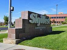

SkyWest Airlines is headquartered in St. George, and is the primary airline provider at the city's regional airport.[17] Walmart has a large distribution center just outside the city and Family Dollar recently opened a distribution center in the Fort Pierce Industrial Park to better serve the southwest region of the U.S.
The Washington County School District main offices are based in the city.[18]
The Cafe Rio restaurant chain was started in St. George in 1997.[19]
A large part of the local economy comes from tourism, due to its proximity to Zion National Park, Bryce Canyon National Park, and Grand Canyon National Park as well as several state parks and recreational areas. Over a dozen golf courses with year-round golfing, and various world-recognized events also make for large contributors to the city's economy.
Transportation
St. George Regional Airport, remotely located southeast of downtown off Southern Parkway, opened in January 2011 at a cost of approximately $175 million, replacing the previous smaller airport that was located on a land-locked mesa in the center of town. Currently, the city is served with daily jet service to Salt Lake City, Denver and Phoenix (as of August 2016).[20]
St. George currently has no rail service. The Union Pacific line between Salt Lake City and Las Vegas is about 60 miles (97 km) north and west of the city.
SunTran is the local public transit system and operates six fixed-routes with over 140 bus stops serving St. George proper and Ivins.[21]
Local governments are putting more emphasis on active transportation, a growing trend in cities today. With the city's 50-plus mile urban trail system along with expanding trail connectivity, and installing of bike lanes on more of the city's roadways, cycling is becoming more popular among commuting residents.
Major highways:
![]() Interstate 15 runs north-south connecting St. George to Salt Lake City and the Canada–US border to the north, and Las Vegas and southern California to the south. St. George is served directly by exits 2, 4, 5, 6, 8 and 10.
The western terminus of Interstate 70, 125 miles (201 km) to the north, connects St. George to Denver, Kansas City and the east coast.
Access to Interstate 10 and Interstate 40 connects St. George to Phoenix and Albuquerque via U.S. Route 93, 120 miles (190 km) to the southwest.
Interstate 15 runs north-south connecting St. George to Salt Lake City and the Canada–US border to the north, and Las Vegas and southern California to the south. St. George is served directly by exits 2, 4, 5, 6, 8 and 10.
The western terminus of Interstate 70, 125 miles (201 km) to the north, connects St. George to Denver, Kansas City and the east coast.
Access to Interstate 10 and Interstate 40 connects St. George to Phoenix and Albuquerque via U.S. Route 93, 120 miles (190 km) to the southwest.
- SR-7 (Southern Parkway) is a partially constructed future beltway.
 U.S. Highway 91, prior to the construction of I-15, was the only major U.S. highway serving the city. Today it is referred to as Old Highway 91.
- SR-8 (Sunset Boulevard)
- SR-34 (St. George Boulevard)
- SR-18 (Bluff Street)
Religion
Statistics as of 2010:
- Other - 24.3%
- Catholic - 4.2%
- Protestant - 2.1%
- LDS - 68.3%[22]
Sports
The St. George community has been the home to two minor-league independent baseball teams. The first, the St. George Pioneerzz (originally the Zion Pioneerzz) who played in the independent Western Baseball League from 1999 to 2001, winning the league championship in 2000. A new franchise, managed by former major league player Darell Evans, was awarded to Utah's Dixie in 2007. The team, the St. George Roadrunners, played in the independent Golden Baseball League before being taken over by the league and moved to Henderson, Nevada in 2010. Several high schools including Dixie, Desert Hills, Pine View, and Snow Canyon all play in 3A state competition. Dixie State College participates in the NCAA Division II Pacific West Conference where famous DSU athletes prevailed including Corey Dillon, Anton Palepoi, Reno Mahe, and Scott Brumfield, who all eventually played in the NFL. Marcus Banks, Lionel Hollins, Keon Clark, and Mo Baker were Dixie players who later played in the NBA. Dixie athletes are called The Rebels, and former Rebels Bradley Thompson and Brandon Lyon later played in major league baseball while Bruce Hurst of Dixie High School later played for the Boston Red Sox as a pitcher, and then ended up managing the now retired Zion Pioneerzz for its inaugural 1999 season (1999).
Rankings
St. George ranked most secure place to live in the United States in 2006.[23] Top 10 Best Small Places for Business and Careers by Forbes[24] Ranked fifth fastest-growing metro area in the country in 2015.;[25] Top 10 safest metro areas in the West.[26]
Parks and recreation
St. George is home to many parks, several award-winning golf courses and recreation areas, as well as over 65 miles of urban trail system.[27] Notable parks and sites include the Canyons Softball Complex; Little Valley Softball Complex; Pioneer Park, Tonaquint Nature Center; St. George Motocross Park a.k.a. SGMX.[28] The Washington County Regional Park and fairgrounds is just east of the city in Hurricane. The Tonaquint All Abilities Park is a first of its kind in the western United States exclusively catering to special needs children, as well as all children. The St. George area has several recreation centers; the St. George Rec Center; Washington City Rec Center in neighboring Washington, and the Sand Hollow Aquatics Center.[29][30] The city also has several dog parks, splash pads, urban fishing ponds and two skateparks.
Media
Radio
| Call sign | Frequency | City of License | Owner | Format | Notes | |
|---|---|---|---|---|---|---|
| KSGU | 90.3 FM | St. George | Nevada Public Radio | Public radio | ||
| KXBN | 92.1 FM | Cedar City | Cherry Creek Radio | Top 40/Contemporary Hit Radio | ||
| KXLI | 94.5 FM | Moapa, Nevada | Radio Activo Broadcasting | Spanish | ||
| KXDS | 91.3 & 94.9 FM | St. George | Dixie State University | Variety (radio) | ||
| KZHK | 95.9 FM | St. George | Canyon Media | Classic rock | ||
| KCLS | 96.3 FM | St. George | Canyon Media | Active Rock | ||
| KYLI | 96.7 FM | Bunkerville, Nevada | Aurora Media | Dance Top 40 | Jelli-programmed; focused on Las Vegas, Nevada | |
| KRQX | 98.9 FM | St. George | Canyon Media | Classic Hits | ||
| KONY | 99.9 FM | St. George, Utah | Canyon Media | Country music | ||
| KFUR-LP | 101.1 FM | St. George | Latinos Unidos Broadcasting | Regional Mexican | ||
| K272AQ | 102.3 FM | St. George | Cherry Creek Radio | Oldies | Repeater of KXFF, Colorado City, Arizona | |
| K279BN | 103.7 FM | St. George | Southwest Media | Oldies | Repeater of KJUL, Las Vegas, Nevada | |
| KURR | 103.1 FM | Hildale | Simmons Media | Top 40 | ||
| KPLD | 94.1 & 105.1 | St. George | Canyon Media | Hot adult contemporary | ||
| KWBR-LP | 105.7 FM | St. George | Association of Community Resources and News | Smooth Jazz | ||
| KIYK | 107.3 FM | St. George | Cherry Creek Radio | Hot adult contemporary | ||
| KDXU | 890 AM | St. George | Cherry Creek Radio | Talk radio | ||
| KHKR | 1210 AM | St. George | Cherry Creek Radio | Sports radio | ||
| KZNU | 1450 AM-93.1 FM | St. George | Canyon Media | Talk radio | – |
Newspapers
- The Spectrum, which is owned by Gannett, is the local, daily newspaper;
- The Independent newspaper offers a monthly print edition featuring local news, arts, entertainment & events coverage. It also provides free online daily news and an online community events calendar.
- St. George News (stgnews.com) is free-access online local and regional news.
- Southern Utah Weekly is a weekly newspaper
The Salt Lake Tribune, Deseret Morning News, and Las Vegas Review-Journal / Las Vegas Sun are also widely distributed in St. George and offer home delivery.
Other publications include; St. George Magazine, a monthly magazine covering a variety of local content, and View On Southern Utah is a magazine offering a variety of content for the southern Utah, southern Nevada and northwestern Arizona area.
Television
St. George has only one television station licensed to the city, KMYU Channel 12, a MyNetworkTV affiliate.[31] The station carries the second half of CBS This Morning and CBS Face the Nation, as well as Family Feud, and has its own newscast at 7:00 p.m. each weeknight. It is carried in HD on Dish Network and DirecTV, as well as on Comcast Ch. 643 in Salt Lake City, and on Ch. 20 on local cable, TDS Communications, formerly Baja Broadband. KMYU (known as My Utah TV[32]) is sister station to KUTV-DT, and is operated out of KUTV's offices in Salt Lake City, although the station has a news bureau with a reporter and photographer based in St. George.
Also in St. George are the offices of Cedar City, Utah-licensed[31] KCSG Channel 14, a MeTV affiliate, which broadcasts local news at 7:00PM and 9:00PM. The city also receives local TV channels from Salt Lake City with broadcast translators in the St. George area.
The Las Vegas NBC affiliate, KSNV-DT, has a local translator owned by Cherry Creek Radio, KVBT-LP channel 41, on which some of its programming airs two hours later than the same programming broadcast on Salt Lake City NBC affiliate KSL-TV.
Education
St. George is home to Dixie State University,[33] a four-year institution, of about 9,000 students (as of 2012), and Dixie Applied Technology College. In addition to the colleges, the city is also home to the College Education Centers of University of Phoenix and Stevens-Henager College.
Public schools

The city of St. George is a part of the Washington County School District. St. George has four public high schools: Dixie High School, Pine View High School, Desert Hills High School, and Snow Canyon High School, as well as Millcreek Alternative High School. The city has four middle schools, three intermediate schools and numerous elementary schools.
Neighboring Ivins is home to Utah's first charter high school, Tuacahn High School for the Performing Arts, which provides an alternative education with no tuition costs to any Utah resident.
Demographics
| Historical population | |||
|---|---|---|---|
| Census | Pop. | %± | |
| 1870 | 1,142 | — | |
| 1880 | 1,384 | 21.2% | |
| 1890 | 1,377 | −0.5% | |
| 1900 | 1,690 | 22.7% | |
| 1910 | 1,769 | 4.7% | |
| 1920 | 2,271 | 28.4% | |
| 1930 | 2,434 | 7.2% | |
| 1940 | 3,591 | 47.5% | |
| 1950 | 4,562 | 27.0% | |
| 1960 | 5,130 | 12.5% | |
| 1970 | 7,097 | 38.3% | |
| 1980 | 11,350 | 59.9% | |
| 1990 | 28,502 | 151.1% | |
| 2000 | 49,728 | 74.5% | |
| 2010 | 72,897 | 46.6% | |
| Est. 2015 | 80,202 | [34] | 10.0% |
In 2015, the city's population was estimated at 80,202. St. George was declared the fifth fastest-growing metropolitan area in the United States in 2015.[25][36]
As of 2011,[37] there were 27,552 households. The population density was 1,135 people per square mile. As of 2010, there were 32,089 housing units at an average density of per square mile. The racial makeup of the city was 87.2% White, 0.7% African-American, 1.5% Native American, 0.8% Asian, 1.0% Pacific Islander, and 8.9% from other races. 12.8% of the population was Hispanic or Latino of any race.
As of the 2000 census, there were 17,367 households out of which 34.2% had children under the age of 18 living with them, 63.6% were married couples living together, 8.6% had a female householder with no husband present, and 24.9% were non-families. 19.4% of all households were made up of individuals and 10.2% have someone living alone who is 65 years old or older. The average household size was 2.81 individuals and the average family size was 3.21.
In the city the age distribution of the population shows 28.4% under the age of 18, 13.7% from 18 to 24, 22.0% from 25 to 44, 16.8% from 45 to 64, and 19.3% who were 65 years of age or older. The median age was 31 years. For every 100 females there were 94.5 males. For every 100 females age 18 and over, there were 91.2 males.
The median income for a household in the city was $36,505, and the median income for a family was $41,788. Males had a median income of $31,106 versus $20,861 for females. The per capita income for the city was $17,022. About 7.4% of families and 11.6% of the population were below the poverty line, including 14.4% of those under age 18 and 4.4% of those age 65 or over. A significant portion of the population is "snow birds", who live in St. George during the winter months.
Notable people
- Juanita Brooks, Mormon writer, editor and historian
- Jeffrey R. Holland, LDS general authority[38]
- Bruce Hurst, former Major League Baseball pitcher[39]
- Asia Carrera, adult film star[40]
- Doug Jolley, NFL tight end[41]
- Tracy Hickman, fantasy author[42]
- Jay Don Blake, NCAA golfer [43]
- LaVell Edwards, former BYU football coach [44]
- Dia Frampton, Runner-up in the inaugural season of The Voice
- John "Cat" Thompson (1906–1990) - basketball player; member of the Basketball Hall of Fame
- Amanda Righetti (b. 1983) - actress (The OC, Reunion, The Mentalist)
- Robert Adamson (b. 1985) - actor (Lincoln Heights)
- Meg and Dia - singing group
- J. Edwin Seegmiller (1923–1986) - physician and medical researcher, member of the National Academy of Sciences, faculty member at the UCSD Medical School
- Tanya Tucker - Country Music Singer [45]
- The Piano Guys (2010–present) - Classical music group
- Brendon Urie - singer-songwriter, musician, guitarist, and pianist, best known as the lead vocalist of Panic! at the Disco
- Aspyn Ovard Ferris - YouTube Vlogger, Beauty Guru. and Personality
Popular culture
Some movies that were filmed in St. George:
- The Conqueror
- Butch Cassidy and the Sundance Kid
- The Car
- Harry's War
- The Electric Horseman
- Jeremiah Johnson
- Romancing the Stone
- High School Musical 2
- The Flyboys
- On Our Own
References
- ↑ http://www.thespectrum.com/story/news/2016/05/22/census-so-utah-growing/84748686/?hootPostID=3b39827fa7a1f310aa2bd5332b360d19
- ↑ http://www.fox13now.com/2015/03/30/st-george-ranked-5th-fastest-growing-area-in-the-country/[]
- ↑ Under Dixie Sun, 1950, Washington County Chapter, Daughters Utah Pioneers, pp 293–294. Printed by Garfield County News, Panguitch Utah.
- ↑ Lynn Arave, "St. George likely named after an LDS apostle", Deseret Morning News, July 8, 2007.
- ↑ "City of St. George, Utah :: Flood Pictures - January 2005". sgcity.org. Retrieved 2011-01-02.
- ↑ "Flooding and streamflow in Utah during water year 2005" (PDF). Retrieved April 7, 2014.
- ↑ Johnson, Carl (1984). "Cancer Incidence in an Area of Radioactive Fallout Downwind From the Nevada Test Site". Journal of the American Medical Association. 251 (2): 230. doi:10.1001/jama.1984.03340260034023.
- ↑ Falk, Jim (1982). Gobal Fission:The Battle Over Nuclear Power, p. 134.
- ↑ Pat Ortmeyer and Arjun Makhijani. The Bulletin of Atomic Scientists, November/December 1997, via October 31, 2007, retrieval.
- ↑ "Merger creates new dynamic in local real estate market". Archived from the original on October 23, 2016. Retrieved October 23, 2016.
- ↑ "St. George Utah Real Estate". Archived from the original on October 23, 2016. Retrieved October 23, 2016.
- 1 2 3 4 5 6 7 8 "NowData - NOAA Online Weather Data". National Oceanic and Atmospheric Administration. Retrieved 2013-07-18.
- ↑ http://www.stgeorgenews.com/news/archive/2013/12/10/mjf-st-george-breaks-long-held-winter-weather-records/#.VwyHrnq6KqI
- ↑ http://www.sterlingcodifiers.com/codebook/index.php?book_id=399
- ↑ "City of St. George | Welcome!". Sgcity.org. Retrieved 2013-03-29.
- ↑
- ↑ "SkyWest Airlines corporate website". Retrieved 9 February 2013.
- ↑ "Washington County School District website". Archived from the original on January 28, 2013. Retrieved 9 February 2013.
- ↑ "Cafe Rio corporate website". Archived from the original on January 11, 2013. Retrieved 9 February 2013.
- ↑ Deseret News - ground is broken for new St. George airport. Nancy perkins, Deseret Morning News. October 20, 2008
- ↑ "suntran web page". City of St. George website. Retrieved 15 February 2013.
- ↑ "St. George, Utah (UT 84770) profile". Retrieved October 15, 2015.
- ↑ http://www.insurancejournal.com/news/west/2006/12/05/74739.htm
- ↑ http://www.forbes.com/places/ut/st-george/
- 1 2 https://www.fox13now.com/2015/03/30/st-george-ranked-5th-fastest-growing-area-in-the-country/[]
- ↑ https://www.stgeorgeutah.com/news/archive/2015/06/02/kss-crime-statistics-study-ranks-st-george-area-in-top-10-safest-metros-in-west/#.VyAVUnq6KqI
- ↑ "Trails". SGCity.org. 2007-11-06. Retrieved 2013-03-29.
- ↑ "SGMX St. George MX Park". Stgeorgemx.com. Retrieved 2013-03-29.
- ↑ SGCity.org
- ↑ "Washington City Community Center - Washington City Utah - Where Dixie Begins". Washingtoncity.org. Retrieved 2013-03-29.
- 1 2 http://communitymediadatabase.org/node/312
- ↑ http://kmyu.tv/
- ↑ "Dixie State University". Dixie.edu. Retrieved 2013-03-29.
- ↑ "Annual Estimates of the Resident Population for Incorporated Places: April 1, 2010 to July 1, 2015". Retrieved July 2, 2016.
- ↑ "Census of Population and Housing". Census.gov. Archived from the original on May 11, 2015. Retrieved June 4, 2015.
- ↑ Colorado’s Greeley, Florida’s Palm Coast, Fastest-Growing Metro and Micro Areas Archived February 24, 2012, at the Wayback Machine.. U.S. Census Bureau News.
- ↑ "Population Estimates". United States Census Bureau. Retrieved 2015-07-12.
- ↑ Biography Archived July 1, 2006, at the Wayback Machine.
- ↑ Biography
- ↑ property record
- ↑ Biography NFL Players Association (NFLPlayers.com)
- ↑ "My History". The Worlds and Works of Tracy Hickman. Retrieved 2011-01-02.
- ↑ Washington County Document Search
- ↑ Washington County Document Search
- ↑ Tanya Tucker | About
External links
-
 Media related to St. George, Utah at Wikimedia Commons
 -
 St. George (Utah) travel guide from Wikivoyage
 - Official website
- Visit St George
 |
Ivins | Veyo | Leeds | |
| Santa Clara | |
Washington | ||
| ||||
| | ||||
| |
|
|
Municipalities and communities of Washington County, Utah, United States | ||
|---|---|---|
| Cities | 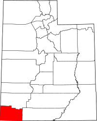 | |
| Towns | ||
| CDPs | ||
| Unincorporated communities | ||
| Ghost towns | ||