Saint-Thurial
| Saint-Thurial Sant-Turiav-Porc'hoed | ||
|---|---|---|
|
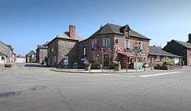
A view within Saint-Thurial | ||
| ||
 Saint-Thurial | ||
|
Location within Brittany region  Saint-Thurial | ||
| Coordinates: 48°01′48″N 1°55′50″W / 48.0300°N 1.9306°WCoordinates: 48°01′48″N 1°55′50″W / 48.0300°N 1.9306°W | ||
| Country | France | |
| Region | Brittany | |
| Department | Ille-et-Vilaine | |
| Arrondissement | Rennes | |
| Canton | Plélan-le-Grand | |
| Intercommunality | Pays de Brocéliande | |
| Government | ||
| • Mayor (2014–2020) | Auguste Thésée | |
| Area1 | 18.01 km2 (6.95 sq mi) | |
| Population (2009)2 | 1,880 | |
| • Density | 100/km2 (270/sq mi) | |
| Time zone | CET (UTC+1) | |
| • Summer (DST) | CEST (UTC+2) | |
| INSEE/Postal code | 35319 / 35310 | |
| Elevation | 32–128 m (105–420 ft) | |
|
1 French Land Register data, which excludes lakes, ponds, glaciers > 1 km² (0.386 sq mi or 247 acres) and river estuaries. 2 Population without double counting: residents of multiple communes (e.g., students and military personnel) only counted once. | ||
.svg.png)
Saint-Thurial (Breton: Sant-Turiav-Porc'hoed, Gallo: Saent-Turiau) is a commune in the Ille-et-Vilaine department in Brittany in northwestern France.
Population
Inhabitants of Saint-Thurial are called Thurialais in French.
| Historical population | ||
|---|---|---|
| Year | Pop. | ±% |
| 1962 | 727 | — |
| 1968 | 749 | +3.0% |
| 1975 | 772 | +3.1% |
| 1982 | 1,020 | +32.1% |
| 1990 | 1,273 | +24.8% |
| 1999 | 1,485 | +16.7% |
| 2009 | 1,880 | +26.6% |
See also
References
External links
| Wikimedia Commons has media related to Saint-Thurial. |
- Official website (French)
- French Ministry of Culture list for Saint-Thurial (French)
This article is issued from Wikipedia - version of the 11/6/2015. The text is available under the Creative Commons Attribution/Share Alike but additional terms may apply for the media files.