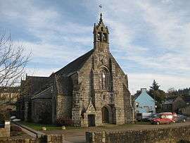
Saint-Servais, Côtes-d'Armor
| Saint-Servais Sant-Servez-Kallag | |
|---|---|
 | |
 Saint-Servais | |
|
Location within Brittany region  Saint-Servais | |
| Coordinates: 48°23′16″N 3°23′12″W / 48.3878°N 3.3867°WCoordinates: 48°23′16″N 3°23′12″W / 48.3878°N 3.3867°W | |
| Country | France |
| Region | Brittany |
| Department | Côtes-d'Armor |
| Arrondissement | Guingamp |
| Canton | Callac |
| Intercommunality | Callac-Argoat |
| Government | |
| • Mayor (2014–2020) | Christian Coail |
| Area1 | 28.04 km2 (10.83 sq mi) |
| Population (2008)2 | 406 |
| • Density | 14/km2 (38/sq mi) |
| Time zone | CET (UTC+1) |
| • Summer (DST) | CEST (UTC+2) |
| INSEE/Postal code | 22328 / 22160 |
| Elevation | 130–292 m (427–958 ft) |
|
1 French Land Register data, which excludes lakes, ponds, glaciers > 1 km² (0.386 sq mi or 247 acres) and river estuaries. 2 Population without double counting: residents of multiple communes (e.g., students and military personnel) only counted once. | |
Saint-Servais (Breton: Sant-Servez-Kallag) is a commune in the Côtes-d'Armor department of Brittany in northwestern France.
Population
| Historical population | ||
|---|---|---|
| Year | Pop. | ±% |
| 1962 | 513 | — |
| 1968 | 657 | +28.1% |
| 1975 | 575 | −12.5% |
| 1982 | 481 | −16.3% |
| 1990 | 436 | −9.4% |
| 1999 | 390 | −10.6% |
| 2008 | 406 | +4.1% |
See also
References
External links
| Wikimedia Commons has media related to Saint-Servais (Côtes-d'Armor). |
This article is issued from Wikipedia - version of the 8/16/2016. The text is available under the Creative Commons Attribution/Share Alike but additional terms may apply for the media files.