Saint-Rémy, Calvados
| Saint-Rémy | |
|---|---|
|
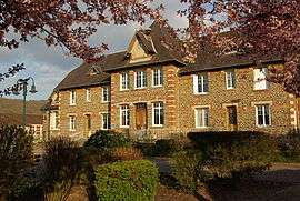
Town hall | |
 Saint-Rémy | |
|
Location within Normandy region  Saint-Rémy | |
| Coordinates: 48°56′27″N 0°30′08″W / 48.9408°N 0.5022°WCoordinates: 48°56′27″N 0°30′08″W / 48.9408°N 0.5022°W | |
| Country | France |
| Region | Normandy |
| Department | Calvados |
| Arrondissement | Caen |
| Canton | Thury-Harcourt |
| Intercommunality | Suisse Normande |
| Government | |
| • Mayor (2008–2014) | André Quindry |
| Area1 | 7.52 km2 (2.90 sq mi) |
| Population (2008)2 | 1,087 |
| • Density | 140/km2 (370/sq mi) |
| Time zone | CET (UTC+1) |
| • Summer (DST) | CEST (UTC+2) |
| INSEE/Postal code | 14656 / 14570 |
| Elevation |
26–216 m (85–709 ft) (avg. 37 m or 121 ft) |
|
1 French Land Register data, which excludes lakes, ponds, glaciers > 1 km² (0.386 sq mi or 247 acres) and river estuaries. 2 Population without double counting: residents of multiple communes (e.g., students and military personnel) only counted once. | |
Saint Rémy is a commune in the Calvados department in the Normandy region in northwestern France. Until 1968 an iron mine was exploited in the village.
Population
| Historical population | ||
|---|---|---|
| Year | Pop. | ±% |
| 1962 | 1,075 | — |
| 1968 | 981 | −8.7% |
| 1975 | 1,012 | +3.2% |
| 1982 | 969 | −4.2% |
| 1990 | 993 | +2.5% |
| 1999 | 1,066 | +7.4% |
| 2008 | 1,087 | +2.0% |
See also
References
| Wikimedia Commons has media related to Saint-Rémy (Calvados). |
This article is issued from Wikipedia - version of the 3/16/2016. The text is available under the Creative Commons Attribution/Share Alike but additional terms may apply for the media files.