Saint-Leu-la-Forêt
| Saint-Leu-la-Forêt | ||
|---|---|---|
|
Town hall | ||
| ||
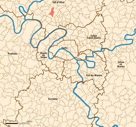 Location (in red) within Paris inner and outer suburbs | ||
| Coordinates: 49°01′03″N 2°14′50″E / 49.0175°N 2.2472°ECoordinates: 49°01′03″N 2°14′50″E / 49.0175°N 2.2472°E | ||
| Country | France | |
| Region | Île-de-France | |
| Department | Val-d'Oise | |
| Arrondissement | Pontoise | |
| Canton | Domont | |
| Intercommunality | Val Parisis | |
| Government | ||
| • Mayor (2008–2020) | Sébastien Meurant | |
| Area1 | 5.24 km2 (2.02 sq mi) | |
| Population (2013)2 | 15,082 | |
| • Density | 2,900/km2 (7,500/sq mi) | |
| Time zone | CET (UTC+1) | |
| • Summer (DST) | CEST (UTC+2) | |
| INSEE/Postal code | 95563 / 95320 | |
| Elevation | 57–191 m (187–627 ft) | |
|
1 French Land Register data, which excludes lakes, ponds, glaciers > 1 km² (0.386 sq mi or 247 acres) and river estuaries. 2 Population without double counting: residents of multiple communes (e.g., students and military personnel) only counted once. | ||

.svg.png)
Saint-Leu-la-Forêt is a commune in the northwestern suburbs of Paris, France. It is located 19.9 km (12.4 mi) from the centre of Paris.
Twin towns
History
In 1806 the commune of Saint-Leu-la-Forêt merged with the neighboring commune of Taverny, resulting in the creation of the commune of Saint-Leu-Taverny.
In 1821 the commune of Saint-Leu-Taverny was demerged. Thus, Saint-Leu-la-Forêt and Taverny were both restored as separate communes.
Transport
Saint-Leu-la-Forêt is served by Saint-Leu-la-Forêt station on the Transilien Paris – Nord suburban rail line.
Cultural connections
- Louis Bonaparte brother to Napoleon I and father to Napoleon III, is buried at Saint-Leu-la-Forêt.
- Wanda Landowska her home in Saint-Leu-la-Forêt became a center for the performance and study of early music, particularly of the Renaissance and Baroque eras.
- Eyvind Johnson lived rue de Boissy, from 1926 to 1930.
- In Patrick Modiano's book, So You Don't Get Lost in the Neighborhood, the narrator spends part of his childhood in the care of a teenage girl living in a mysterious house in Saint-Leu-la-Forêt.
See also
References
External links
| Wikimedia Commons has media related to Saint-Leu-la-Forêt. |
- Official website (French)
- Land use (IAURIF) (English)
This article is issued from Wikipedia - version of the 3/15/2016. The text is available under the Creative Commons Attribution/Share Alike but additional terms may apply for the media files.