Saint-Jacut-les-Pins
| Saint-Jacut-les-Pins Sant-Yagu-ar-Bineg | |
|---|---|
|
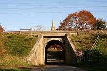
The road into Saint-Jacut-les-Pins | |
 Saint-Jacut-les-Pins | |
|
Location within Brittany region  Saint-Jacut-les-Pins | |
| Coordinates: 47°41′10″N 2°12′51″W / 47.6861°N 2.2142°WCoordinates: 47°41′10″N 2°12′51″W / 47.6861°N 2.2142°W | |
| Country | France |
| Region | Brittany |
| Department | Morbihan |
| Arrondissement | Vannes |
| Canton | Allaire |
| Intercommunality | Pays de Redon |
| Government | |
| • Mayor (2008—2014) | Alain Hercouët |
| Area1 | 22.81 km2 (8.81 sq mi) |
| Population (1999)2 | 1,552 |
| • Density | 68/km2 (180/sq mi) |
| Time zone | CET (UTC+1) |
| • Summer (DST) | CEST (UTC+2) |
| INSEE/Postal code | 56221 / 56220 |
| Elevation | 2–88 m (6.6–288.7 ft) |
|
1 French Land Register data, which excludes lakes, ponds, glaciers > 1 km² (0.386 sq mi or 247 acres) and river estuaries. 2 Population without double counting: residents of multiple communes (e.g., students and military personnel) only counted once. | |

Saint-Jacut-les-Pins (Breton: Sant-Yagu-ar-Bineg) is a commune in the Morbihan department of Brittany in north-western France.
Geography
The river River Arz forms all of the commune's northern boundary.
History
The Celtic Veneti, and then the Romans occupied the area in Classical times.
In the High Middle Ages, Britons founded several villages, Bodnaga, Brehadou Guidemais, Bina, Redillac, Brandicoet, and Calleon to name just a few of their towns in the area. The name Saint-Jacut-les-Pins comes form a 6th-century Saint Jacut, who arrived with the British emigrants as a boy and established a church nearby.
The parish suffered heavily in the French Revolution.
Facilities
The municipality has a medical home, Doctors, a pharmacy and a retirement home [1] which provides a course of activities health for seniors.
Educationally, the commune has a nursery and primary school (École Saint-Joseph), a medical Institute and a technology high school (ISSAT).
In sporting terms, the municipality has a Sports Hall, and the dynamism of its numerous sports associations (cycling, hiking, running foot, basketball, football, tennis, motorcycling, water gymnastics, hunting and fishing).
Finally, on the cultural level, the municipality has a media library (Médiathèque Saint-Jacut-les-Pins) and many associations (theatre, choral, foyer des jeunes).
Transport
The commune is located 10 minutes by car from Redon station. Nantes Atlantique Airport and Rennes–Saint-Jacques Airport are respectively at 1 h 15 min and 1 h by car.
The municipality is crossed from East to West by the main rail axis of the southern Brittany. This line Savenay - Landerneau opened up to Lorient in 1862, it allows by Redon relations between the stations of the Brittany cities of the South and Paris by Rennes. The municipality has long disposed of a station and then a train stop, currently these two stations are closed and abandoned.[2] The railway history of the commune will may be rebound with freight activity.
Demographics
| Historical population | ||
|---|---|---|
| Year | Pop. | ±% |
| 1793 | 1,375 | — |
| 1821 | 1,141 | −17.0% |
| 1851 | 1,355 | +18.8% |
| 1881 | 1,468 | +8.3% |
| 1901 | 1,457 | −0.7% |
| 1911 | 1,482 | +1.7% |
| 1921 | 1,448 | −2.3% |
| 1931 | 1,698 | +17.3% |
| 1946 | 1,525 | −10.2% |
| 1954 | 1,496 | −1.9% |
| 1968 | 1,485 | −0.7% |
| 1982 | 1,590 | +7.1% |
| 1990 | 1,570 | −1.3% |
| 1999 | 1,552 | −1.1% |
| 2006 | 1,702 | +9.7% |
| 2011 | 1,741 | +2.3% |
Inhabitants of Saint-Jacut-les-Pins are called in French Jacutais. In 2011, the town had 1,741 inhabitants. The evolution of the number of inhabitants is known through the population censuses carried out in the town since 1793.[3][4]
See also
References
- ↑ Tudgual Ruellan, « Une première en France : les personnes âgées ont leur parcours de santé à Saint-Jacut-les-Pins (Morbihan) », sur Tugdual Ruellan Information, journalisme et communication, 5 september 2011 (retrieved 19 october 2013)
- ↑ Jean-Pierre Nennig, « 519+943 - Gare de Saint-Jacut », Le Chemin de fer de Bretagne Sud, 2008, p. 87.
- ↑ At the beginning of the 21st century, the terms of census have been amended by Act No. 2002-276 of 27 February 2002 [archive], known as the 'law of democracy of proximity' relating to local democracy, and in particular title V 'census operations", in order to allow, after a transitional period running from 2004 to 2008, the annual publication of the legal population of the different French administrative districts. For municipalities with a population greater than 10 000 inhabitants, a sample survey is carried out each year, all of the territory of these communes is taken into account at the end of the same period of five years. The first legal population later than 1999 and within this new system came into force on January 1, 2009 and corresponds to the Census of 2006.
- ↑ in the census table and the chart, by convention in Wikipedia, and in order to allow a correct comparison between surveys spaced for a period of five years, the principle has been retained, for legal people after 1999 to display in the table of censuses and the graph that populations corresponding to the years 2006, 2011, 2016 etc., as well as the last legal population published by Insee.
External links
| Wikimedia Commons has media related to Saint-Jacut-les-Pins. |
- Map of Saint-Jacut-les-Pins on Michelin (English)