Saint-Germain-Laval, Loire
| Saint-Germain-Laval | ||
|---|---|---|
|
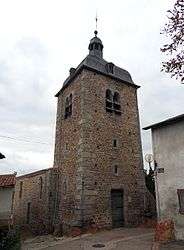
The tower of the chapel, in Saint-Germain-Laval | ||
| ||
 Saint-Germain-Laval | ||
|
Location within Auvergne-Rhône-Alpes region  Saint-Germain-Laval | ||
| Coordinates: 45°49′51″N 4°00′48″E / 45.8308°N 4.0133°ECoordinates: 45°49′51″N 4°00′48″E / 45.8308°N 4.0133°E | ||
| Country | France | |
| Region | Auvergne-Rhône-Alpes | |
| Department | Loire | |
| Arrondissement | Roanne | |
| Canton | Saint-Germain-Laval | |
| Intercommunality | Vals d'Aix et d'Isable | |
| Government | ||
| • Mayor | Jacques Perrin | |
| Area1 | 17.08 km2 (6.59 sq mi) | |
| Population (1999)2 | 1,488 | |
| • Density | 87/km2 (230/sq mi) | |
| Time zone | CET (UTC+1) | |
| • Summer (DST) | CEST (UTC+2) | |
| INSEE/Postal code | 42230 / 42260 | |
| Elevation |
344–526 m (1,129–1,726 ft) (avg. 430 m or 1,410 ft) | |
|
1 French Land Register data, which excludes lakes, ponds, glaciers > 1 km² (0.386 sq mi or 247 acres) and river estuaries. 2 Population without double counting: residents of multiple communes (e.g., students and military personnel) only counted once. | ||

Saint-Germain-Laval is a commune in the Loire department in central France.
The North American explorer Daniel Greysolon, Sieur du Lhut was born in Saint-Germain-Laval.
Geography
The commune is located 35 kilometers south of Roanne and 6 kilometers south of exit 5 of autoroute A72 (future A89) linking Clermont-Ferrand (85 km distant) to Saint-Étienne (62 km distant).
Twin towns
Saint-Germain-Laval is twinned with:
-
 San Germano, Italy
See also
References
| Wikimedia Commons has media related to Saint-Germain-Laval, Loire. |
This article is issued from Wikipedia - version of the 10/28/2016. The text is available under the Creative Commons Attribution/Share Alike but additional terms may apply for the media files.