Sailana State
| Sailana State सैलाना रियासत | ||||||
| Princely State | ||||||
| ||||||
| ||||||
 | ||||||
| History | ||||||
| • | Established | 1736 | ||||
| • | Independence of India | 1948 | ||||
| Area | ||||||
| • | 1941 | 769 km2 (297 sq mi) | ||||
| Population | ||||||
| • | 1941 | 35,000 | ||||
| Density | 45.5 /km2 (117.9 /sq mi) | |||||
| Sailana (Princely State) | ||||||


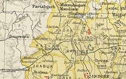
Sailana State was a princely state in India during the British Raj[1] with an area of 769 km². It belonged to the Malwa Agency, part of Central India Agency. Sailana state was so intermingled with the state of Ratlam that it was impossible to show it on map, but It consisted of roughly one-third of Ratlam State apart from its lands in Raoti. The flag was a red triangle.
History
Sailana State was founded by Jai Singh, great-grandson of Ratan Singh, founder of Ratlam State in 1736. Jai singh took revenge against his uncle for the murder of his father, he killed him in a pitched battle at sagode and secured Ratlam for his elder brother. The two brothers then split the state between themselves. Jai singh's capital was initially at Raoti. He built Sailana city as his new capital in 1736. He fought 22 battles in his lifetime, turning Sailana into an independent state.[1] On 5 January 1819 Shailana State became a British protectorate. Its last ruler signed the accession to the Indian Union on 15 June 1948.[2]
Rulers
The rulers of Sailana State were Rathore Rajputs.
Rajas
- 1736 - 1757 Jai Singh- Fought 22 battles and formed the Sailana State (d. 1757)
- 1757 - 1772 Jaswant Singh I (d. 1772)
- 1772 - 1782 Ajab Singh- came under the influence of the Scindias. (d. 1782)
- 1782 - 1797 Mokham Singh- Suffered loss of land to the Scindias. (d. 1797)
- 1797 - 1826 Lakshman Singh- Fought against the Scindias of Gwalior and defeated an army under Bhujang rao. Later he signed a treaty with the British in which he agreed to pay a fixed tribute of 42,000 salim shai to the Scindias. The British have called him notorious and a threat to the British Empire, in a letter that was sent to the British governor of Malwa. (d. 1826)
- 1826 - 1827 Ratan Singh (d. 1827)
- 1827 - 23 Aug 1841 Nahar Singh (d. 1841)
- 23 Aug 1841 - 1850 Takhat Singh (d. 1850)
- 1850 - 11 Oct 1895 Dule Singh- A very pious man, he built a small house near kedareshwar temple and spent most his time praying. He did a lot for the Bhils of Sailana for which he is still remembered and loved. Dule singh's character is shown in the event when he refused the invitation to come to the delhi darbaar in 1877 and bow before the British. He was sharply reprimanded for this insult to the British Empire. (b. 1838 - d. 1895)
- 1850 - 1857 .... -Administrator
- 1857 - 1859 Rani Nath Kanwarji (f) -Regent (b. 1795 - d. 1885)
- 11 Oct 1895 - 13 Jul 1919 Jashwant Singh II (b. 1864 - d. 1919) (from 26 Jun 1904, Sir Jashwant Singh II)
- 14 Jul 1919 - 15 Aug 1947 Dileep Singh (b. 1891 - d. 1961) (from 1 Jan 1936, Sir Dhalip Singh)
See also
References
- 1 2 Imperial Gazetteer of India. Vol.21. Oxford: Clarendon Press. 1908. pp. 385–7.
- ↑ Princely States of India
External links
Coordinates: 23°28′N 74°55′E / 23.47°N 74.92°E