Siaha
| Siaha Siaha | |
|---|---|
| Town | |
 Siaha  Siaha | |
| Coordinates: 22°29′N 92°58′E / 22.48°N 92.97°ECoordinates: 22°29′N 92°58′E / 22.48°N 92.97°E | |
| Country | India |
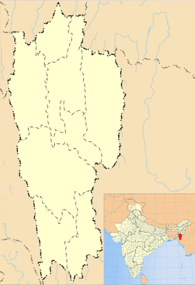
| State | Mizoram |
| District | Siaha |
| Elevation | 729 m (2,392 ft) |
| Population (2014)[1] | |
| • Total | 25,110 |
| Time zone | IST (UTC+5:30) |
| Vehicle registration | MZ |
| Website |
mizoram |
Siaha (official name given by the Mara Autonomous District Council,[2] popularly known as Saiha) is a census town in Siaha district in the Indian north-eastern state of Mizoram. It is the Headquarters of the Mara Autonomous District Council, one of the three autonomous district councils within Mizoram. It is located in the South Central part of the state. The word 'Siaha' in the local Mara language is 'Sia' for Masia which means elephant and 'ha' meaning tooth - An elephant tooth. It was a place where a large amount of elephant teeth were found. Though the local people name the town as Siaha, Mizos called it by the name 'Saiha', which is purely a translated term in Mizo language.
Siaha is a commercial hub for Mara people.
Geography
Siaha is located at 22°29′N 92°58′E / 22.48°N 92.97°E.[3] The average elevation is 729 metres (2391 feet).
Demographics
As of 2001 India census,[4] Saiha had a population of 19,731. Males constitute 52% of the population and females 48%. Saiha has an average literacy rate of 79%, higher than the national average of 59.5%: male literacy is 80%, and female literacy is 77%. In Saiha, 16% of the population is under 6 years of age. Siaha is the fastest growing town in Mizoram, 2008 statistical handbook of Mizoram reveals that the town has a population of 29,275 in 2008 against 19,731 in 2001.[5]
Education
There is one college - Saiha College, under Mizoram University and a number of public and private schools.
Transport
A Helicopter service by Pawan Hans[6] has been started which connects the Aizawl with Saiha.[7] The Distance between Saiha and Aizawl through NH 54 is 378 km and is connected with regular service of Bus and Jeeps.[8]
Media
The Major Newspapers in Saiha are:[9]
- Buannel
- Chhim Aw
- Kawl Eng
- Maraland
- Moonlight Moonlight Online
- Mara Thlala Mara Thlala
- Saiha Post
- Saikhawpui
- Saiha Times
- Awsicharu [awsicharu.wordpress.com]
- Deiva Mara Daily Deiva Mara Daily
References
- ↑ "Census of India Search details". censusindia.gov.in. Retrieved 10 May 2015.
- ↑ http://www.madconline.com/wp-content/uploads/2015/01/Official_Resolution.pdf
- ↑ Falling Rain Genomics, Inc - Saiha
- ↑ "Census of India 2001: Data from the 2001 Census, including cities, villages and towns (Provisional)". Census Commission of India. Archived from the original on 16 June 2004. Retrieved 1 November 2008.
- ↑ Dept. of Economic & Statistic, Gov't of Mizoram Statistical Handbook 2008.
- ↑ "MIZORAMA HELICOPTER SERVICE TUR CHIEF MINISTER IN HAWNG". Mizoram DIPR. Retrieved 14 August 2012.
- ↑ "Nilaini atangin 'Helicopter Service". The Zozam Times. Retrieved 20 August 2012.
- ↑ "Aizawl to Siaha". Mizoram NIC. Retrieved 29 August 2012.
- ↑ "Accredited Journalists". DIPR Mizoram. Retrieved 5 September 2012.
External links
- Saiha District Website
- Maraland.NET : Mara people's Online site
- SiahaOnline.com : Siaha Online website
| State symbols | |
|---|---|
| Government | |
| Topics | |
| Districts | |
| Urban Areas | |
| Infrastructure | |
| Education |
|
| Tourism | |
| Protected areas | |