Sagvåg
| Sagvåg | |
|---|---|
| Village | |
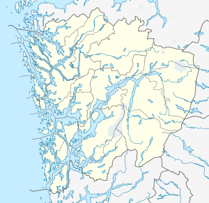 Sagvåg  Sagvåg Location in Hordaland county | |
| Coordinates: 59°46′53″N 05°23′23″E / 59.78139°N 5.38972°ECoordinates: 59°46′53″N 05°23′23″E / 59.78139°N 5.38972°E | |
| Country | Norway |
| Region | Western Norway |
| County | Hordaland |
| District | Sunnhordland |
| Municipality | Stord |
| Area[1] | |
| • Total | 2.59 km2 (1.00 sq mi) |
| Elevation[2] | 38 m (125 ft) |
| Population (2013)[1] | |
| • Total | 3,416 |
| • Density | 1,319/km2 (3,420/sq mi) |
| Time zone | CET (UTC+01:00) |
| • Summer (DST) | CEST (UTC+02:00) |
| Post Code | 5410 Sagvåg |
Sagvåg is a village in Stord municipality in Hordaland county, Norway. The village is located on the southwest coast of the island of Stord, about 5 kilometres (3.1 mi) west of the town of Leirvik. The Stord Airport, Sørstokken lies about 2 kilometres (1.2 mi) northwest of Sagvåg. Nysæter Church was built here in 1991 to serve the population of the village. The small mining village of Litlabø lies just northeast of Sagvåg.[3]

The 2.59-square-kilometre (640-acre) village has a population (2013) of 3,416. This gives the village a population density of 1,319 inhabitants per square kilometre (3,420/sq mi).[1] This makes it Sunnhordland's second largest community, after the nearby town of Leirvik.
Wärtsilä Norway AS has a factory in Sagvåg, producing automation systems for the marine industry. The harbour of Sagvåg is noted to be excellent for visiting leisure boats. There was considerable shipbuilding activities in Sagvåg up until the 1960s, building wooden fishing and whaling vessels. Prior to the Triangle Link bridges and tunnel in 2001, Sagvåg was a ferry port with regular ferry routes connecting Stord and Bømlo to the west.
References
- 1 2 3 Statistisk sentralbyrå (1 January 2013). "Urban settlements. Population and area, by municipality.".
- ↑ "Sagvåg, Stord (Hordaland)" (in Norwegian). yr.no. Retrieved 2015-02-04.
- ↑ Store norske leksikon. "Sagvåg" (in Norwegian). Retrieved 2015-02-04.