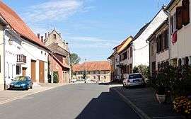
Sarrewerden
| Sarrewerden | ||
|---|---|---|
 | ||
| ||
 Sarrewerden | ||
|
Location within Grand Est region  Sarrewerden | ||
| Coordinates: 48°55′25″N 7°05′04″E / 48.9236°N 7.0844°ECoordinates: 48°55′25″N 7°05′04″E / 48.9236°N 7.0844°E | ||
| Country | France | |
| Region | Grand Est | |
| Department | Bas-Rhin | |
| Arrondissement | Saverne | |
| Canton | Ingwiller | |
| Government | ||
| • Mayor (2007–2008) | Jean-Joseph Taesch | |
| Area1 | 16.73 km2 (6.46 sq mi) | |
| Population (2006)2 | 982 | |
| • Density | 59/km2 (150/sq mi) | |
| Time zone | CET (UTC+1) | |
| • Summer (DST) | CEST (UTC+2) | |
| INSEE/Postal code | 67435 / 67260 | |
| Elevation | 217–336 m (712–1,102 ft) | |
|
1 French Land Register data, which excludes lakes, ponds, glaciers > 1 km² (0.386 sq mi or 247 acres) and river estuaries. 2 Population without double counting: residents of multiple communes (e.g., students and military personnel) only counted once. | ||

Sarrewerden (German: Saarwerden) is a commune in the Bas-Rhin department in Grand Est in northeastern France.
The localities of Bischtroff-sur-Sarre and Zollingen are incorporated in the commune since 1972.
See also
References
| Wikimedia Commons has media related to Sarrewerden. |
This article is issued from Wikipedia - version of the 11/13/2016. The text is available under the Creative Commons Attribution/Share Alike but additional terms may apply for the media files.