São Manuel
| São Manuel | |
|---|---|
| Municipality | |
 | |
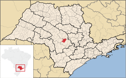 Location in São Paulo state | |
 São Manuel Location in Brazil | |
| Coordinates: 22°43′51″S 48°34′15″W / 22.73083°S 48.57083°WCoordinates: 22°43′51″S 48°34′15″W / 22.73083°S 48.57083°W | |
| Country |
|
| Region | Southeast Region |
| State | São Paulo |
| Area | |
| • Total | 651 km2 (251 sq mi) |
| Population (2015) | |
| • Total | 40,367 |
| • Density | 62/km2 (160/sq mi) |
| Time zone | BRT/BRST (UTC-3/-2) |
São Manuel is a municipality in the state of São Paulo in Brazil. The population is 40,367 (2015 est.) in an area of 651 km².[1] The elevation is 709 m.
People from São Manuel
- Alice Sommerlath (1906-1997), mother of Queen Silvia of Sweden.
- Karina Bacchi (born in 1976), actress.
- Emilio Surita (born in 1961), humorist.
- Teresa Surita (born in 1956), politician.
References
- ↑ "IBGE - Instituto Brasileiro de Geografia e Estatstica". cod.ibge.gov.br. Retrieved 2016-06-27.
This article is issued from Wikipedia - version of the 6/27/2016. The text is available under the Creative Commons Attribution/Share Alike but additional terms may apply for the media files.