São Carlos
| São Carlos | |||
|---|---|---|---|
| Municipality | |||
| The Municipality of São Carlos | |||
|
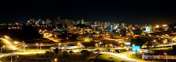
Views of São Carlos, Top left:Night view of São Carlos Cathedral, Top right:Federal University of São Carlos, 2nd:Planes display in Wings of a Dream Museum, P-47D Thunderbolt(left), Santos Dumont Demoiselle(right), Middle:São Carlos Railroad Station, Entrance Building(left), track and platform(right), 4th left:Chamine Garden, 4th right:Alvaro Guiao School, Bottom:Night view of Downtown São Carlos from Iguatemi Shopping Mall | |||
| |||
|
Nickname(s): The Capital of Technology, Weather City and Sanca | |||
|
Motto: "A bandeirantibus venio" (Latin) "Proceed from bandeirantes" | |||
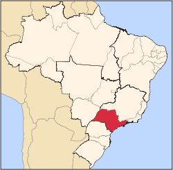
 Location in the São Paulo state. | |||
 São Carlos Location in Brazil | |||
| Coordinates: 22°01′04″S 47°53′27″W / 22.01778°S 47.89083°W | |||
| Country |
| ||
| Region | Southeast | ||
| State |
| ||
| Founded | November 4, 1857 | ||
| Incorporated | 1880 | ||
| Government | |||
| • Mayor | Paulo Altomani (PSDB) | ||
| Area | |||
| • Municipality | 1,137.30 km2 (439.11 sq mi) | ||
| • Urban | 67.25 km2 (25.97 sq mi) | ||
| Elevation | 856 m (2,808.4 ft) | ||
| Population (2010/IBGE[1]) | |||
| • Municipality | 221,950 | ||
| • Density | 195.15/km2 (505.4/sq mi) | ||
| Time zone | UTC-3 (UTC-3) | ||
| • Summer (DST) | UTC-2 (UTC-2) | ||
| Website | saocarlos.sp.gov.br - São Carlos' Prefecture | ||
| HDI (2000) 0.841 – high | |||
.jpg)


Coordinates: 22°01′04″S 47°53′27″W / 22.01778°S 47.89083°W
São Carlos (Saint Charles, in English, Portuguese pronunciation: [sɐ̃w̃ ˈkaʁlus]; named after Saint Charles Borromeo) is a city of 221,950[1] inhabitants (IBGE/2010) in the state of São Paulo, Brazil. It is located at 22°01′04″S 47°53′27″W / 22.01778°S 47.89083°W, at about 231 km from the city of São Paulo.
History
The region started to be settled in the end of the 18th century, with the opening of a road that led to the gold mines in Cuiabá and Goiás. Leaving from Piracicaba, passing through Rio Claro, the hills, fields and by typical vegetations of the Brazilian countryside, settlers established in the region. São Carlos' history started in 1831, when the "Pinhal" (Pines) allotment was demarcated.
On the city's foundation date, November 4, 1857, the population resided in some houses around the chapel and the inhabitants were mostly Arruda Botelho's family heirs, who were the first owners of the "Pinhal" alloments. Between 1831 and 1857 the pioneer coffee farms were formed, starting the first economic activity in the city. The coffee crops came to the "Pinhal" farm in 1840 and spread throughout the fertile lands around, becoming the main export item. The city foundation is credited to Antônio Carlos de Arruda Botelho, Count of Pinhal, an influent farmer and entrepreneur.
São Carlos was elevated to village in 1865, when a "Câmara", or ruling chamber, was created. In 1874, the village had 6,897 inhabitants, as a humble highlight of its fast growth and regional importance. It became a city in 1880 and in 1886, with a population of 16,104, its urban structure was settled.
The city arises on the coffee crops expansion context, which is relevant to the last two decades of the 19th century and to the first two of the 20th century. The arrival of the railway in 1884 provided an efficient system to transport the coffee production to the Santos harbor and boosted the economy of the region. The railway also contributed to the political and economic consolidation of the central area of the city.
When African-Brazilian slaves were freed, failure to fully integrate them into the economy led to them begging to work for food and shelter. Worried about Brazil becoming a "black" country, the government created incentives programs to European immigrants. São Carlos had already received German nationals brought by the Count of Pinhal in 1876. Between 1880 and 1904, the city was one of the most important immigration centers in São Paulo state, the majority of them being Northern Italians. They worked in coffee plantations and in manufacturing factories, as well as dealt with trading activities.
In the beginning of the 20th century, countless cultural societies developed social activities aiming to promote literacy. Vittorio Emanuele Society in 1900 and Dante Alighieri in 1902 were but a few of them. The Italian presence was so significant that during the first half of the 20th century, the Italian government had a consulate branch in São Carlos.
With the Wall Street crash of 1929, coffee production went through a crisis, which made many immigrants leave rural areas for factories, wood artifact production, pottery, and construction.
Farmers had already applied the profits obtained with coffee in the constitution of several types of companies in São Carlos: banks, electricity, cable cars, telephones, water pumps, sewers, theaters, hospitals and schools. This established a foundation for industrialization in the city. With the arrival of immigrants from other urban centers from the 1930s - 1940s, their expertise was used to consolidate industrialization as the main economic activity in the city. Its peak years were the 1950s, when São Carlos became a manufacturing center, with relevant industrial expression in São Paulo state.
The industrial sector also developed through workshops that incorporated the coffee industry. The manufacture of processing machinery, shoes, fertilizers, hardware, furniture, pasta, cigars, as well as activities such as tailory, breweries, foundries, sawmills, weaving, pottery and pencil production expanded the economy of São Carlos in the 1930s. In the 1950s and 1960s, with the expansion of refrigeration, new factories of machinery and tractors arrived. Numerous small- and medium-sized companies which provided products and services were also established.
In the second half of the 20th century, the city received a boost of technological and higher educational development when in 1953 the Escola de Engenharia de São Carlos, or the Engineering School of the University of São Paulo, was created. In the 1970s, the Federal University of São Carlos was launched.
Geography
São Carlos is located on the geographic center of the São Paulo state, approximately 231 km (144 mi) from the city of São Paulo. The city is the center of a microregion with 308,777 inhabitants.[2]
Its altitude is over 856 m, offering a mild altitude climate. Most of the year the city is windy, sunny and with mild temperatures at night. For this reason the city is nicknamed "Cidade do Clima" (Weather City) and celebrates once a year an event called "Festa do Clima", or "Weather Festival".
The city has a total area of 1.141 km², which includes two districts to the north (Santa Eudóxia and Água Vermelha), one district to the west (Bela Vista São-carlense), and one district to the east (Vila Nery).
Climate
According to the Köppen Climate Classification, the city has an altitude tropical climate with dry winter, with minimum average temperatures of 15,3 °C and maximum of 27,0 °C.
| Month | Jan | Feb | Mar | Apr | May | Jun | Jul | Aug | Sep | Oct | Nov | Dec | Year |
|---|---|---|---|---|---|---|---|---|---|---|---|---|---|
| Max. Temperature (average) °C | 28,0 | 28,0 | 28,0 | 28,0 | 25,0 | 24,0 | 24,0 | 27,0 | 28,0 | 28,0 | 28,0 | 25,0 | 27,0 |
| Min. Temperature (average)°C | 18,0 | 18,0 | 17,0 | 16,0 | 13,0 | 12.0 | 12,0 | 13,0 | 15,0 | 16,0 | 16,0 | 18,0 | 15,3 |
| Rainfall mm | 268,7 | 227,4 | 136,7 | 59,4 | 49,7 | 32,1 | 15,5 | 26,6 | 58,9 | 132,8 | 164,9 | 240,1 | 1422,8 |
| Source: Unicamp - Cepagri | |||||||||||||
Economy
The city has an active industrial profile with important national and international industries and certain agricultural importance, backed by technologies developed by Embrapa, owner of two research complexes in the city. Due to its increasing number of high technology industries, the city has been proclaimed "The National Capital of Technology" by Brazilian President Dilma Rousseff in 2011.
The city hosts several locally-grown technology-based companies, such as Opto Eletrônicos, and factories of multinational corporations such as Faber Castell, Electrolux, Husqvarna, Tecumseh and the Brazilian plant of Volkswagen engines, and national corporations such as TAM MRO - Technology Center, Toalhas São Carlos, Tapetes São Carlos, Papel São Carlos, Prominas Brasil and Latina.
The economic basis of São Carlos is the Tertiary sector. Commerce and services corresponds to 65.9% of the city's GDP. Industry is also relevant. With 32.3% of the economy, the Secondary sector has a bigger participation than the state of São Paulo's average. The Primary sector corresponds to 1.7% of the GDP.[3]
Culture

São Carlos is home to two Universidade de São Paulo campuses and the Universidade Federal de São Carlos (UFSCar), two of the most important higher learning centers in Brazil. Moreover, another minor and private university, Centro Universitário Central Paulista (UNICEP), is also based in São Carlos, and community colleges like SENAI, SESI, SESC, SENAC and the Escola Técnica Estadual Paulino Botelho. This has turned São Carlos into a university-oriented town, with an abundance of student-focused commercial establishments. It is also known for its student parties.
São Carlos' cultural life is marked by a young audience that enjoys musical concerts of Brazilian contemporary alternative artists that usually include the city in their tours. Also, São Carlos has 3 theaters and 7 commercial movie-theaters rooms.
There are two important events celebrated every year in the city, the Climate Party, which happens in April and has a traditional Orchid Exposition which features a craftwork fair and several food barracks. An Oktobertech fest is held yearly along with the São Carlos High Tech Fair (Fealtec).
The TAM Airlines Wings of a Dream Museum (Museu TAM) is in São Carlos, 15 kilometers (9.3 mi) from central São Carlos.[4]
Transportation
Roads
- SP-310 - Rodovia Washington Luís - 244 km to São Paulo
- SP-318 - Rodovia Eng. Thales de Lorena Peixoto Junior - 116 km to Ribeirão Preto
- SP-215 - Rodovia Luís Augusto de Oliveira
Air
The city is served by Mário Pereira Lopes Airport, where one of the maintenance bases of TAM Airlines is located and well as the air and space TAM Museum, owned and maintained by the company.
Notable people
Were born in São Carlos:
- Fábio Aurélio: Liverpool F.C. full-back
- Nenê: Washington Wizards player
- Maurren Maggi: 2008 Olympics gold medallist
- Ronald Golias: deceased actor and comedian
- Thiago Silva: UFC fighter
- Izabel Goulart: model
Twin towns — Sister cities
-
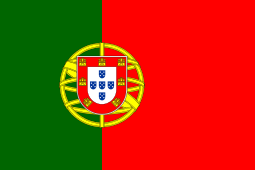 Coimbra, Portugal (since 1970)
 -
 Tecumseh, Oklahoma, United States (since 1997)
 -
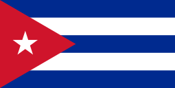 Santa Clara, Cuba (since 2005)
 -
 Santa Cruz, Rio Grande do Norte, Brazil
See also
- University of São Paulo - USP
- Federal University of São Carlos - UFSCar
- Rodovia Washington Luís
- São Carlos Airport
- GE Sãocarlense
- São Carlos FC
- Estádio Luís Augusto de Oliveira
- São Carlos Clube
- Estádio Paulista
External links
| Wikimedia Commons has media related to São Carlos. |
- (Portuguese) City Hall's Official Website
- (Portuguese) Fundação Sistema Estadual de Análise de Dados has further demographic data for São Carlos.
- (Portuguese) Aeronautical Engineering Students Website
- (Portuguese) Official Web Site Aeronautical Museum
References
- 1 2 "2010 Census of the IBGE - State of SP" (PDF). IBGE.gov.br. Retrieved 12 July 2011.
- ↑ "2010 Census of the IBGE - Synopsis - Table 761" (in Portuguese). IBGE.gov.br. Retrieved 22 July 2011.
- ↑ "Municipal Profile at SEADE". SEADE.gov.br. Retrieved 12 July 2011.
- ↑ "Visitação e Localização". TAM Museum. Retrieved on December 15, 2011. "Rodovia SP 318, km249,5 – Água Vermelha São Carlos SP – CEP 13578-000" and "Rod. Eng. Thales de Lorena Peixoto Júnior São Carlos - São Paulo"
Capital: São Paulo | |||||||||||||||||||||||||||||||||||||
|  | ||||||||||||||||||||||||||||||||||||
|
| |||||||||||||||||||||||||||||||||||||
| |||||||||||||||||||||||||||||||||||||
| |||||||||||||||||||||||||||||||||||||
| |||||||||||||||||||||||||||||||||||||
| |||||||||||||||||||||||||||||||||||||
| |||||||||||||||||||||||||||||||||||||
| |||||||||||||||||||||||||||||||||||||
| |||||||||||||||||||||||||||||||||||||
| |||||||||||||||||||||||||||||||||||||
| |||||||||||||||||||||||||||||||||||||
| |||||||||||||||||||||||||||||||||||||
| |||||||||||||||||||||||||||||||||||||