Rujan
For the village, see Rujan (Široki Brijeg).
| Rujan | |
|---|---|
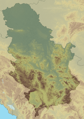 Rujan Location in Serbia | |
| Highest point | |
| Elevation | 968 m (3,176 ft) [1] |
| Coordinates | 42°21′58″N 21°49′06″E / 42.36611°N 21.81833°ECoordinates: 42°21′58″N 21°49′06″E / 42.36611°N 21.81833°E |
| Geography | |
| Location | Serbia |
Rujan[1] (Serbian Cyrillic: Рујан) or Rujen (Рујен), is a mountain in southern Serbia, near the town of Bujanovac. Its highest peak Kalje has an elevation of 968 meters (3,176 ft) above sea level. On the mountain, there is Kale-Krševica archeological site, dating from the 13th century BC. The Pčinja flows through the valley of Rujen.
References
- 1 2 Jovan Đokić. "Katalog planina Srbije". PSD Kopaonik Beograd.
This article is issued from Wikipedia - version of the 7/30/2016. The text is available under the Creative Commons Attribution/Share Alike but additional terms may apply for the media files.