Rudnik pri Moravčah
For other places with the same name, see Rudnik.
| Rudnik pri Moravčah | |
|---|---|
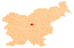
 Rudnik pri Moravčah Location in Slovenia | |
| Coordinates: 46°8′3.46″N 14°44′1.14″E / 46.1342944°N 14.7336500°ECoordinates: 46°8′3.46″N 14°44′1.14″E / 46.1342944°N 14.7336500°E | |
| Country |
|
| Traditional region | Upper Carniola |
| Statistical region | Central Slovenia |
| Municipality | Moravče |
| Area | |
| • Total | 0.69 km2 (0.27 sq mi) |
| Elevation | 348 m (1,142 ft) |
| Population (2002) | |
| • Total | 19 |
| [1] | |
Rudnik pri Moravčah (pronounced [ˈɾuːdnik pɾi mɔˈɾaːu̯tʃax]) is a settlement west of Moravče in central Slovenia. Traditionally the area was part of Upper Carniola. It is now included with the rest of the Municipality of Moravče in the Central Slovenia Statistical Region.[2]
Name
The name of the settlement was changed from Rudnik to Rudnik pri Moravčah in 1953.[3]
Church

Our Lady of Sorrows Church
The local church, built on Hribce Hill south of the settlement, is dedicated to Our Lady of Sorrows and belongs to the Parish of Moravče. It was built after the 1895 earthquake on the site of an older chapel.[4]
References
- ↑ Statistical Office of the Republic of Slovenia
- ↑ Moravče municipal site
- ↑ Spremembe naselij 1948–95. 1996. Database. Ljubljana: Geografski inštitut ZRC SAZU, DZS.
- ↑ Slovenian Ministry of Culture register of national heritage reference number ešd 2066
External links
This article is issued from Wikipedia - version of the 5/20/2016. The text is available under the Creative Commons Attribution/Share Alike but additional terms may apply for the media files.