Rubite
| Rubite | |||
|---|---|---|---|
| village | |||
| |||
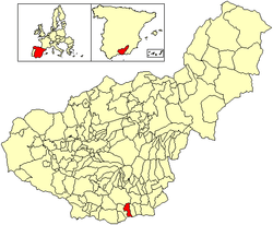 Location of Rubite | |||
| Country | Spain | ||
| Province | Granada | ||
| Municipality | Rubite | ||
| Area | |||
| • Total | 28 km2 (11 sq mi) | ||
| Population (2004) | |||
| • Total | 492 | ||
| • Density | 17.6/km2 (46/sq mi) | ||
| Time zone | CET (UTC+1) | ||
| • Summer (DST) | CEST (UTC+2) | ||

.svg.png)
Rubite is a municipality located in the province of Granada, Spain. According to the 2004 census (INE), the village had a population of 492 inhabitants. Rubite is a locality and Spanish municipality situated at the east central of the region “La Costa Granadina” in the province of Granada, independent community of Andalusia. On the shores of the Mediterranean Sea, Rubite is bordered by the municipalities of Lújar, Órgiva and Polopos.
Location and landscape
Nestled in the southwest of the province of Granada, Rubite is at the bottom of the Sierra de Lujar and Contraviesa, 80 km away from Granada capital. The access can be done from the coast via a route that connects with the N -340 as it passes through Castell de ferro (15 km.), And from the C -333 through the scenic road Contraviesa. The peaceful streets of Moorish design and the hospitality of its people make Rubite a special corner where mass tourism has not yet taken a toll. Its geographical location allows you to enjoy the sea and mountain, counting in their municipality with Lance Beaches and Casarones.
The landscape around the village is beautiful, formed by a harmonious combination between forms of mountainous terrain, whimsical and impossible ravines, patches of natural vegetation and traditional crops of almonds, grapes, figs, with the Mediterranean Sea his feet and the peaks of Sierra Nevada as a roof.
Costumes
The grape harvest celebrated in October is maybe the only tradition that remains nowadays where the grapes are trampeled with an “agobias” (little straw shoes). The wine of Rubite is really important for the region of La Alpujarra.
History
Rubite is a mozarabic word and a Latin word “Rubus-Robetum” that means bramble. The first news of the town are located in the Andalusian period
Between the thirteenth and fifteenth centuries in the Sierra de la Contraviesa . In the sixteenth century a significant number fled the North African Moors, leaving the unpopulated area but the repopulation of the eighteenth century, the area increased markedly in population and economic prosperity. In the seventeenth century the sale of land and houses to farmers in the region was authorized, although paying the Count of Cifuentes. The decline of growing grapes in the nineteenth century forced to make almond its main production .
The Rubiteños have been called lifelong Güenos of Rubite. El The origin lies in a fact happened in the early nineteenth century . There was by then a family surnamed “bueno”. In autumn 1810 a routine patrol of the French army surprised by family members on their properties “bueno”. The confrontation of the “bueno” with the French killed soldiers, the story spread quickly through the contours and leaving the “bueno” as an example of patriotism for all residents .
External links
Coordinates: 36°48′32″N 3°20′50″W / 36.8089°N 3.34722°Whttp://www.rubite.es/