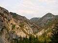
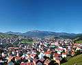
Rožaje
| Rožaje Рожаје | ||
|---|---|---|
 | ||
| ||
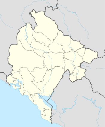 Rožaje Location of Rožaje in Montenegro | ||
| Coordinates: 42°50′N 20°10′E / 42.84°N 20.16°ECoordinates: 42°50′N 20°10′E / 42.84°N 20.16°E | ||
| Country | Montenegro | |
| Municipality | Rožaje Municipality | |
| Settlements | 66 | |
| Government | ||
| • Mayor | Ejup Nurković | |
| • Ruling party | Bosniak Party of Montenegro | |
| Area | ||
| • Total | 432 km2 (167 sq mi) | |
| Population (2011[1]) | ||
| • Total |
| |
| • Density | 53/km2 (140/sq mi) | |
| • Municipality |
| |
| Demonym(s) | Rožajci | |
| Time zone | CET (UTC+1) | |
| • Summer (DST) | CEST (UTC+2) | |
| Postal code | 84310 | |
| Area code | +382 51 | |
| ISO 3166-2 code | ME-17 | |
| Car plates | RO | |
| Website |
www | |
Rožaje (Montenegrin Cyrillic: Рожаје, pronounced [rɔ̂ʒajɛ]), is a town in northeastern Montenegro. It has a population of 9,567 (2011 census.)
Rožaje is the centre of the Rožaje Municipality.
History
Rožaje was first settled in the 7th century, by Illyrians, Romans and Greeks. Later, during the migration of the Slavs, Slavs settled in the area.[2] Rožaje was first mentioned in 1571 and 1585. The settlement surrounding the then fort was called Trgovište, which it was called until 1912.
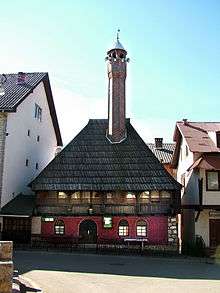
In 1797 the Ganić kulla, a defensive measurement of the Islamified Kuči (Muslim members of the clan) who supported Muslim authority and culture, was built. Today the building is the town museum.[3]
Forces of the Kingdom of Montenegro captured the city in 1912 from the Ottoman Empire, during the First Balkan War. It was officially ceded to Montenegro following the Treaty of London in 1913, ending the war.
In 1992, during the Yugoslav wars, Bosniaks of Foča were resettled in Rožaje.[4]
Population and Demographics
Rožaje is administrative centre of Rožaje municipality, which has 23,312 residents. The town of Rožaje itself has a population of 9,567.
Rožaje is considered the centre for the Bosniak community of Montenegro. Bosniaks form the majority in both town and municipality.
Population of Rožaje:
- March 3, 1981 - 7,336
- March 3, 1991 - 8,828
- November 1, 2003 - 9,121
- July 1, 2011 - 9,567
Transport
Rožaje is situated on the main road connecting Montenegro with Kosovo, known as Rožaje-Kula-Peć road. It also has a link with Novi Pazar in Central Serbia. The Ibarska magistrala is the main regional road that connects Montenegro with Serbia. It is connected with the inland Montenegro by two-laned highway via Berane, which is some 30 km (19 mi) far. The nearest airport is the Pristina International Airport in Pristina, Kosovo which is 116 km (72 mi) away. Podgorica Airport is about 180 km (110 mi) away, and has regular flights to major European destinations throughout the year.
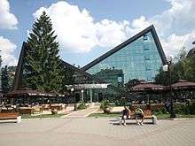
Photo


See also
- Immovable cultural property of Rožaje
- Sultan Murat II Mosque
- Kučanska Mosque
- Sports Center Rožaje
- KK Ibar
- OK Ibar
- FK Ibar
- Vrelo Ibra
- Hajla
References
- ↑ Prvi rezultati popisa 2011. (PDF) (in Montenegrin), Monstat, 15 May 2011, p. 9
- ↑ "History of Rožaje". Retrieved 28 June 2013.
- ↑ Darren (Norm) Longley; Rough Guides (30 March 2009). The Rough Guide to Montenegro. Penguin. p. 156. ISBN 978-1-4053-8425-4. Retrieved 10 May 2012.
- ↑ Human Rights Watch, 2006-Genocide, war crimes, and crimes against humanity: a topical digest of the case law of the International Criminal Tribunal for the former Yugoslavia