Roville-aux-Chênes
| Roville-aux-Chênes | |
|---|---|
|
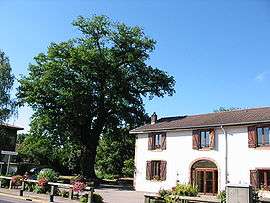
Old oak tree and town hall | |
 Roville-aux-Chênes | |
|
Location within Grand Est region  Roville-aux-Chênes | |
| Coordinates: 48°23′09″N 6°36′15″E / 48.3858°N 6.6042°ECoordinates: 48°23′09″N 6°36′15″E / 48.3858°N 6.6042°E | |
| Country | France |
| Region | Grand Est |
| Department | Vosges |
| Arrondissement | Épinal |
| Canton | Rambervillers |
| Intercommunality | Région de Rambervillers |
| Government | |
| • Mayor (2008–2014) | Jocelyne Vilmain |
| Area1 | 8.59 km2 (3.32 sq mi) |
| Population (2006)2 | 567 |
| • Density | 66/km2 (170/sq mi) |
| Time zone | CET (UTC+1) |
| • Summer (DST) | CEST (UTC+2) |
| INSEE/Postal code | 88402 / 88700 |
| Elevation |
260–321 m (853–1,053 ft) (avg. 276 m or 906 ft) |
|
1 French Land Register data, which excludes lakes, ponds, glaciers > 1 km² (0.386 sq mi or 247 acres) and river estuaries. 2 Population without double counting: residents of multiple communes (e.g., students and military personnel) only counted once. | |
Roville-aux-Chênes is a commune in the Vosges department in Grand Est in northeastern France.
Geography
The river Mortagne forms part of the commune's western border.
See also
References
| Wikimedia Commons has media related to Roville-aux-Chênes. |
This article is issued from Wikipedia - version of the 11/6/2016. The text is available under the Creative Commons Attribution/Share Alike but additional terms may apply for the media files.