Rouyn-Noranda Regional County Municipality
| Rouyn-Noranda | |
|---|---|
| Regional county municipality | |
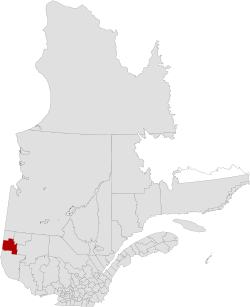 The former Rouyn-Noranda RCM | |
| Coordinates: 48°15′N 79°02′W / 48.250°N 79.033°WCoordinates: 48°15′N 79°02′W / 48.250°N 79.033°W[1] | |
| Country |
|
| Province |
|
| Region | Abitibi-Témiscamingue |
| Effective | April 1981[1] |
| Dissolved | December 31, 2001 |
| County seat | Rouyn-Noranda |
| Government | |
| • Type | Prefecture |
| Area[1][2] | |
| • Total | 6,632 km2 (2,561 sq mi) |
| • Land | 5,991.81 km2 (2,313.45 sq mi) |
| Population (2001)[2] | |
| • Total | 39,621 |
| • Density | 6.6/km2 (17/sq mi) |
| • Change (1996–2001) |
|
| • Dwellings | 18,545 |
| Time zone | EST (UTC−5) |
| • Summer (DST) | EDT (UTC−4) |
| Area code(s) | 819 |
Rouyn-Noranda Regional County Municipality was a former regional county municipality and census division in the Abitibi-Témiscamingue region of Quebec, Canada.[1]
It was formed in 1981 and dissolved when all of its component municipalities amalgamated into the new City of Rouyn-Noranda on January 1, 2002,[3] as part of the early 2000s municipal reorganization in Quebec.
Based on the last census prior to its dissolution, Rouyn-Noranda RCM consisted of:[2]
| Name | Type/status | Land area in km2 | 2001 population | 1996 population |
|---|---|---|---|---|
| Arntfield | Municipality | 396.52 | 471 | 433 |
| Bellecombe | Municipality | 691.42 | 731 | 755 |
| Cadillac | City | 366.32 | 828 | 930 |
| Cloutier | Municipality | 89.78 | 351 | 356 |
| Cléricy | Municipality | 185.59 | 481 | 538 |
| D'Alembert | Municipality | 380.74 | 920 | 810 |
| Destor | Municipality | 258.37 | 391 | 445 |
| Lac-Montanier | Unorganized territory | 252.63 | 0 | 0 |
| Lac-Surimau | Unorganized territory | 170.23 | 0 | 7 |
| McWatters | Municipality | 440.14 | 1815 | 1914 |
| Mont-Brun | Municipality | 505.08 | 519 | 537 |
| Montbeillard | Municipality | 308.82 | 728 | 677 |
| Rapides-des-Cèdres | Unorganized territory | 1019.82 | 10 | 0 |
| Rollet | Municipality | 382.38 | 356 | 408 |
| Rouyn-Noranda | City | 348.07 | 28270 | 30936 |
| Évain | Municipality | 195.90 | 3750 | 3892 |
| Totals | 5991.81 | 39,621 | 42,638 |
The unorganized territory of Rapides-des-Cèdres was occasionally written as Rapide-des-Cèdres (there is an unrelated Rapide-des-Cèdres which is a hamlet within the municipality of Lebel-sur-Quévillon[4]).
See also
References
- 1 2 3 4 "Rouyn-Noranda (Municipalité régionale de comté)" (in French). Commission de toponymie du Québec. Retrieved 2012-05-20.
- 1 2 3 "2001 Census profile: Rouyn-Noranda, Québec (Municipalité régionale de comté)".
- ↑ "Rouyn-Noranda (Ville)" (in French). Commission de toponymie du Québec. Retrieved 2012-05-20.
- ↑ Reference number 52336 of the Commission de toponymie du Québec (French)
| Regional county municipalities and equivalent territories | |
|---|---|
| Municipalities | |
This article is issued from Wikipedia - version of the 1/19/2016. The text is available under the Creative Commons Attribution/Share Alike but additional terms may apply for the media files.