Rothaar Mountains
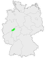
The Rothaar Mountains[1][2][3][4][5] (German: Rothaargebirge, also Rotlagergebirge), or Rothaar, is a low mountain range reaching heights of up to 843.1 m in North Rhine-Westphalia and Hesse, Germany.
It is believed that its name must once have been Rod-Hard-Gebirge, or "the cleared forest mountain range", as the range has nothing whatsoever to do with the colour red (rot in German), nor with hair (Haar).
Geography
Location
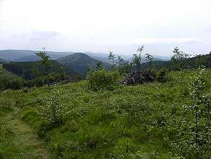
The thickly wooded Rothaar, rich in mineral deposits, is found mostly in Westphalia between the Sauerland in the north, the Upland (northeastern foothills of the Rothaar) in the northeast, Wittgenstein Land in the southeast and the Siegerland in the southwest; only the range's southeastern foothills are actually in Hesse. It stretches from the upper Eder and the Lenne from the Kahler Asten (841 m) southwest of the Winterberg Tableland (Winterberger Hochfläche) some 30 km to the southwest and drops off steeply towards the west, but much less sharply towards the east.
The Rothaar is a narrow, banklike, mostly over 600 m high mountain chain forming geologically a large northeastern part of the Rhine Massif (Rheinisches Schiefergebirge). Since the land's elevation averages quite high, the mountains themselves, up to the 843.1 m-high Langenberg hardly stand out from each other.
The Rothaar Mountains are more or less co-extensive with the Rothaar Mountain Nature Park, parts of which do, however, reach into neighbouring geological areas, such as the ones named here.
Bodies of water
In the northern Rothaar rise, among others, the rivers Diemel, Lenne, Neger, Nuhne, Odeborn, Orke, Ruhr, Wenne and Wilde Aa. In the south rise the Dill, Eder, Ferndorfbach, Ilse, Lahn and Sieg. Over the range runs the Rhine-Weser watershed. In the farthest southwest of the Rothaar are the Obernau and Breitenbach dams.
Mountains
Among the best known (but not necessarily the highest) of the Rothaar's peaks, which consist partly of porphyry, are (including all "Achthunderter", or "eight-hundreders", sorted by height):
|
|
|
The German Wikipedia has a more exhaustive list of the Rothaar's many peaks.
Places
In the Rothaar Mountains and/or the Rothaar Mountain Nature Park or their outskirts are found, among others, these municipalities:
Activities
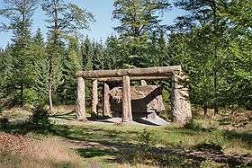
Many hiking trails run through the Rothaar Mountains, among others the Rothaar Path, a 154 km-long trail through the heights, and the Waldskulpturenweg ("Forest Sculpture Way") along which are found various sculptures and other artworks by different artists.
In winter, many sporting opportunities beckon visitors to the range. Suitable facilities for this include the Postwiesen skiing area (near Neuastenberg), the Skiliftkarussell Winterberg and Snow World Züschen.
Within or on the outskirts of the Rothaar are found the Panorama-Park Sauerland and Fort Fun Abenteuerland amusement parks.
Free-ranging wisents?
The club Taurus Naturentwicklung e. V. in cooperation with the Wittgenstein-Berleburg'sche Rentkammer and the internationally active Large Herbivore Foundation (LHF), and with the involvement of the Hochsauerland biological station, is preparing to reintroduce free-ranging wisents into the Rothaar Mountains (Sauerland, North Rhine-Westphalia). The project is, however, not without its controversy in the region, with cultivators in particular worrying about possible damage that the creatures might do.
References
- ↑ Pollock, J.K. and Thomas, H.L. (1952). Germany in Power and Eclipse: the background og German development, Van Nostrand, p. 424.
- ↑ Keller, R.E. (XXXX). German Dialects: Phonology and Morphology, p. 301.
- ↑ Deutsche Lufthansa (1953-). The tourist's atlas of Germany, p. 20.
- ↑ Lyde, L.W. (1926). The continent of Europe, Macmillan, pp. 306 and 329.
- ↑ Clapham, Sir John Harold et al. (1941). The Cambridge Economic History of Europe from the Decline of the Roman Empire: The agrarian life of the Middle Ages, Cambridge University Press, p. 29.
External links
Coordinates: 51°05′N 8°15′E / 51.083°N 8.250°E
