Rosetown
| Rosetown | |
|---|---|
| Town | |
|
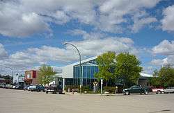
Rosetown's Main Street | |
| Motto: Discover Life Here | |
 Rosetown  Rosetown | |
| Coordinates: 51°33′N 107°59′W / 51.550°N 107.983°WCoordinates: 51°33′N 107°59′W / 51.550°N 107.983°W | |
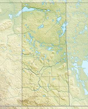
| Country | Canada |
| Province | Saskatchewan |
| Rural Municipalities (R.M.) | St. Andrew's |
| Post office Founded | 1907-09-01 |
| Village established | 1909 |
| Town incorporated | 1910 |
| Government | |
| • Mayor | Adam Krieser |
| • MP | Kelly Block, Conservative Party of Canada |
| • MLA | Jim Reiter, Saskatchewan Party |
| Area | |
| • Total | 10.59 km2 (4.09 sq mi) |
| Population (2011) | |
| • Total | 2,317 |
| • Density | 220/km2 (570/sq mi) |
| Website |
www |
| [1][2][3][4] | |
Rosetown is a town in the Canadian province of Saskatchewan, at the junction of provincial Highway 7 and Highway 4, approximately 115 km southwest of Saskatoon.
The town's motto, "The Heart of the Wheat Belt" reflects its history of being a farming community. It is the largest town located in the Rural Municipality St. Andrew's 287, Saskatchewan.
Rosetown belongs currently to the federal electoral district of Saskatoon—Rosetown—Biggar which was formerly known as Saskatoon—Rosetown. Rosetown belongs to census division 12 for purposes of enumerating the population which was 2,277 residents in 2006.
Rosetown won the 2004 Provincial Communities in Bloom.
History
On September 14, 1905, James and Anne Rose migrated from Lancashire, England to an area of Saskatchewan, Canada.[5] They were the first settlers in the area now known as Rosetown.[6] Later, in 1907, a group of people from the area, wanting a post office, made an application for one. As a name had to be given to the post office, the group decided to dedicate it to the towns most senior settlers, the Roses. As the name "Rose" was already taken, the group added "town" to it to create "Rosetown". The Post Office opened on September 7, 1907.
A Jewish colony was established near Rosetown after 1906.
Rosetown became a village on August 29, 1909 after Wilrod Bifair sold his homestead for $12.00 an acre to the Canadian National Railway. Village status was granted on August 4, 1909 when the population reached 500 people. W.G. King, W.R. Ferguson, and N.B. Douglas formed the Village Council in the same year. The first Village Council meeting was held on September 27, 1909. W.G. King established the first business in the village in 1909. Later that year he built three other stores at different locations.
Demographics
| Canada census – Rosetown community profile | |||
|---|---|---|---|
| 2011 | 2006 | 2001 | |
| Population: | 2,317 (1.8% from 2006) | 2,277 (-7.9% from 2001) | 2,471 (- 1.0% from 1996) |
| Land area: | 12.14 km2 (4.69 sq mi) | 10.59 km2 (4.09 sq mi) | 10.59 km2 (4.09 sq mi) |
| Population density: | 190.8/km2 (494/sq mi) | 215/km2 (560/sq mi) | 233.4/km2 (605/sq mi) |
| Median age: | 46.8 (M: 45.2, F: 48.6) | 42.1 (M: 40.1, F: 44.7) | |
| Total private dwellings: | 1,121 | 1,114 | 1,151 |
| Median household income: | $45,861 | $38,259 | |
| References: 2011[7] 2006[8] 2001[9] | |||
Climate
Rosetown experiences a semi-arid climate (Köppen climate classification BSk). Precipitation is quite low, with the majority of it falling in the summer months.
The highest temperature ever recorded in Rosetown was 43.9 °C (111 °F) on 4 July 1937. The coldest temperature ever recorded was −47.2 °C (−53 °F) on 23 January 1943.[10]
| Climate data for Rosetown, 1981–2010 normals, extremes 1937–present | |||||||||||||
|---|---|---|---|---|---|---|---|---|---|---|---|---|---|
| Month | Jan | Feb | Mar | Apr | May | Jun | Jul | Aug | Sep | Oct | Nov | Dec | Year |
| Record high °C (°F) | 10.0 (50) |
11.0 (51.8) |
24.3 (75.7) |
35.6 (96.1) |
36.0 (96.8) |
42.2 (108) |
43.9 (111) |
43.3 (109.9) |
37.0 (98.6) |
33.3 (91.9) |
22.2 (72) |
16.1 (61) |
43.9 (111) |
| Average high °C (°F) | −9.7 (14.5) |
−5.6 (21.9) |
1.4 (34.5) |
12.2 (54) |
19.0 (66.2) |
23.2 (73.8) |
25.8 (78.4) |
25.8 (78.4) |
19.1 (66.4) |
11.6 (52.9) |
−1.1 (30) |
−7.4 (18.7) |
9.5 (49.1) |
| Daily mean °C (°F) | −15.2 (4.6) |
−11.1 (12) |
−3.9 (25) |
4.9 (40.8) |
11.3 (52.3) |
15.9 (60.6) |
18.2 (64.8) |
17.8 (64) |
11.5 (52.7) |
4.5 (40.1) |
−6.1 (21) |
−12.7 (9.1) |
2.9 (37.2) |
| Average low °C (°F) | −20.6 (−5.1) |
−16.4 (2.5) |
−9.3 (15.3) |
−2.4 (27.7) |
3.6 (38.5) |
8.6 (47.5) |
10.6 (51.1) |
9.8 (49.6) |
3.8 (38.8) |
−2.7 (27.1) |
−11.1 (12) |
−17.9 (−0.2) |
−3.7 (25.3) |
| Record low °C (°F) | −47.2 (−53) |
−43.0 (−45.4) |
−42.2 (−44) |
−30.0 (−22) |
−12.2 (10) |
−5.0 (23) |
−2.8 (27) |
−3.0 (26.6) |
−13.9 (7) |
−25.0 (−13) |
−35.1 (−31.2) |
−42.0 (−43.6) |
−47.2 (−53) |
| Average precipitation mm (inches) | 12.9 (0.508) |
6.0 (0.236) |
15.1 (0.594) |
19.5 (0.768) |
44.2 (1.74) |
57.1 (2.248) |
57.3 (2.256) |
41.1 (1.618) |
29.2 (1.15) |
17.2 (0.677) |
15.2 (0.598) |
12.4 (0.488) |
327.0 (12.874) |
| Average rainfall mm (inches) | 0.5 (0.02) |
0.2 (0.008) |
3.8 (0.15) |
14.0 (0.551) |
39.9 (1.571) |
57.1 (2.248) |
57.3 (2.256) |
41.1 (1.618) |
27.1 (1.067) |
12.4 (0.488) |
2.6 (0.102) |
0.1 (0.004) |
256.2 (10.087) |
| Average snowfall cm (inches) | 12.4 (4.88) |
5.8 (2.28) |
11.3 (4.45) |
5.5 (2.17) |
4.2 (1.65) |
0.0 (0) |
0.0 (0) |
0.0 (0) |
2.1 (0.83) |
4.8 (1.89) |
12.7 (5) |
12.2 (4.8) |
70.8 (27.87) |
| Source: Environment Canada[10][11][12] | |||||||||||||
Education
Walter Aseltine School is the elementary school in Rosetown named after a member of parliament Walter Aseltine. Rosetown Central High School provides secondary school education for Rosetown and surrounding rural areas. Both schools are part of the Sun West School Division. The Sun West School Division Office which provides education to west-central Saskatchewan is located in Rosetown.
Students in Kindergarten to Grade 6 attend Walter Aseltine School and Grades 7 to 12 attend the Rosetown Central High School. The average graduating class is 45-60 students depending on the year.
Prairie West Regional College provides post secondary education.
Media
Radio
- 1330 AM - CJYM, classic hits
- 104.9 FM - CKVX-FM, adult contemporary
Newspapers
Transportation
The first transportation was provided by a Red River Cart Trail called Old Bone Trail as well as The Battleford Trail . The town grew in 1910 once the Canadian National Railway track reached Rosetown.[13]
Rosetown Airport (TC LID: CJX4) is located near Rosetown. Both Highway 7 and Highway 4 serve vehicular traffic to and from Rosetown.
Notable natives
- Lloyd Arntzen, musician, school teacher
- Walter Aseltine, PC, BA, QC was a Canadian parliamentarian and senator.
- The Very Rev. Walter Farquharson, Moderator of the United Church of Canada
- Rob Friend, a former professional and Canadian international soccer player
- Randy Ireland, a Buffalo Sabres Goaltender from Rosetown, Saskatchewan.
- Sherry Middaugh née Sherry Hamel, a Canadian curler.
- Robert (Bob) Ogle, a Roman Catholic priest, broadcaster and Member of the Canadian House of Commons.
- Eldon Woolliams, an Alberta politician
See also
- Sun West School Division
- List of communities in Saskatchewan
- List of rural municipalities in Saskatchewan
References
- ↑ National Archives, Archivia Net, Post Offices and Postmasters
- ↑ Government of Saskatchewan, MRD Home, Municipal Directory System (– Scholar search) Archived November 21, 2008, at the Wayback Machine.
- ↑ Canadian Textiles Institute (2005), CTI Determine your provincial constituency
- ↑ Commissioner of Canada Elections, Chief Electoral Officer of Canada (2005), Elections Canada On-line
- ↑ Russell, E.T. (1975), What's in a Name?, Saskatoon, SK: Western Producer Prairie Books, p. 276, ISBN 1-894022-92-0
- ↑ Barry, Bill (2003), People Places Contemporary Saskatchewan Placenames, Regina, Canada: Print West communications, p. 230, ISBN 1-894022-92-0
- ↑ "2011 Community Profiles". Canada 2011 Census. Statistics Canada. July 5, 2013. Retrieved 20 May 2012.
- ↑ "2006 Community Profiles". Canada 2006 Census. Statistics Canada. March 30, 2011. Retrieved 2011-07-06.
- ↑ "2001 Community Profiles". Canada 2001 Census. Statistics Canada. February 17, 2012. Retrieved 2011-07-06.
- 1 2 "Rosetown CDA EPF". Environment Canada. 1 May 2016. Retrieved 1 May 2016.
- ↑ "Rosetown". Environment Canada. 1 May 2016. Retrieved 1 May 2016.
- ↑ "Rosetown East". Environment Canada. 1 May 2016. Retrieved 1 May 2016.
- ↑ Saskatchewan Government Sask Biz (2004), Colonsay Geography Rosetown is situated in the heart of the Midwest..., retrieved 2007-08-01
External links
- Rosetown official website
- Page about the Rosetown airport on the Canadian Owners & Pilots Association Places to Fly Airport Directory
- Encyclopedia of Saskatchewan
 |
Biggar | | ||
| Brock / D'Arcy, Kindersley | |
Outlook | ||
| ||||
| | ||||
| Elrose |