Rosenfeld, Germany
| Rosenfeld | ||
|---|---|---|
| ||
 Rosenfeld | ||
Location of Rosenfeld within Zollernalbkreis district 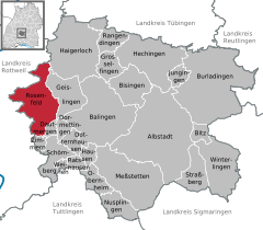
 | ||
| Coordinates: 48°17′11″N 08°43′27″E / 48.28639°N 8.72417°ECoordinates: 48°17′11″N 08°43′27″E / 48.28639°N 8.72417°E | ||
| Country | Germany | |
| State | Baden-Württemberg | |
| Admin. region | Tübingen | |
| District | Zollernalbkreis | |
| Government | ||
| • Mayor | Thomas Miller | |
| Area | ||
| • Total | 51.11 km2 (19.73 sq mi) | |
| Population (2015-12-31)[1] | ||
| • Total | 6,433 | |
| • Density | 130/km2 (330/sq mi) | |
| Time zone | CET/CEST (UTC+1/+2) | |
| Postal codes | 72348 | |
| Dialling codes | 07428 | |
| Vehicle registration | BL | |
| Website | www.rosenfeld.de | |

Rosenfeld is a town in the Zollernalbkreis district, in Baden-Württemberg, Germany. It is situated 10 km west of Balingen.
History
Between 1971 and 1975, six former municipalities were merged with Rosenfeld: Heiligenzimmern, Leidringen, Täbingen, Bickelsberg, Brittheim and Isingen. Rosenfeld, Leidringen, Täbingen, Bickelsberg, Brittheim and Isingen were part of Württemberg, while Heiligenzimmern was formerly part of the Prussian Province of Hohenzollern.
Towns and municipalities in Zollernalb district | ||
|---|---|---|
References
This article is issued from Wikipedia - version of the 10/19/2016. The text is available under the Creative Commons Attribution/Share Alike but additional terms may apply for the media files.