Rohuneeme
| Rohuneeme | |
|---|---|
| Village | |
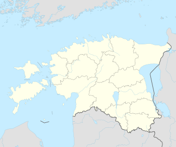 Rohuneeme Location in Estonia | |
| Coordinates: 59°33′42″N 24°48′01″E / 59.56167°N 24.80028°ECoordinates: 59°33′42″N 24°48′01″E / 59.56167°N 24.80028°E | |
| Country |
|
| County |
|
| Municipality |
|
| First mentioned | 1375 |
| Population (2011 Census[1]) | |
| • Total | 440 |
| Website |
www |
Rohuneeme is a village in Viimsi Parish, Harju County in northern Estonia. It's located about 14 km (9 mi) northeast of the centre of Tallinn, situated on the northern end of the Viimsi Peninsula. As of 2011 Census, the settlement's population was 440.[1]
The northernmost cape of the peninsula is named Rohuneem (literally: Cape of Grass).
The island of Aegna, which administratively belongs to Tallinn, is located about 1.5 km northwest of Rohuneeme. There are also two small islets Kräsuli and Kumbli located in the straits between, which belong to Rohuneeme.
Rohuneeme was first mentioned in 1375 as opidum Longenes. The narrow strait between Kräsuli and Aegna was known as Wulfs Sund. It's been known as a point for pirates to ambush the Novgorodian merchant ships which brought valuable goods to Tallinn. The strait has been suggested to be the location of the Battle of the Iron Gate which took place in 1032 between the Estonians and Novgorodians led by Ulf Ragvaldsson.[2]
In the Middle Ages Rohuneeme was settled by Coastal Swedes. During the Soviet times a missile base was located on the southern side of the village.
There is a harbour, store and a cemetery with chapel located in the village.
The second President of Estonia Lennart Meri lived on the cape of Rohuneeme.
References
- 1 2 "Population by place of residence (settlement), sex and age". Statistics Estonia. 31 December 2011. Retrieved 31 May 2013.
- ↑ "Rohuneeme küla" (in Estonian). eestigiid.ee.
 |
Aegna (Tallinn) | Gulf of Finland | Gulf of Finland | |
| Püünsi, Tallinn Bay | |
Kelvingi, Gulf of Finland | ||
| ||||
| | ||||
| Püünsi | Lubja | Kelvingi, Lubja |
| Small boroughs |  | |
|---|---|---|
| Villages | ||