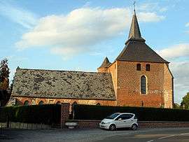
Rogny
| Rogny | |
|---|---|
 | |
 Rogny | |
|
Location within Hauts-de-France region  Rogny | |
| Coordinates: 49°46′10″N 3°48′38″E / 49.7694°N 3.8106°ECoordinates: 49°46′10″N 3°48′38″E / 49.7694°N 3.8106°E | |
| Country | France |
| Region | Hauts-de-France |
| Department | Aisne |
| Arrondissement | Vervins |
| Canton | Vervins |
| Intercommunality | Thiérache du Centre |
| Government | |
| • Mayor (2008–2014) | Jean-René Delaporte |
| Area1 | 5.61 km2 (2.17 sq mi) |
| Population (2008)2 | 102 |
| • Density | 18/km2 (47/sq mi) |
| Time zone | CET (UTC+1) |
| • Summer (DST) | CEST (UTC+2) |
| INSEE/Postal code | 02652 / 02140 |
| Elevation |
81–159 m (266–522 ft) (avg. 114 m or 374 ft) |
|
1 French Land Register data, which excludes lakes, ponds, glaciers > 1 km² (0.386 sq mi or 247 acres) and river estuaries. 2 Population without double counting: residents of multiple communes (e.g., students and military personnel) only counted once. | |
Rogny is a commune in the Aisne department in Hauts-de-France in northern France.
Population
| Historical population | ||
|---|---|---|
| Year | Pop. | ±% |
| 1793 | 216 | — |
| 1800 | 230 | +6.5% |
| 1806 | 245 | +6.5% |
| 1821 | 275 | +12.2% |
| 1831 | 270 | −1.8% |
| 1836 | 252 | −6.7% |
| 1841 | 278 | +10.3% |
| 1846 | 276 | −0.7% |
| 1851 | 276 | +0.0% |
| 1856 | 265 | −4.0% |
| 1861 | 280 | +5.7% |
| 1866 | 284 | +1.4% |
| 1872 | 277 | −2.5% |
| 1876 | 252 | −9.0% |
| 1881 | 238 | −5.6% |
| 1886 | 220 | −7.6% |
| 1891 | 212 | −3.6% |
| 1896 | 198 | −6.6% |
| 1901 | 191 | −3.5% |
| 1906 | 185 | −3.1% |
| 1911 | 178 | −3.8% |
| 1921 | 175 | −1.7% |
| 1926 | 176 | +0.6% |
| 1931 | 176 | +0.0% |
| 1936 | 184 | +4.5% |
| 1946 | 145 | −21.2% |
| 1954 | 187 | +29.0% |
| 1962 | 179 | −4.3% |
| 1968 | 142 | −20.7% |
| 1975 | 138 | −2.8% |
| 1982 | 138 | +0.0% |
| 1990 | 129 | −6.5% |
| 1999 | 116 | −10.1% |
| 2008 | 102 | −12.1% |
See also
References
| Wikimedia Commons has media related to Rogny. |
This article is issued from Wikipedia - version of the 11/8/2016. The text is available under the Creative Commons Attribution/Share Alike but additional terms may apply for the media files.