Rock Springs, New Mexico
| Rock Springs, New Mexico | |
|---|---|
| CDP | |
| Nickname(s): Rock Springs Chapter | |
| Motto: "Servicing the Governmental Needs of the Rock Springs Chapter Community Residents." | |
 Location of Rock Springs, New Mexico | |
 Rock Springs, New Mexico Location in the United States | |
| Coordinates: 35°36′34″N 108°49′35″W / 35.60944°N 108.82639°WCoordinates: 35°36′34″N 108°49′35″W / 35.60944°N 108.82639°W | |
| Country | United States |
| State | New Mexico |
| County | McKinley |
| Government | |
| • Type | Chapter Government |
| • President | Tulley Haswood |
| • Vice-President | Delphina Bedonie |
| • Secretary-Treasurer | Jasper Long |
| Area | |
| • Total | 6.0 sq mi (15.6 km2) |
| • Land | 6.0 sq mi (15.6 km2) |
| • Water | 0.0 sq mi (0.0 km2) |
| Elevation | 6,581 ft (2,006 m) |
| Population (2000) | |
| • Total | 558 |
| • Density | 92.4/sq mi (35.7/km2) |
| Time zone | Mountain (MST) (UTC-7) |
| • Summer (DST) | MDT (UTC-6) |
| Area code(s) | 505 |
| FIPS code | 35-64230 |
| GNIS feature ID | 1852634 |
| Website | www.rocksprings.nndes.org |
Rock Springs (Navajo: Tséchʼízhí) is a census-designated place (CDP) in McKinley County, New Mexico, United States. The population was 558 at the 2000 census.
Geography
Rock Springs is located at 35°36′34″N 108°49′35″W / 35.60944°N 108.82639°W (35.609485, -108.826376).[1]
According to the United States Census Bureau, the CDP has a total area of 6.0 square miles (16 km2), all of it land.
Demographics
As of the census[2] of 2000, there were 558 people, 132 households, and 114 families residing in the CDP. The population density was 92.4 people per square mile (35.7/km²). There were 189 housing units at an average density of 31.3 per square mile (12.1/km²). The racial makeup of the CDP was 99.64% Native American, 0.18% White, 0.18% from other races. Hispanic or Latino of any race were 1.61% of the population.
There were 132 households out of which 68.9% had children under the age of 18 living with them, 50.0% were married couples living together, 28.0% had a female householder with no husband present, and 13.6% were non-families. 11.4% of all households were made up of individuals and 4.5% had someone living alone who was 65 years of age or older. The average household size was 4.23 and the average family size was 4.51.
In the CDP the population was spread out with 47.0% under the age of 18, 10.0% from 18 to 24, 29.2% from 25 to 44, 11.1% from 45 to 64, and 2.7% who were 65 years of age or older. The median age was 20 years. For every 100 females there were 95.1 males. For every 100 females age 18 and over, there were 85.0 males.
The median income for a household in the CDP was $26,429, and the median income for a family was $24,271. Males had a median income of $24,250 versus $22,500 for females. The per capita income for the CDP was $6,499. About 39.0% of families and 44.3% of the population were below the poverty line, including 51.0% of those under age 18 and none of those age 65 or over.
History
The Rock Springs Chapter started to take form in the late 1930s. Rock Springs Chapter is part of the "Checker Board Area" in the Eastern Agency of the Navajo Nation. The Chapter area covers the communities of Sagebrush, China Springs, and Rock Springs. The community of Yatahey Junction (including Navajo Estates) is within the Chapter boundaries although is not governed by the Chapter. The Chapter is within commuting distance of Gallup and is influenced by this city in terms of modernization.
References
Rock Springs Chapter Webite - www.rocksprings.nndes.org
- ↑ "US Gazetteer files: 2010, 2000, and 1990". United States Census Bureau. 2011-02-12. Retrieved 2011-04-23.
- ↑ "American FactFinder". United States Census Bureau. Retrieved 2008-01-31.
Municipalities and communities of McKinley County, New Mexico, United States | ||
|---|---|---|
| City | 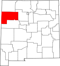 | |
| CDPs | ||
| Unincorporated communities | ||
| Indian reservation |
| |
| Footnotes | ‡This populated place also has portions in an adjacent county or counties | |