Riverside Municipal Airport
| Riverside Municipal Airport | |||||||||||||||
|---|---|---|---|---|---|---|---|---|---|---|---|---|---|---|---|
 | |||||||||||||||
| IATA: RAL – ICAO: KRAL – FAA LID: RAL | |||||||||||||||
| Summary | |||||||||||||||
| Airport type | Public | ||||||||||||||
| Operator | City of Riverside | ||||||||||||||
| Location | Riverside, California | ||||||||||||||
| Elevation AMSL | 819 ft / 250 m | ||||||||||||||
| Coordinates | 33°57′07″N 117°26′42″W / 33.95194°N 117.44500°WCoordinates: 33°57′07″N 117°26′42″W / 33.95194°N 117.44500°W | ||||||||||||||
| Runways | |||||||||||||||
| |||||||||||||||
| Helipads | |||||||||||||||
| |||||||||||||||
Riverside Municipal Airport (Riverside Arlington Airport, decades ago) (IATA: RAL, ICAO: KRAL, FAA LID: RAL), is four miles (6 km) southwest of downtown Riverside, the county seat of Riverside County, California.[1]
Scheduled flights to Laughlin/Bullhead International Airport (Arizona) on Western Express Air ended when that airline ceased operations at the end of May 2007.[2]
Runway 9/27 was paved about 1956 and Bonanza Air Lines appeared soon after. Until 1969 it and successor Air West flew DC-3s and Fairchild F-27s to LAX, Las Vegas, Palm Springs and beyond. Golden West Airlines served Riverside during the 1970s with nonstop and direct de Havilland Canada DHC-6 Twin Otters to LAX.
Riverside Municipal Airport has been home to Civil Air Patrol Squadron 5 since 2005.
"FedEx Express donated a Boeing 727-200F to California Baptist University for its new aviation science program. The aircraft will be on permanent display at the airport and will provide a working laboratory for aviation science students." The aircraft, N266FE (cn 21672/1538), is a Boeing 727-233/Adv(F). A video of its arrival on January 10, 2013 can be found here.[3]
Facilities
The airport covers 525 acres (212 ha) and has two runways and one helipad:
- 9/27: 5,401 x 100 ft. (1,646 x 30 m) Asphalt
- 16/34: 2,850 x 48 ft. (869 x 15 m) Asphalt
- H1: 60 x 60 ft. (18 x 18 m) Asphalt
The runway has ILS, GPS, and VOR approaches.
Should there be plans to expand, the Airport's Master Plan supports lengthening runway 9/27 to 6,153 feet (1,875 m). Runway 27 has a Visual Approach Slope Indicator.
The crosswind runway, RWY 16-34, is suited for smaller aircraft. Runway 34 has a Precision Approach Path Indicator.
References
- ↑ FAA Airport Master Record for RAL (Form 5010 PDF)
- ↑ Western Air Express (official site)
- ↑ "FedEx donates Boeing 727 to CBU Aviation Science program". PR Newswire. Retrieved 2013-02-03.
External links
- Riverside Municipal Airport (official City of Riverside web site)
- Riverside Airshow
- Civil Air Patrol, Senior Squadron 5
- FAA Airport Diagram (PDF), effective December 8, 2016
- Resources for this airport:
- FAA airport information for RAL
- AirNav airport information for KRAL
- ASN accident history for RAL
- FlightAware airport information and live flight tracker
- NOAA/NWS latest weather observations
- SkyVector aeronautical chart, Terminal Procedures
Airports in the Inland Empire | ||
|---|---|---|
| Commercial airports | 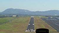 | |
| Towered general aviation airports | ||
| Non-towered general aviation airports | ||
| Military airports | ||