River Tawe


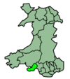
The River Tawe (Welsh: Afon Tawe; Welsh pronunciation: [taʊ.ɛ]) is a river in South Wales. It flows in a principally southwesterly direction for some 48 km (30 mi) from its source below Moel Feity in the Old Red Sandstone hills of the western Brecon Beacons to the Bristol Channel at Swansea. Its main tributaries are the right bank Upper and Lower Clydach Rivers and the Afon Twrch. The total area of the catchment is some 246 km2 (95 square miles).[1] The Tawe passes through a number of towns and villages including Ystradgynlais, Ystalyfera, Pontardawe, and Clydach and meets the sea at Swansea Bay below Swansea. The Tawe Valley (Cwm Tawe in Welsh) is more commonly known as the Swansea Valley.
The lower part of the valley was intensely industrialised in the 18th and 19th centuries and was especially impacted by metal refining and working and to a much lesser extent by porcelain manufacture. Large areas of the lower valley remain contaminated by industrial spoil containing copper, lead, nickel and zinc. The only significant extant relic of those times is a major nickel refinery at Clydach which is part of the Canadian company Vale Inco. The quality of the river has now greatly improved. Large salmon swim up the river to spawn, whilst trout are in abundance.
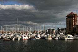
In 1992, a barrage was built at the mouth of the river.
National Cycle Route 43 follows this river for much of its course.
Bridges and crossings
Bridges over the River Tawe within the City and County of Swansea, from north to south:
- A4067 (Ffordd Cwm Tawe) road bridge
- B4291 road bridge at Glais
- A4067 road bridge (second crossing)
- former rail access to the Vale Inco works at Clydach
- disused railway bridge (former GWR route from Felin Fran to Clydach)
- A4067 road bridge (third crossing)
- Park Road bridge at Clydach
- M4 motorway bridge
- railway bridge (Swansea District Line)
- Swansea Vale road bridge
- A48 Morriston road bridge - links Morriston town centre to the Swansea Enterprise Park
- Beaufort Bridge - historic access point from Beaufort Road to the now Enterprise Park area.
- Mannesmann pedestrian and cycle bridge - links the Enterprise Park to Beaufort Road in Plasmarl
- southern Beaufort Road bridge (unnamed)
- Landore railway viaduct (South Wales Main Line)
- Morfa footbridge - links the Morfa Retail Park to the Liberty Stadium
- White Rock Bridge - road and pedestrian bridge linking the Landore district with the Bon-y-maen district
- Parc Tawe Bridge - road and pedestrian bridge linking Parc Tawe with St Thomas
- Quay Parade Bridge - road and pedestrian bridge linking Quay Parade with Fabian Way
- Old Swansea Bridge - a former railway bridge: the bridge deck no longer exists but the piers remain
- Sail Bridge - a pedestrian and cycle bridge linking the Maritime Quarter near Sainsbury's superstore to the SA1 Swansea Waterfront development area
- Trafalgar Bridge - a pedestrian and cycle bridge located near the Swansea barrage: built at a cost of £1.2 million, it crosses the barrage lock and part of the bridge swings with the lock gates
Future developments
There are plans for further housing developments on both east and west banks of the River Tawe and a proposal to operate river taxis along the river.[2] A report was commissioned by Natural Resources Wales in 2015 as part of its 'Tawe Trial' initiative - completed by regeneration consultants Trilein Ltd. it recommended a number of initiatives to better connect the urban areas on the west of the river with the more rural areas of Kilvey Hill and Crymlyn Bog beyond to the east.[3]
See also
- Lower Swansea valley
- Swansea Barrage
- Swansea University Rowing Club, who train on the river.
References
- ↑ "First Water Resources Survey : Report", South West Wales River Authority, Published 1970, Page 41; Table 1
- ↑ Wales Online - Move to make Swansea a European city of distinction
- ↑ http://www.trilein.com/links-resources
External links
Coordinates: 51°37′N 3°56′W / 51.617°N 3.933°W