River Drone
| River Drone | |
|---|---|
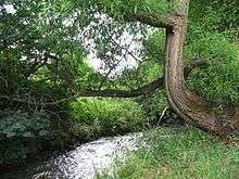 River Drone by Ramshaw Woods, Unstone | |
| Country | England |
| Basin | |
| Main source |
Sheffield Border 140 m (460 ft) (Dronfield) |
| River mouth | River Rother |
| Basin size | 57.8 km2 (22.3 sq mi) |
| Physical characteristics | |
| Length | 9.6 kilometres (6.0 mi) |
| Discharge |
|
The River Drone is a river which flows south from its source on the Sheffield, South Yorkshire border. It flows through Dronfield, Unstone and Unstone Green in Derbyshire before merging at Sheepbridge to the north of Chesterfield with the Barlow Brook. It then flows south east till it merges with the River Rother at Brimmington Road North (B6050) at Chesterfield. It is one of the three main tributaries of the Rother.[1][2]
In the late 1990s the river burst its banks and flooded Dronfield 'bottom' shopping area, and as a result a flood storage reservoir was built at Bowshaw to hold back (attenuate) the storm water runoff from the Batemoor and Jordanthorpe housing estates in the south of Sheffield, which form part of the catchment area. Some work was also done to build up the bank level with bunds or retaining walls in some sections of the valley.
The river used to feed several water wheels at early factories in the Dronfield valley in the 18th and 19th centuries. Part of the mill race is visible off Mill Lane in Dronfield, the remains of the mill being demolished in the 1970s.
This river was highly polluted at times in the past and devoid of any fish life along its full length from Sheffield to its confluence with the Barlow Brook due to mine workings discharging into the river. Also, as with other local rivers, it suffered from sewage discharges from storm overflows. It has been cleaned up in recent years, as the water boards have to meet tighter environmental regulations with brown trout making an appearance below Unstone.
The flow of the river has been measured using a weir, just below the confluence with the Barlow Brook at Sheepbridge since 1976. This long-term record shows that the catchment of 50 square kilometres (19 sq mi) to the gauging station yielded an average flow of 0.8 cubic metres per second (28 cu ft/s).[3]
References
- ↑ "Drone/Whitting from Source to River Rother". Catchment Data Explorer. Environment Agency. Retrieved 20 April 2016.
- ↑ "Barlow Brook from Source to River Drone". Catchment Data Explorer. Environment Agency. Retrieved 28 April 2016.
- ↑ "27052 - Whitting at Sheepbridge Daily Flow Data". National Rivers Flow Archive. Centre for Ecology & Hydrology. Retrieved 28 April 2016.
External links
| Unitary authorities | |
|---|---|
| Boroughs or districts | |
| Major settlements |
|
| Rivers | |
| Topics | |
Coordinates: 53°16′30″N 1°26′31″W / 53.27500°N 1.44190°W