River Bend Lodge, California
| River Bend Lodge | |
|---|---|
| Unincorporated community | |
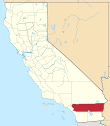
 River Bend Lodge Location within the state of California | |
| Coordinates: 33°52′10″N 114°31′36″W / 33.86944°N 114.52667°WCoordinates: 33°52′10″N 114°31′36″W / 33.86944°N 114.52667°W | |
| Country | United States |
| State | California |
| County | Riverside |
| Time zone | Pacific (PST) (UTC-8) |
| • Summer (DST) | PDT (UTC-7) |
| ZIP codes | 92225 |
| Area code(s) | 760 |
River Bend Lodge is an unincorporated community in Riverside County, California, also known as Aha Quin. The community is near Hall Island along the Colorado River and hosts Riverside County Fire Department, Station 46.[1] River Bend Lodge is also inside the Mojave Desert Air Quality Management District.
This community is part of the Colorado River Indian Reservation.[2] The reservation was established on March 3, 1865.[3] Residents are primarily of Hualapai, Yavapai, Navajo, and Hopi affiliation.[4] In some regulatory filings, tribal government used the name, Colorado River Indian Tribes Utilities Services.[5]
The locale named Haakers Camp[6] is about 0.5 miles, straight-line distance, south. The locale named Thompsons Camp[7] is about 1.1 miles, straight-line distance, south. Both are located on the west shore of the Colorado River. Both are plotted at the edge of the reservation boundary.[8]
The ZIP Code is 92225, and the community is apart inside area code 760.
Geography
At about 300 feet above mean sea level, River Bend Lodge is at latitude/longitude 33°51′43″N 114°31′39″W / 33.86194°N 114.52750°W.
Transportation
U.S. Route 95 runs north-south through the area.[9]
Aha-Quin airport (FAA identifier: 1CA4) is described as a private airstrip located in the vicinity at.[10][11]
Communications
Area residences have U.S. Postal Service contract route box addresses along Highway Contract Route HC 20 with a city name of Blythe and a ZIP Code of 92225. Wired telephone numbers work out of the Blythe exchange. This area is included inside Area code 760.
References
- ↑ US Geological Survey, Big Maria Mountains SE, California, 7.5 minute quadrangle, 1975. Fire station number is from RCFD web site listed in External links below. The community name is not in the 1995 National Geographic Names Database.
- ↑ U.S. Geological Survey Geographic Names Information System: Colorado River Indian Reservation
- ↑ US Geological Survey, National Geographic Names Database, 1995.
- ↑ Seen on a display at the Heard Museum, 2301 N Central Av., Phoenix, Arizona.
- ↑ Seen on several regulatory filings submitted to the California Public Utilities Commission.
- ↑ U.S. Geological Survey Geographic Names Information System: Haakers Camp
- ↑ U.S. Geological Survey Geographic Names Information System: Thompsons Camp
- ↑ US Geological Survey, Big Maria Mountains SE, California, 7.5 minute quadrangle, 1975 and US Geological Survey, National Geographic Names Database, 1995. "Locale" means the USGS sees them as unpopulated as of 1995.
- ↑ US Geological Survey, Big Maria Mountains SE, California, 7.5 minute quadrangle, 1975.
- ↑ Airport Facility Directory, Southwest, US Department of Transportation, Federal Aviation Administration, unknown year.
- ↑ U.S. Geological Survey Geographic Names Information System: Aha-quin Airport (historical)