River Ayr
| River Ayr (Uisge Air) | |
| River | |
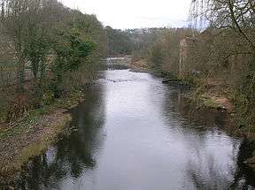 The River Ayr near Mauchline | |
| Country | Scotland |
|---|---|
| Counties | Ayrshire |
| Tributaries | |
| - left | Lugar Water, Garpel Water |
| - right | Greenock Water |
| Cities | Ayr, Catrine, Muirkirk |
| Landmarks | Ayr Beach, Peden's Cove, Glenbuck Loch |
| Source | Glenbuck Loch |
| - location | Muirkirk, Scotland |
| Mouth | Ayr Harbour, Firth of Clyde |
| - location | Ayr, Scotland |
| Length | 65 km (40 mi) |
The River Ayr (pronounced like air, Uisge Àir in Gaelic) is a river in Ayrshire, Scotland. At 65 km (40 mi) it is the longest river in the county.
The river was held as sacred by pre-Christian cultures. The remains of several prehistoric sacrificial horse burials have been found along its banks, mainly concentrated around the town of Ayr.
Etymology
The name Ayr comes from a pre-Celtic word meaning "watercourse". The town of Ayr was formerly known as Inver Ayr meaning "mouth of the Ayr", but this was later shortened to just Ayr.[1]
Geography
The River Ayr has a watershed area of 574 km2 (222 sq mi).
The river originates at Glenbuck Loch in East Ayrshire, close to the border with Lanarkshire. It winds its way through East and South Ayrshire to its mouth at the town of Ayr, where it empties into the Firth of Clyde.
On its way, the river passes through the villages of Muirkirk, Sorn, Catrine, Failford, Stair and Annbank, as well as passing the location of (the now ruined) Ayr Castle. The largest settlements being Ayr, Cumnock, Catrine, Ochiltree, Muirkirk and Sorn.
Major land uses within the catchment area are agriculture, forestry, mining, leisure and recreation and urban development.
Tributaries
Principal tributaries include:
- Greenock Water
- Lugar Water
- Water of Fail
- Water of Coyle.
River Ayr Way
Many practitioners of hillwalking and other related activities are probably aware that the river is pathed for upwards of 90% of its length. Due to disputes with estate owners and weather damage, the walk does temporarily abandon the river in a couple of locations. The path begins in the former village of Glenbuck, now a casualty of opencast mining and general industry decline. It follows the river from its source at Glenbuck Loch and ends at the coastal town of Ayr, where the river empties into the ocean at the Firth of Clyde. Typically the walk is done in 2 or 3 stages.
References
- ↑ Taylor, Iain (2011). Place-names of Scotland. Edinburgh: Birlinn Ltd.
External links
| Wikimedia Commons has media related to River Ayr. |
Coordinates: 55°30′N 4°41′W / 55.500°N 4.683°W