Ritacuba Blanco
| Ritacuba Blanco | |
|---|---|
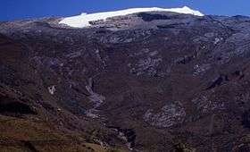 Ritacuba Blanco from the west | |
| Highest point | |
| Elevation | 5,410 m (17,750 ft) [1] |
| Prominence |
3,645 m (11,959 ft) [1] Ranked 46th |
| Isolation | 501 kilometres (311 mi) |
| Listing | Ultra |
| Coordinates | 06°29′39″N 72°17′51″W / 6.49417°N 72.29750°WCoordinates: 06°29′39″N 72°17′51″W / 6.49417°N 72.29750°W [1] |
| Geography | |
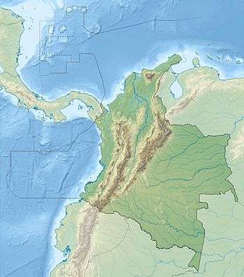 Ritacuba Blanco Location in Colombia | |
| Location | Sierra Nevada del Cocuy, Colombia |
| Parent range | Cordillera Oriental, Colombia; Andes |
| Climbing | |
| Easiest route | glacial hike |
Ritacuba Blanco is the highest peak of Cordillera Oriental, in the Andes Mountains of Colombia. It's also named Ritak'uwa, an ancient name from the U'wa indigenous people that live in the lowlands of the National Park Sierra Nevada del Cocuy y Güicán, where the Ritacuba Blanco is located. The summit is accessible from the west via the town of El Cocuy, the village of Güicán and the hamlet of Las Cabañas. The hike is fairly easy, but weather is not reliable, and a glacier must be crossed. Because of global warming, its glacier is melting at very high rates, backing down 25 linear mts per year; same is happening at amazing speeds to all other snow-covered tropical mountains in Colombia. In 1950, Ritacuba Blanco's glacier extended down to 4,500 metres (14,800 ft) above sea level; in January 2007 its lowest point was at 4,800 metres (15,700 ft) above sea level. If this melting rate continues, the glacier is expected to disappear before 2025.
Directions to access the mountain
You can access Ritacuba Blanco either from the Cocuy or Guican in the Boyaca department. After departing from either town you have to travel to Kanwara to start the main hike to the base of the mountain.
Climbing Routes
North West: It is the normal route which is easy technically. You will need basic mountaineering knowledge to climb up the mountain.
East: This route is closed. However this route has great challenges for big wall climbers.
See also
Notes
- 1 2 3 "Colombia: 22 Mountain Summits with Prominence of 1,500 meters or greater" Peaklist.org. Retrieved 2011-11-20.
References
- John Biggar, The Andes, A Guide for Climbers, Andes, 3rd edition, 2005, ISBN 0-9536087-2-7
External links
- Close up of the Summit Ritacuba Blanco and places around it
- Parque Nacional Natural El Cocuy Info in Spanish about the National Park where the Ritacuba Blanco is located.
- Ritacuba Blanco on Andes site