Ringelsdorf-Niederabsdorf
| Ringelsdorf-Niederabsdorf | |
|---|---|
 Ringelsdorf-Niederabsdorf Location within Austria | |
| Coordinates: 48°34′N 16°52′E / 48.567°N 16.867°ECoordinates: 48°34′N 16°52′E / 48.567°N 16.867°E | |
| Country | Austria |
| State | Lower Austria |
| District | Gänserndorf |
| Government | |
| • Mayor | Wolfgang Weigert |
| Area | |
| • Total | 32.46 km2 (12.53 sq mi) |
| Elevation | 170 m (560 ft) |
| Population (1 January 2016)[1] | |
| • Total | 1,272 |
| • Density | 39/km2 (100/sq mi) |
| Time zone | CET (UTC+1) |
| • Summer (DST) | CEST (UTC+2) |
| Postal code | 2272 |
| Area code | 02536 |
Ringelsdorf-Niederabsdorf is a town in the district of Gänserndorf in the Austrian state of Lower Austria.
Geography
Ringelsdorf-Niederabsdorf lies in the eastern Weinviertel on the Zaya River, exactly at the meeting of the borders with Slovakia and the Czech Republic. About 15.68 percent of the municipality is forested.
References
- ↑ Statistik Austria - Bevölkerung zu Jahresbeginn 2002-2016 nach Gemeinden (Gebietsstand 1.1.2016) for Ringelsdorf-Niederabsdorf.
External links
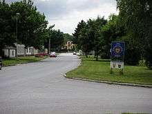
Untere Hauptstrasse in Ringelsdorf
| Wikimedia Commons has media related to Category:Ringelsdorf-Niederabsdorf. |
This article is issued from Wikipedia - version of the 11/22/2013. The text is available under the Creative Commons Attribution/Share Alike but additional terms may apply for the media files.