Right Fork Little Kanawha River
| Right Fork Little Kanawha River | |
| Country | United States |
|---|---|
| State | West Virginia |
| Counties | Upshur, Webster, Lewis, Braxton |
| Source | |
| - location | west of Helvetia |
| - elevation | 2,698 ft (822 m) [1] |
| - coordinates | 38°41′44″N 80°17′01″W / 38.6956607°N 80.2836907°W [2] |
| Mouth | Little Kanawha River |
| - location | southwest of Wildcat |
| - elevation | 945 ft (288 m) [2] |
| - coordinates | 38°44′36″N 80°27′18″W / 38.7434347°N 80.4550862°WCoordinates: 38°44′36″N 80°27′18″W / 38.7434347°N 80.4550862°W [2] |
| Length | 14.1 mi (23 km) |
| Basin | 37.6 sq mi (97 km2) |
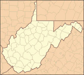 Location of the mouth of the Right Fork Little Kanawha River in West Virginia | |
The Right Fork Little Kanawha River is a tributary of the Little Kanawha River, 14.1 miles (22.7 km) long,[3] in central West Virginia in the United States. Via the Little Kanawha and Ohio rivers, it is part of the watershed of the Mississippi River, draining an area of 37.6 square miles (97 km2)[4] in a rural region.
The Right Fork Little Kanawha River rises in extreme southeastern Upshur County, approximately 4 miles (6.4 km) west of Helvetia, and flows generally westward along the boundary between Upshur and Webster counties; then along the boundary between Lewis and Webster counties, through the community of Cleveland. Near its mouth it flows through a small portion of the eastern extremity of Braxton County, and flows into the Little Kanawha River from the south near the boundary between Braxton and Lewis counties, approximately 2 miles (3.2 km) southwest of the community of Wildcat.[5]
Upstream of Cleveland the Right Fork collects a tributary named Left Fork Right Fork Little Kanawha River,[6] which flows westward for 7.1 miles (11.4 km)[3] through southern Upshur County.[5]
See also
References
- ↑ Google Earth elevation for GNIS source coordinates. Retrieved on 2011-10-13.
- 1 2 3 Geographic Names Information System. "Geographic Names Information System entry for Right Fork Little Kanawha River (Feature ID #1545666)". Retrieved 2011-10-13.
- 1 2 United States Environmental Protection Agency. "Watershed Assessment, Tracking & Environmental Results: Assessment Summary for Reporting Year 2008, West Virginia, Little Kanawha Watershed". Archived from the original on 2011-10-13. Retrieved 2011-10-13.
- ↑ West Virginia Department of Environmental Protection. "HUC 8-12 Watersheds". Archived from the original (PDF) on 2011-10-12. Retrieved 2011-10-13. HUC 12 watershed 050302030301, totaling 24094.52 acres.
- 1 2 West Virginia Atlas & Gazetteer. Yarmouth, Me.: DeLorme. 1997. p. 46. ISBN 0-89933-246-3.
- ↑ Geographic Names Information System. "Geographic Names Information System entry for Left Fork Right Fork Little Kanawha River (Feature ID #1541710)". Retrieved 2011-10-13.