Rieux-en-Val
| Rieux-en-Val | ||
|---|---|---|
|
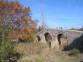
Pont de l'âne | ||
| ||
 Rieux-en-Val | ||
|
Location within Occitanie region  Rieux-en-Val | ||
| Coordinates: 43°04′56″N 2°31′54″E / 43.0822°N 2.5317°ECoordinates: 43°04′56″N 2°31′54″E / 43.0822°N 2.5317°E | ||
| Country | France | |
| Region | Occitanie | |
| Department | Aude | |
| Arrondissement | Carcassonne | |
| Canton | Lagrasse | |
| Intercommunality | Canton of Lagrasse | |
| Government | ||
| • Mayor (2008–2014) | Bernard Taudou | |
| Area1 | 6.9 km2 (2.7 sq mi) | |
| Population (2008)2 | 82 | |
| • Density | 12/km2 (31/sq mi) | |
| Time zone | CET (UTC+1) | |
| • Summer (DST) | CEST (UTC+2) | |
| INSEE/Postal code | 11314 / 11220 | |
| Elevation |
165–449 m (541–1,473 ft) (avg. 175 m or 574 ft) | |
|
1 French Land Register data, which excludes lakes, ponds, glaciers > 1 km² (0.386 sq mi or 247 acres) and river estuaries. 2 Population without double counting: residents of multiple communes (e.g., students and military personnel) only counted once. | ||
.svg.png)
Rieux-en-Val is a commune in the Aude department in southern France. It is located approximately halfway between Carcasonne and Perpignan.
Population
| Historical population | ||
|---|---|---|
| Year | Pop. | ±% |
| 1962 | 89 | — |
| 1968 | 105 | +18.0% |
| 1975 | 99 | −5.7% |
| 1982 | 86 | −13.1% |
| 1990 | 82 | −4.7% |
| 1999 | 84 | +2.4% |
| 2008 | 82 | −2.4% |
See also
References
| Wikimedia Commons has media related to Rieux-en-Val. |
This article is issued from Wikipedia - version of the 7/21/2016. The text is available under the Creative Commons Attribution/Share Alike but additional terms may apply for the media files.