Ridley Creek
| Ridley Creek | |
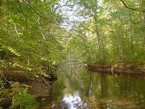
 Ridley Creek flowing through Ridley Creek State Park | |
| Country | United States |
|---|---|
| State | Pennsylvania |
| Counties | Chester, Delaware |
| Source | |
| - location | Frazer, Chester County |
| - elevation | 2,180 ft (664 m) [1] |
| - coordinates | 40°01′03″N 75°32′22″W / 40.01750°N 75.53944°W [2] |
| Mouth | Delaware River |
| - location | Eddystone Borough, Delaware County |
| - coordinates | 39°50′59″N 75°20′38″W / 39.84972°N 75.34389°WCoordinates: 39°50′59″N 75°20′38″W / 39.84972°N 75.34389°W [2] |
| Length | 23.4 mi (37.7 km) [1] |
| Basin | 37.9 sq mi (98.2 km2) [3] |
 Location of the Mouth of Ridley Creek in Delaware County, Pennsylvania | |
Ridley Creek is a tributary of the Delaware River in Chester and Delaware counties, Pennsylvania in the United States.[4]
The entire drainage basin is in the suburban Philadelphia area, but the upper creek and extensive park lands on the creek retain a rural character, while the mouth of the creek has long been heavily industrialized. It was named for the parish of Ridley, Cheshire, England.[5]
Course
Two branches of the creek rise between Malvern and Frazer in Chester County, and then join about a mile south in Frazer. The creek flows south, then southeast to enter Delaware County and Ridley Creek State Park. Leaving the park, it passes the Tyler Arboretum and the town of Media, while entering a deep gorge. It passes local parks in Rose Valley and the Taylor Memorial Arboretum in Wallingford. Before flowing into the tidal Delaware River, it forms the border between the city of Chester and the borough of Eddystone.
The length from the confluence of the two branches to the mouth is about 22 miles (35 km); including the longer Northeast branch gives a length of about 23 miles (37 km).
Watershed
The upper creek has Piedmont Upland geological features and the mouth has Coastal Plain features. Rocks include granite gneiss, mica schist, and sand and gravel.[6]
Seventeen municipalities, with a population of about 62,000, are included in the 38-square-mile (98 km2) watershed. The 40,000 residents of Upper Providence, Nether Providence, and Middletown townships, and Media use 2.7 millions gallons per day of drinking water supplied from Aqua Pennsylvania's Media plant.[7]
History
Olof Persson Stille, a Swedish millwright who arrived in the area in 1641, settled on the north bank of the creek in present-day Eddystone, and the creek was called Olle Stille's Creek.[8] Thomas Holme's map of 1687 labeled the creek "Preest Cr." next to a land grant at the mouth of the creek labeled "Preest" and shows land grants from William Penn extending the length of the creek, into the Welsh Tract at the source.
Water mills were established along the creek early in its history, including the Providence Mills gristmill in 1718, and the Old Mill in Rose Valley in 1789. Providence Mills, located in present-day Ridley Creek State Park and now known as Sycamore Mills, expanded to include a nail factory and a saw mill which operated until 1901.[9] The Old Mill started as a snuff mill, then became a paper mill, and finally a woolen textile mill, which operated until about 1880.[10]
In 1826 there were 15 mills operating on the creek, including gristmills, sawmills, cotton mills rolling and slitting mills, snuffmills, a tilt mill, and a woolen mill.[11]
The Leiper Railroad, which has a claim to be America's first railroad, operated from 1810-1828 between Thomas Leiper's quarry on Crum Creek to tidewater on Ridley Creek, a distance of about three-fourths mile.[12]
From 1906-1956 the Baldwin Locomotive Works operated north of the mouth of the creek along the Delaware in Eddystone. Today an Exelon generating plant operates in the area. In 2006 Harrah's Chester established a harness racing track and casino near the south bank of the creek at its confluence with the Delaware River.
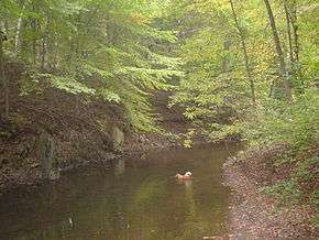
 In Ridley Creek State Park.39°56′57″N 75°25′48″W / 39.9491°N 75.4301°W |
 Long Point in Rose Valley.39°53′38″N 75°23′09″W / 39.8938°N 75.3858°W |
 Mouth of Ridley Creek on the Delaware River. |
Tributaries
- Vernon Run
- Spring Run
- Dismal Run
- Hunters Run
See also
Notes
- 1 2 Shaw 1984, p. 82
- 1 2 "Elevations and Distances in the United States". U.S Geological Survey. April 29, 2005. Retrieved 2006-11-07.
- ↑ Pennsylvania Department of Environmental Protection; Bureau of Watershed Management, Division of Water Use Planning (2001). "Pennsylvania Gazetteer of Streams" (PDF). Prepared in Cooperation with the United States Department of the Interior Geological Survey. Retrieved 2008-02-19. Cite uses deprecated parameter
|coauthors=(help) - ↑ Gertler, Edward. Keystone Canoeing, Seneca Press, 2004. ISBN 0-9749692-0-6
- ↑ "Feature Detail Report for: Ridley Creek". Geographic Names Information System (GNIS). Retrieved October 12, 2009.
- ↑ Shaw 1984 p. 82
- ↑ "Ridley Creek Watershed". Chester - Ridley - Crum Watersheds Association. Retrieved October 12, 2009.
- ↑ Modern notes to the "Account of the Swedish Churches of New Sweden" by the Reverend Israel Acrelius, 1759, reprinted in Narratives of Early Pennsylvania, West New Jersey and Delaware, 1630-1707. Adamant Media Corporation. 2001. p. 74. ISBN 1402195893.
- ↑ Barr 1993 pp.12-13
- ↑ "Rose Valley History". Rose Valley Borough. Archived from the original on September 6, 2009. Retrieved October 12, 2009.
- ↑ Case, Robert P.; Ellen M. Cronin; Marianne D. Squyres; Nancy V. Webster; H. Dabbs Woodfin (1994). A survey of mills in Delaware County, Pennsylvania, 1826-1880. Media, PA: Delaware County Community College. p. 144.
- ↑ McMaster, John Bach (1921). A History of the People of the United States, from the Revolution to the Civil War. D. Appleton and company. p. 494.
References
- Barr, Jeffery Robert (1993). Preservation in Ridley Creek State Park: Documentation of the Historic Farmsteads. Philadelphia: University of Pennsylvania Masters Thesis. p. 142.
- Gertler, Edward (2004). Keystone Canoeing: A Guide to Canoeable Waters of Eastern Pennsylvania. Seneca Press. p. 431. ISBN 0-9749692-0-6.
- Shaw, Lewis C. (June 1984). Pennsylvania Gazetteer of Streams Part II (Water Resources Bulletin No. 16). Prepared in Cooperation with the United States Department of the Interior Geological Survey (1st ed.). Harrisburg, PA: Commonwealth of Pennsylvania, Department of Environmental Resources.
External links
- U.S. Geological Survey: PA stream gaging stations
- DCNR page for Ridley Creek State Park
- Chester-Ridley-Crum Watershed Association