Richwoods, Missouri
| Richwoods, Missouri | |
|---|---|
| Unincorporated community | |
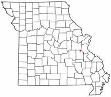 Location of Richwoods, Missouri | |
| Coordinates: 38°09′37″N 90°49′41″W / 38.16028°N 90.82806°WCoordinates: 38°09′37″N 90°49′41″W / 38.16028°N 90.82806°W | |
| Country | United States |
| State | Missouri |
| County | Washington |
| Settled | 1830 |
| ZIP code | 63071 |
| Area code(s) | 573 |
Richwoods is an unincorporated community in northern Washington County, Missouri, United States founded in 1830. It is located just off Route 47 about 15 miles west of De Soto and 19 miles south of St. Clair.
History
Richwoods was laid out in 1827. It was named from the dense forests in the vicinity.[1]
Emergency Agencies
Fire
- Richwoods Fire Protection District. Chief - David Hoffmann Jr
- Firemen - 25
- Junior Firemen - 4
- EMT-B - 1
- Emergency Medical Responders - 21
- No. Of Stations - 1
- No. Of Trucks - 8
- Area District - Town Of Richwoods, Parts of Blackwell, Fletcher, Lonedell, and Sullivan Zip Codes.
- District Highway Coverage
- State Hwy 47
- State Hwy A
- State Hwy H
- State Hwy T
- State Hwy WW
Ambulance
Washington County Ambulance District. Administrator - Mal Gum
- Paramedics - 12
- EMT-B - 10
- No. of Stations - 2
- No. of Ambulances - 6
- No. of Support Vehicles - 2
- Area District - All of Washington County
Law Enforcement
- Washington County Sheriff's Office Sheriff - Andy Skiles
- Sheriff - Andy Skiles
- Captain - Mike Gum
- Lieutenant - Todd Mahaney
- Sergeant - Jeremy Stetina
- Area District - All of Washington County
Education
The Richwoods area is served by the Richwoods School District (K-8). They offer pre-school and kindergarten through eighth grade. After the completion of the eighth grade, students may choose to attend high schools in the following areas: Potosi, Grandview, Kingston, DeSoto, St. Clair, or Sullivan. [2]
Churches and Cemeteries
- The Book of Acts Church 10050 Polar Rd 573-678-2005
- Church Apostolic
- Richwoods 1st Freewill Baptist Church
- Cross Roads Baptist Church
St. Stephen Catholic Church and Cemetery
The parish was established in 1841. [3]
Saint Stephen cemetery is located behind the church and rectory.
Horine Cemetery
Horine Cemetery is located in Richwoods, Missouri take Hwy 47 to Richwoods; turn onto Hwy A from jct of A & H. Turn on first gravel road to the left at sign by the Methodist Church (just before Richwoods Lions Club). Approx one mile south of Hwy A; cemetery at end of road.[4]
Local Events

- Easter Egg Hunt (The Saturday after Easter at the Richwoods Fire Department) http://www.richwoodsfire.com
- Bear Cove Mud Sling (April - October One Day a Month located at Bear Cove Rd)
- ROMP MX (Spring, Summer, and Fall)
- Free Fireworks Display (Saturday after July 4)
- Antique Tractor Pull (Sept) Richwoods Lions Club
- Twisted Minds Haunted House (Fridays and Saturdays and Halloween night in October)
- Haunted Hayride (Last two Fridays and Saturdays in October) http://www.richwoodsfire.com
- Christmas Parade (Saturday after Thanksgiving) http://www.richwoodsfire.com
- Christmas Bazaar (Saturday after Thanksgiving) Richwoods R-7 School.
External links
- Richwoods R-7 School District
- Richwoods Fire Protection District
- Bear Cove Enterprises
- St. Stephen Catholic Church
References
- ↑ Eaton, David Wolfe (1918). How Missouri Counties, Towns and Streams Were Named. The State Historical Society of Missouri. p. 370.
- ↑ http://schoolweb.missouri.edu/richwoods.k12.mo.us/index.html
- ↑ http://www.ststephenchurchrichwoodsmo.org/phistory.html
- ↑ http://www.mogenweb.org/washington/cemetery/horine.html[]
| Topics |  | |
|---|---|---|
| Central city | ||
| Largest cities (over 50,000 in 2010) | ||
| Medium-sized cities (over 20,000 in 2010) | ||
| Largest towns and villages (over 10,000 in 2010) |
| |
| Missouri Counties | ||
| Illinois Counties | ||
| Subregions | ||
Municipalities and communities of Washington County, Missouri, United States | ||
|---|---|---|
| Cities | 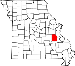 | |
| Villages | ||
| Townships |
| |
| Unincorporated communities | ||