Richland Township, Greene County, Indiana
| Richland Township | |
|---|---|
| Township | |
|
Downtown Bloomfield, in Richland Township | |
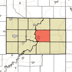 Location in Greene County | |
| Coordinates: 39°02′05″N 86°54′01″W / 39.03472°N 86.90028°WCoordinates: 39°02′05″N 86°54′01″W / 39.03472°N 86.90028°W | |
| Country | United States |
| State | Indiana |
| County | Greene |
| Government | |
| • Type | Indiana township |
| Area | |
| • Total | 43.16 sq mi (111.8 km2) |
| • Land | 42.79 sq mi (110.8 km2) |
| • Water | 0.37 sq mi (1.0 km2) 0.86% |
| Elevation | 499 ft (152 m) |
| Population (2010) | |
| • Total | 5,019 |
| • Density | 117.3/sq mi (45.3/km2) |
| GNIS feature ID | 0453794 |

Richland Township is one of fifteen townships in Greene County, Indiana, USA. As of the 2010 census, its population was 5,019.[1]
| Historical population | |||
|---|---|---|---|
| Census | Pop. | %± | |
| 2000 | 5,008 | — | |
| 2010 | 5,019 | 0.2% | |
| Source: US Census Bureau | |||
Geography
According to the 2010 census, the township has a total area of 43.16 square miles (111.8 km2), of which 42.79 square miles (110.8 km2) (or 99.14%) is land and 0.37 square miles (0.96 km2) (or 0.86%) is water.[1] The streams of Beech Creek, Letsinger Branch, Miller Branch, Ore Branch, Plummer Creek, Ritter Branch, Skinner Branch, Stalcup Branch and Wildcat Branch run through this township.
Cities and towns
- Bloomfield (the county seat)
Unincorporated towns
(This list is based on USGS data and may include former settlements.)
Adjacent townships
- Highland Township (north)
- Beech Creek Township (northeast)
- Center Township (east)
- Jackson Township (southeast)
- Taylor Township (south)
- Washington Township (southwest)
- Fairplay Township (west)
- Jefferson Township (northwest)
Cemeteries
The township contains four cemeteries: Flater, Mount Zion, Union Bethel, and Van Slyke.
Major highways
References
- 1 2 "Population, Housing Units, Area, and Density: 2010 - County -- County Subdivision and Place -- 2010 Census Summary File 1". United States Census. Retrieved 2013-05-10.
External links
- Indiana Township Association
- United Township Association of Indiana
- Bloomfield Volunteer Fire Department
- Richland Township Volunteer Fire Department
Municipalities and communities of Greene County, Indiana, United States | ||
|---|---|---|
| Cities | ||
| Towns | ||
| Townships | ||
| CDPs | ||
| Other unincorporated communities |
| |
| Footnotes | ‡This populated place also has portions in an adjacent county or counties | |
This article is issued from Wikipedia - version of the 9/10/2016. The text is available under the Creative Commons Attribution/Share Alike but additional terms may apply for the media files.