Richfield, Utah
| Richfield, Utah | |
|---|---|
|
Sevier County Courthouse | |
| Nickname(s): Red Hill Country; Panoramalan | |
 Location in Sevier County and the state of Utah. | |
| Coordinates: 38°45′57″N 112°5′15″W / 38.76583°N 112.08750°WCoordinates: 38°45′57″N 112°5′15″W / 38.76583°N 112.08750°W | |
| Country | United States |
| State | Utah |
| County | Sevier |
| Settled | 1864 |
| Founded by | Albert Lewis |
| Named for | Rich fields of wheat |
| Area | |
| • Total | 5.3 sq mi (13.7 km2) |
| • Land | 5.3 sq mi (13.7 km2) |
| • Water | 0.0 sq mi (0.0 km2) |
| Elevation | 5,354 ft (1,632 m) |
| Population (2010) | |
| • Total | 7,520 |
| • Density | 1,424.7/sq mi (551.2/km2) |
| Time zone | Mountain (MST) (UTC-7) |
| • Summer (DST) | MDT (UTC-6) |
| ZIP code | 84701 |
| Area code(s) | 435 |
| FIPS code | 49-63570[1] |
| GNIS feature ID | 1444889[2] |
| Website | Official city website |


Richfield is a city in and the county seat of Sevier County, Utah, in the United States, and is the largest city in southern-central Utah. As of the 2010 census, the city population was 7,551. It lies in the Mormon Corridor, just off of Interstate 70 about 40 miles east of its junction with Interstate 15. The county can be best described as "rural diversified" due to the convergence of agricultural, retail and industrial activities. One of Richfield's regional roles is that it lies on the interstate freeway almost precisely halfway between Los Angeles and Denver, attracting many travelers who stop at the city.
Though not large, Richfield is remote from larger cities. One has to travel about 100 miles or more in any direction to reach a more populous town, while dozens of less populous communities are found in the general area. Its remoteness, plus its location on major transportation corridors, makes it central Utah's de facto regional capital, a shopping and "commercial capital of a vast mountain-valley region."[3] Many people travel to Richfield to shop, bowl, golf, to attend theater, concerts, or for religious gatherings. They are also drawn to the community college, affiliated with Snow College, and to receive medical care. Richfield is part of "Panoramaland", and is a thoroughfare to several nearby National Parks and forests.
Settlement history
Prehistoric people occupied the Richfield area for more than 7,000 years. Fremont culture remains are found near most community sites in the Sevier area and are dated from approximately CE 1 to CE 1000. In the late summer of 1776, Father Escalante and his party of Spanish explorers passed through the general vicinity, looking for a trail to link Nuevo Mexico and California. During the late 1820s, Jedediah Smith and other fur traders crossed the area. Sevier County lies on one of the variants on the Old Spanish Trail between Santa Fe, New Mexico and California and was used by travelers between 1830 and 1850.
In the early part of January 1864, a party of ten men under the leadership of Albert Lewis came from Sanpete County, Utah and arrived in what is now Richfield. The Mormon settlers found fertile soil, good water and wood in the nearby hills. They decided that it was a desirable site for a settlement. These pioneers made a dwelling place for all ten men, which they called 'The Hole in the Ground.' They carefully covered this hole with brush willows and other materials and made a crude chimney of rocks. This dugout was located on today's Main Street. These men spent the remainder of the winter in this dwelling, planning and preparing for the time when they could bring their families.
The early Mormon settlements were abandoned in 1867 due to the conflict known as the Black Hawk War. But, when resettled in 1871, Richfield grew to become a regional center. The coming of the Denver and Rio Grande Railroad in 1891 opened the valley for expanded agricultural commerce and mining.
In 1939, Utah Governor Henry H. Blood vetoed a proposal for a junior college in Richfield. Fifty-seven years later, Snow College opened a Richfield campus, which serves about 600 students per year.
Religion
Like most settled areas of rural Utah, The Church of Jesus Christ of Latter-day Saints (LDS Church) plays a prominent role. "The Mormons were highly industrious colonizers. From 1847, when they founded Salt Lake City, until 1877, they founded 360 towns.[4] Following direction from Brigham Young, Latter-day Saints founded the town and outlying hamlets about 150 years ago, and members of the LDS Church remain the vast majority of residents.[5]
Even in this heart of Mormon country, non-Mormons and non-participating Mormons, the latter euphemistically called "less-actives," fill a percentage of elected offices.[6] However, largely due to combined rural populace and Latter-day Saint influences, the city and the surrounding county are heavily Republican. In the 2006 elections no city or county office had a Democrat on the ballot in the whole of Sevier County.
The Richfield Area offers 20 major denominational churches: The Church of Jesus Christ of Latter-day Saints, St. Elizabeth Catholic Church, First Baptist Church, Sister of Holy Cross, Jehovah's Witnesses, the Church of Scientology, Good Shepherd Lutheran Church, Assembly of God and others.
Geography and climate
According to the United States Census Bureau, the city has a total area of 5.3 square miles (13.7 km²), all land. Richfield is located 5,280 feet (1,610 m) above sea level.
Richfield is served by major transportation access - situated along Interstate 70 and within 30 minutes of Interstate 15. Richfield is located 159 miles (256 km) from Salt Lake City and 164 miles (264 km) from St. George.
Richfield experiences four distinct seasons. Winter high temperatures average in the 30s and 40s with many milder days; low temperatures average in the teens and twenties, with a few mornings starting near or below zero. Snowfall is common, but usually melts in a day or two; however, deeper lasting snow cover is not uncommon. Still, December and January average among Richfield's drier months. Summer days are warm, with normal July highs in the 90s and occasional hot spells that near 100 degrees. Nighttime temperatures during the summer are comfortable—usually in the 50s or 60s. July through September, "monsoonal" thunderstorms frequently form over the nearby peaks contributing to over a third of the 8.12 inches (206.3mm) of annual rainfall.[7] Because of its low humidity and mile-high altitude, the Sevier Valley experiences its average first frost by late September and its last in late May, despite the typically warm fall and spring days. Richfield's record high is 104 °F (40 °C), set on July 23, 1931, and the record low is -33 °F (-36 °C), set on February 6, 1989.[8]
Average January temperatures are a high of 41.6 °F and a low of 14.4 °F. Average July temperatures are a high of 90.1 °F and a low of 52.1F°. There are an average of 41.2 days with highs of 90 °F (32 °C) or higher and an average of 186.4 days with lows of 32 °F (0 °C) or higher.
The wettest year was 1936 with 13.00 inches and the driest year was 1976 with 4.36 inches. The most rainfall in one month was 3.28 inches in July 1936. The most rainfall in 24 hours was 2.00 inches on March 24, 1899. There are an average of 64 days with measurable precipitation. Average snowfall is 19.6 inches. The snowiest year was 1948 with 52.0 inches. The most snow in one month was 30.0 inches in April 1912.[9]
| Climate data for Richfield, Utah (1981–2010) | |||||||||||||
|---|---|---|---|---|---|---|---|---|---|---|---|---|---|
| Month | Jan | Feb | Mar | Apr | May | Jun | Jul | Aug | Sep | Oct | Nov | Dec | Year |
| Average high °F (°C) | 40.6 (4.8) |
46.6 (8.1) |
56.5 (13.6) |
64.4 (18) |
73.4 (23) |
83.5 (28.6) |
89.7 (32.1) |
87.6 (30.9) |
79.9 (26.6) |
67.4 (19.7) |
52.3 (11.3) |
40.9 (4.9) |
65.2 (18.4) |
| Average low °F (°C) | 16.3 (−8.7) |
20.9 (−6.2) |
26.9 (−2.8) |
31.9 (−0.1) |
39.2 (4) |
46.2 (7.9) |
53.0 (11.7) |
51.7 (10.9) |
42.5 (5.8) |
32.0 (0) |
23.5 (−4.7) |
16.3 (−8.7) |
33.4 (0.8) |
| Average precipitation inches (mm) | 0.46 (11.7) |
0.47 (11.9) |
0.72 (18.3) |
0.61 (15.5) |
0.94 (23.9) |
0.63 (16) |
0.62 (15.7) |
0.81 (20.6) |
0.87 (22.1) |
1.04 (26.4) |
0.58 (14.7) |
0.57 (14.5) |
8.34 (211.8) |
| Average snowfall inches (cm) | 4.4 (11.2) |
4.5 (11.4) |
2.7 (6.9) |
0.8 (2) |
0 (0) |
0.0 (0) |
0.0 (0) |
0.0 (0) |
0.0 (0) |
0.4 (1) |
2.8 (7.1) |
4.5 (11.4) |
20.2 (51.3) |
| Source: NOAA[10] | |||||||||||||
Demographics
| Historical population | |||
|---|---|---|---|
| Census | Pop. | %± | |
| 1870 | 4 | — | |
| 1880 | 1,197 | 29,825.0% | |
| 1890 | 1,531 | 27.9% | |
| 1900 | 1,908 | 24.6% | |
| 1910 | 2,602 | 36.4% | |
| 1920 | 3,303 | 26.9% | |
| 1930 | 3,067 | −7.1% | |
| 1940 | 3,584 | 16.9% | |
| 1950 | 4,212 | 17.5% | |
| 1960 | 4,412 | 4.7% | |
| 1970 | 4,471 | 1.3% | |
| 1980 | 5,482 | 22.6% | |
| 1990 | 5,593 | 2.0% | |
| 2000 | 6,847 | 22.4% | |
| 2010 | 7,551 | 10.3% | |
| Est. 2015 | 7,592 | [11] | 0.5% |
As of the census[1] of 2010, there were 7,551 people living in the city. The population density was 1,424.7 people per square mile (551.2/km²). There were 2,792 housing units at an average density of 526.79 per square mile (200.9/km²). The racial makeup of the city was 94.41% White, 0.39% African American, 3.29% Native American, 0.26% Asian, 0.07% Pacific Islander, 0.55% from other races, and 1.02% from two or more races. Hispanic or Latino of any race were 2.35% of the population.
In 2000, there were 2,166 households out of which 44.0% had children under the age of 18 living with them, 66.2% were married couples living together, 8.9% had a female householder with no husband present, and 22.3% were non-families. 20.4% of all households were made up of individuals and 11.3% had someone living alone who was 65 years of age or older. The average household size was 2.97 and the average family size was 3.45.
In the city the population was spread out with 35.4% under the age of 18, 10.8% from 18 to 24, 22.7% from 25 to 44, 17.0% from 45 to 64, and 14.1% who were 65 years of age or older. The median age was 29 years. For every 100 females there were 97.1 males. For every 100 females age 18 and over, there were 94.1 males.
The median income for a household in the city was $36,024, and the median income for a family was $40,284. Males had a median income of $33,000 versus $20,489 for females. The per capita income for the city was $14,320. About 7.0% of families and 9.3% of the population were below the poverty line, including 10.5% of those under age 18 and 9.4% of those age 65 or over.
The city has seen an increase in population in every decennial census since 1940, at which time it was reported to have 3,584 people residing in the city.[13]
Education
Richfield is located in the Sevier School District. There are two elementary schools (Ashman and Pahvant), one middle school (Red Hills), one high school (Richfield), and one alternative high school (Cedar Ridge).[14] There is also a satellite campus of Snow College.[15]
Notable people
- Edward O. Anderson, architect for the LDS Church - born in Richfield
- Theodore Brandley, former Mayor of Richfield and a Mormon missionary and colonizer of Stirling, Alberta, Canada.
- Jake Garn, served as a U.S. Senator representing Utah; the first member of the United States Congress to fly in space - born in Richfield
- Joseph Hansen, secretary and guard to Leon Trotsky in Mexico for the last three years before Trotsky was murdered - born in Richfield
- Walter Frederick Morrison, the inventor of the Frisbee - born in Richfield
See also
- Clear Creek (Utah)
- Fishlake National Forest
- Fish Lake, Utah
- Fremont Indian State Park
- Glenwood, Utah
- Intermountain Health Care
- KUES, PBS station, local channel 19 (a full power relay station of KUED, carrying a remodulated analog signal)
- Richfield Municipal Airport
- List of Registered Historic Places in Utah:Sevier County
- Sevier River
- The Richfield Reaper — local newspaper
- Reel Theatres
Notes
- 1 2 "American FactFinder". United States Census Bureau. Retrieved 2008-01-31.
- ↑ "US Board on Geographic Names". United States Geological Survey. 2007-10-25. Retrieved 2008-01-31.
- ↑ Ward Roylance, Utah: A Guide to the State, Salt Lake City, 1982, p. 602
- ↑ Jim Kjelgaard, The Coming of the Mormons, New York, Random House, 1953, p. 174.
- ↑ Leonard Arrington, Great Basin Kingdom: An Economic History of the Latter-day Saints: 1830-1900.
- ↑ Wallace Stegner, Mormon Country, about 1940.
- ↑ Utah Climate Summaries - Richfield Radio KSVC precipitation table
- ↑ Utah Climate Summaries - Richfield Radio KSVC temperature table
- ↑ http://www.wrcc.dri.edu/cgi-bin/cliMAIN.pl?ut7260>
- ↑ "NOWData - NOAA Online Weather Data". National Oceanic and Atmospheric Administration. Retrieved May 5, 2013.
- ↑ "Annual Estimates of the Resident Population for Incorporated Places: April 1, 2010 to July 1, 2015". Retrieved July 2, 2016.
- ↑ "Census of Population and Housing". Census.gov. Archived from the original on May 11, 2015. Retrieved June 4, 2015.
- ↑ http://www.governor.utah.gov/dea/HTMLBriefs/CityCountyBrief/Historic/CityPop.htm
- ↑ Sevier School District
- ↑ Snow College website
External links
| Wikimedia Commons has media related to Richfield, Utah. |
- Official city website
- Website for Snow College Richfield Campus
 |
Holden Fillmore Meadow |
Scipio | Aurora Sigurd |
|
| Kanosh | |
Glenwood | ||
| ||||
| | ||||
| Elsinore | Central Valley | Annabella |
Municipalities and communities of Sevier County, Utah, United States | ||
|---|---|---|
| Cities | 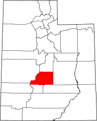 | |
| Towns | ||
| Unincorporated communities | ||
| Ghost town | ||