Rennebu
| Rennebu kommune | |||
|---|---|---|---|
| Municipality | |||
|
Map of the municipality | |||
| |||
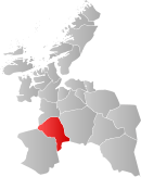 Rennebu within Sør-Trøndelag | |||
| Coordinates: 62°49′51″N 9°52′28″E / 62.83083°N 9.87444°ECoordinates: 62°49′51″N 9°52′28″E / 62.83083°N 9.87444°E | |||
| Country | Norway | ||
| County | Sør-Trøndelag | ||
| District | Orkdalen | ||
| Administrative centre | Berkåk | ||
| Government | |||
| • Mayor (2005) | Bjørn Rogstad (H) | ||
| Area | |||
| • Total | 947.97 km2 (366.01 sq mi) | ||
| • Land | 924.96 km2 (357.13 sq mi) | ||
| • Water | 23.01 km2 (8.88 sq mi) | ||
| Area rank | 114 in Norway | ||
| Population (2010) | |||
| • Total | 2,622 | ||
| • Rank | 294 in Norway | ||
| • Density | 2.8/km2 (7/sq mi) | ||
| • Change (10 years) | -2.9 % | ||
| Demonym(s) | Rennbygg[1] | ||
| Time zone | CET (UTC+1) | ||
| • Summer (DST) | CEST (UTC+2) | ||
| ISO 3166 code | NO-1635 | ||
| Official language form | Neutral | ||
| Website |
www | ||
|
| |||


Rennebu is a municipality in Sør-Trøndelag county, Norway. It is part of the Orkdalen region. The administrative centre of the municipality is the village of Berkåk, located along European route E6. The majority of the population lives in Berkåk, Innset, Stamnan, Ulsberg, Voll, and Nerskogen.
General information
The municipality of Rennebu was established in 1839 when it was separated from Meldal. Initially, the population was 2,368. On 1 January 1966, the parish of Innset (population: 420) was transferred from Kvikne (and also from Hedmark county) to Rennebu (and Sør-Trøndelag county). Then on 1 January 1970, the Garlia area (population: 5) was transferred from Tynset (and Hedmark county) to Rennebu (and Sør-Trøndelag).[2]
Name
The Old Norse form of the name was Rennabú. The first element is, maybe, the plural genitive case of renna which means "journey", "march", or "road". Probably because two old important roads cross the municipality: one follows the Orkla river from the Orkdalsfjord (part of the Trondheimsfjord) to the village of Berkåk where it connects with the road from Gudbrandsdalen and Oppdal to Gauldalen and Trondheim (today the European route E6). The last element is bú which means "rural district".[3]
Coat of arms
The coat of arms is from modern times (approved on 19 February 1982). It shows the outline of the local church, Rennebu kirke (erected 1669), which is one of the oldest (and very few) churches in Norway based on a Y-shaped outline.[4]
Churches
The Church of Norway has three parishes (sokn) within the municipality of Rennebu. It is part of the Deanery (prosti) of Gauldal and the Diocese of Nidaros.
| Parish (Sokn) | Church Name | Year Built | Location of the Church |
|---|---|---|---|
| Berkåk | Berkåk kirke | 1878 | Berkåk |
| Innset | Innset kirke | 2000 | Innset |
| Rennebu | Rennebu kirke | 1669 | Voll |
| Nerskogen kapell | 1962 | Nerskogen |
Geography

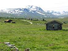
Rennebu mainly consists of uncultivated areas of mountains, lakes, moors, and forests. The highest point is the 1,548-metre (5,079 ft) tall Svarthetta. The mountain Ilfjellet is located in the northeastern part of the municipality.
The Orkla River flows through the municipality from south to north in the Orkdalen valley. The northeasternmost part of the Trollheimen mountain range also lies within the municipality of Rennebu.
The municipality is surrounded by Oppdal and Rindal to the west, Meldal to the north, Midtre Gauldal to the east, and Tynset to the south. The Forollhogna National Park lies in the extreme southeastern part of the municipality.
References
- ↑ "Navn på steder og personer: Innbyggjarnamn" (in Norwegian). Språkrådet. Retrieved 2015-12-01.
- ↑ Jukvam, Dag (1999). "Historisk oversikt over endringer i kommune- og fylkesinndelingen" (PDF) (in Norwegian). Statistisk sentralbyrå.
- ↑ Rygh, Oluf (1901). Norske gaardnavne: Søndre Trondhjems amt (in Norwegian) (14 ed.). Kristiania, Norge: W. C. Fabritius & sønners bogtrikkeri. p. 166.
- ↑ Norske Kommunevåpen (1990). "Nye kommunevåbener i Norden". Retrieved 27 October 2008.
External links
| Wikimedia Commons has media related to Rennebu. |
 Sør-Trøndelag travel guide from Wikivoyage
- Municipal fact sheet from Statistics Norway